![](/images/other/stat-length.png)
![Randonnée Marche Fournels - De Fournels à St-Chély-d'Apcher - Photo](https://media.geolcdn.com/t/1900/400/ext.pjpeg?maxdim=2&url=https%3A%2F%2Fservices.sitytrail.com%2FGeolivesWS%2FDownloadMedia.ashx%3FTrailID%3D172923%26Media%3D14391_4.jpg)
De Fournels à St-Chély-d'Apcher
tracegps
Utilisateur
![Longueur](/images/other/stat-length.png)
Longueur
17,7 km
![Altitude max](https://static1.geolcdn.com/siteimages/upload/files/1508320355ic_sort_altitude_max_24dp.png)
Altitude max
1197 m
![Dénivelé positif](https://static1.geolcdn.com/siteimages/upload/files/1508320355ic_sort_den_pos_24dp.png)
Dénivelé positif
394 m
![Km-Effort](/images/other/stat-length.png)
Km-Effort
23 km
![Altitude min](https://static1.geolcdn.com/siteimages/upload/files/1508320355ic_sort_altitude_min_24dp.png)
Altitude min
957 m
![Dénivelé négatif](https://static1.geolcdn.com/siteimages/upload/files/1508320355ic_sort_den_neg_24dp.png)
Dénivelé négatif
342 m
![Boucle](https://static1.geolcdn.com/siteimages/upload/files/16400158638029165_repeat_loop_refresh_sync_direction_icon.png)
Boucle
Non
Date de création :
2014-12-10 00:00:00.0
Dernière modification :
2014-12-10 00:00:00.0
![Marche](https://static1.geolcdn.com/sitytour/trail-icons/101.png)
4h10
Difficulté : Difficile
![Scannez ce code QR pour ouvrir la randonnée dans l'application SityTrail](https://capi.geolives.com/qq0zvz2zws4bq2lad0pu/sitytour/trails/172923/qr.png?size=200)
Application GPS de randonnée GRATUITE
À propos
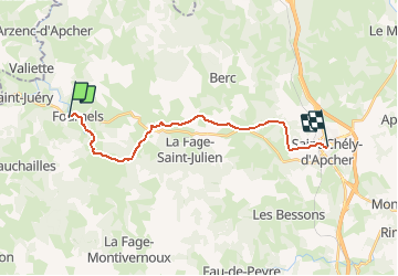
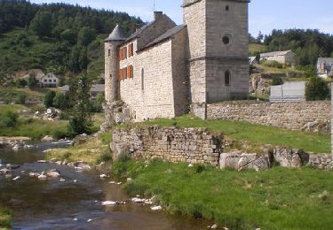
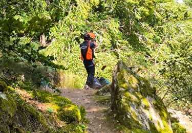
Randonnée Marche de 17,7 km à découvrir à Occitanie, Lozère, Fournels. Cette randonnée est proposée par tracegps.
Description
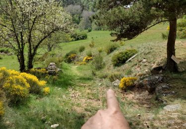
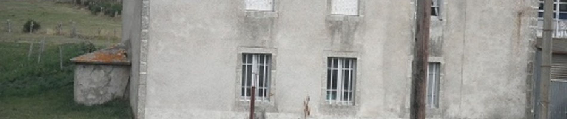
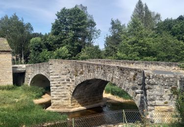
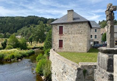
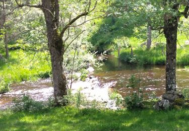
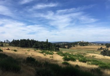
Départ devant "les hameaux de la Lozère". On parvient à Pruniérette, on continue sur Termes puis le chemin nous mène à travers prairies et bois jusqu'au moulin de la Grifette. On continue à travers la forêt jusque St-Chély-d'Apcher.
Localisation
Pays :
France
Région :
Occitanie
Département/Province :
Lozère
Commune :
Fournels
Localité :
Unknown
Départ:(Dec)
Départ:(UTM)
509119 ; 4962607 (31T) N.
Commentaires
Randonnées à proximité
![Randonnée A pied Chauchailles - le sentier des Espagnols - Photo](https://media.geolcdn.com/t/375/260/ext.jpg?maxdim=2&url=https%3A%2F%2Fstatic1.geolcdn.com%2Fsiteimages%2Fupload%2Ffiles%2F1545311037marcheuse_200dpi.jpg)
![A pied A pied](https://static1.geolcdn.com/sitytour/trail-icons/100.png)
le sentier des Espagnols
A pied
Difficile
(1)
Chauchailles,
Occitanie,
Lozère,
France
![](/images/other/stat-length.png)
22 km | 31 km-effort
7h 7min
![](https://static1.geolcdn.com/siteimages/upload/files/16400158638029165_repeat_loop_refresh_sync_direction_icon.png)
Oui
![Randonnée Marche Chauchailles - sentier des espagnols - Photo](https://media.geolcdn.com/t/375/260/3a0f3874-78ce-48ea-a436-24dea33476d2.jpg&format=jpg&maxdim=2)
![Marche Marche](https://static1.geolcdn.com/sitytour/trail-icons/101.png)
sentier des espagnols
Marche
Difficile
Chauchailles,
Occitanie,
Lozère,
France
![](/images/other/stat-length.png)
22 km | 32 km-effort
6h 48min
![](https://static1.geolcdn.com/siteimages/upload/files/16400158638029165_repeat_loop_refresh_sync_direction_icon.png)
Oui
![Randonnée Marche Chauchailles - Gorges du Bèz sentier des espagnols - Photo](https://media.geolcdn.com/t/375/260/9def8888-645c-4270-a3bb-b3f990eb7ef3.jpg&format=jpg&maxdim=2)
![Marche Marche](https://static1.geolcdn.com/sitytour/trail-icons/101.png)
Gorges du Bèz sentier des espagnols
Marche
Très difficile
Chauchailles,
Occitanie,
Lozère,
France
![](/images/other/stat-length.png)
22 km | 31 km-effort
7h 34min
![](https://static1.geolcdn.com/siteimages/upload/files/16400158638029165_repeat_loop_refresh_sync_direction_icon.png)
Oui
![Randonnée Marche Termes - Termes Aumont aubrac - Photo](https://media.geolcdn.com/t/375/260/f87d16b1-1f73-4a88-8df5-61d0347ec4b8.jpg&format=jpg&maxdim=2)
![Marche Marche](https://static1.geolcdn.com/sitytour/trail-icons/101.png)
Termes Aumont aubrac
Marche
Moyen
Termes,
Occitanie,
Lozère,
France
![](/images/other/stat-length.png)
19,1 km | 23 km-effort
7h 22min
![](https://static1.geolcdn.com/siteimages/upload/files/16400158638029165_repeat_loop_refresh_sync_direction_icon.png)
Non
![Randonnée Marche Termes - TERMES 48 - autour de la Rau de la FAGE - Photo](https://media.geolcdn.com/t/375/260/ext.jpg?maxdim=2&url=https%3A%2F%2Fservices.sitytrail.com%2FGeolivesWS%2FDownloadMedia.ashx%3FTrailID%3D445928%26Media%3D20150715150322.jpg)
![Marche Marche](https://static1.geolcdn.com/sitytour/trail-icons/101.png)
TERMES 48 - autour de la Rau de la FAGE
Marche
Moyen
Termes,
Occitanie,
Lozère,
France
![](/images/other/stat-length.png)
12,2 km | 15,4 km-effort
2h 36min
![](https://static1.geolcdn.com/siteimages/upload/files/16400158638029165_repeat_loop_refresh_sync_direction_icon.png)
Oui
![Randonnée Marche Termes - TERMES 48 - petit circuit - Photo](https://media.geolcdn.com/t/375/260/ext.jpg?maxdim=2&url=https%3A%2F%2Fservices.sitytrail.com%2FGeolivesWS%2FDownloadMedia.ashx%3FTrailID%3D445926%26Media%3D20150712174806.jpg)
![Marche Marche](https://static1.geolcdn.com/sitytour/trail-icons/101.png)
TERMES 48 - petit circuit
Marche
Facile
(1)
Termes,
Occitanie,
Lozère,
France
![](/images/other/stat-length.png)
7,3 km | 8,8 km-effort
1h 46min
![](https://static1.geolcdn.com/siteimages/upload/files/16400158638029165_repeat_loop_refresh_sync_direction_icon.png)
Oui
![Randonnée Marche Chauchailles - Les Gorges du Bes - Photo](https://media.geolcdn.com/t/375/260/ext.jpg?maxdim=2&url=https%3A%2F%2Fservices.sitytrail.com%2FGeolivesWS%2FDownloadMedia.ashx%3FTrailID%3D103575%26Media%3D5887_6.jpg)
![Marche Marche](https://static1.geolcdn.com/sitytour/trail-icons/101.png)
Les Gorges du Bes
Marche
Difficile
(1)
Chauchailles,
Occitanie,
Lozère,
France
![](/images/other/stat-length.png)
21 km | 30 km-effort
7h 0min
![](https://static1.geolcdn.com/siteimages/upload/files/16400158638029165_repeat_loop_refresh_sync_direction_icon.png)
Oui
![Randonnée Marche Chauchailles - les Gorges du Bes - Photo](https://media.geolcdn.com/t/375/260/c987b7ea-518c-4395-9a06-f2e4d18857b3.jpg&format=jpg&maxdim=2)
![Marche Marche](https://static1.geolcdn.com/sitytour/trail-icons/101.png)
les Gorges du Bes
Marche
Moyen
Chauchailles,
Occitanie,
Lozère,
France
![](/images/other/stat-length.png)
15,3 km | 21 km-effort
7h 7min
![](https://static1.geolcdn.com/siteimages/upload/files/16400158638029165_repeat_loop_refresh_sync_direction_icon.png)
Oui
![Randonnée Marche Saint-Juéry - Le Bes - Photo](https://media.geolcdn.com/t/375/260/ab6404e2-993f-412a-b877-fdd25667143f.jpg&format=jpg&maxdim=2)
![Marche Marche](https://static1.geolcdn.com/sitytour/trail-icons/101.png)