Randonnée V.T.T. Saint-Gilles - Balade St-Gillaise - St-Gilles - Photo

Balade St-Gillaise - St-Gilles

 tracegps
tracegps

Utilisateur

© OpenStreetMap contributors
Longueur
Longueur
23 km
Altitude max
Altitude max
109 m
Dénivelé positif
Dénivelé positif
382 m
Km-Effort
Km-Effort  
28 km
Altitude min
Altitude min
4 m
Dénivelé négatif
Dénivelé négatif
382 m
Boucle
Boucle
Oui
Date de création :
2014-12-10 00:00:00.0
Dernière modification :
2014-12-10 00:00:00.0

(1 Avis)

V.T.T.
V.T.T.
2h30
Difficulté : Moyen

Scannez ce code QR pour ouvrir la randonnée dans l'application SityTrail

Application GPS de randonnée GRATUITE

Logo SityTrail SityTrail

IGN / Instituts géographiques

Télécharger SityTrail sur l'App Store Télécharger SityTrail sur Google Play

Logo SityTrail SityTrail World

Le monde est à vous

Télécharger SityTrail sur l'App Store Télécharger SityTrail sur Google Play Télécharger SityTrail sur Huawei AppGallery

À propos

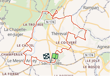
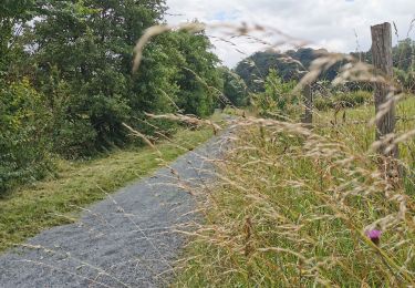
Randonnée V.T.T. de 23 km à découvrir à Normandie, Manche, Saint-Gilles. Cette randonnée est proposée par tracegps.

Description

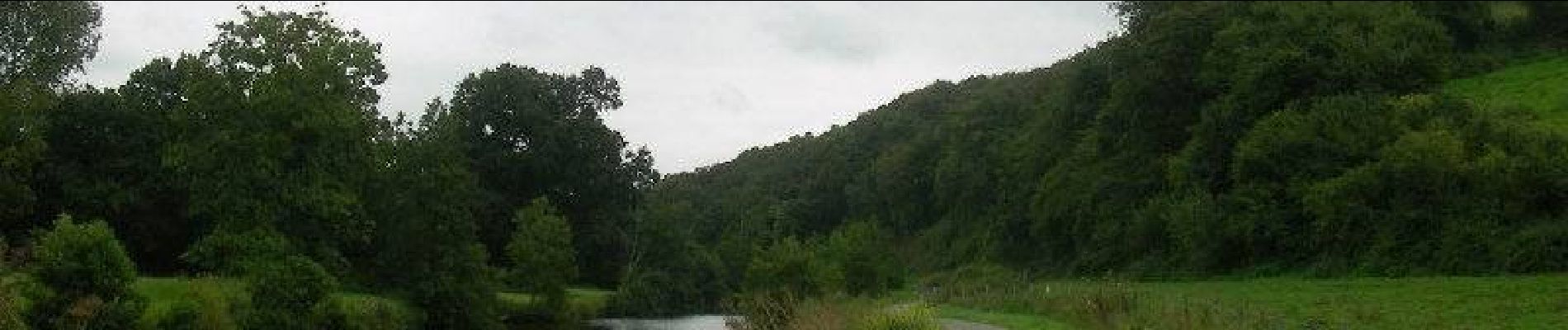
Balade de 23km sur route et chemin en bord de rivière à certains endroits. vous longerez aussi le chemin de halage. Randonnée sans grosse difficulté.

Profil altimétrique

Photos

Localisation

Pays :
France
Région :
Normandie
Département/Province :
Manche
Commune :
Saint-Gilles
Localité :
Unknown
Départ:(Dec)
Départ:(UTM)
633149 ; 5440668 (30U) N.

Commentaires

Veuillez vous connecter pour laisser un commentaire ou une note


Randonnées à proximité

Randonnée Marche Saint-Gilles - St Gilles Château de Canisy - Photo
Marche
guy50880

Marche

Très facile
Saint-Gilles, Normandie, Manche, France
9 km | 10,7 km-effort
2h 26min
Oui
Randonnée V.T.T. Agneaux - L'Agnelaise 2014 - Agneaux - Photo
V.T.T.
tracegps

V.T.T.

Difficile
Agneaux, Normandie, Manche, France
44 km | 52 km-effort
3h 0min
Oui
Randonnée Marche Canisy - Le circuit Jean Follain - Canisy - Photo
Marche
tracegps

Marche

Moyen
Canisy, Normandie, Manche, France
9,2 km | 10,9 km-effort
2h 19min
Oui
Randonnée Cyclotourisme Saint-Lô - Vélomaritime Cherbourg Caen #J4 20210708 Saint-Lô - Courson - Photo
Cyclotourisme
BureauChris

Cyclotourisme

Très facile
Saint-Lô, Normandie, Manche, France
44 km | 51 km-effort
Inconnu
Non
Randonnée V.T.T. Agneaux - Marathon Saint Lois -Agneaux - Photo
V.T.T.
tracegps

V.T.T.

Très difficile
Agneaux, Normandie, Manche, France
75 km | 92 km-effort
5h 0min
Oui
Randonnée V.T.T. Agneaux - Le tour de Saint Lô en VTT - Photo
V.T.T.
tracegps

V.T.T.

Difficile
Agneaux, Normandie, Manche, France
44 km | 54 km-effort
3h 0min
Oui
Randonnée V.T.T. Agneaux - VTT près d'Agneaux - Photo
V.T.T.
tracegps

V.T.T.

Difficile
Agneaux, Normandie, Manche, France
41 km | 49 km-effort
3h 0min
Non
Randonnée Marche Marigny-Le-Lozon - Marigny le lozon - Photo
Marche
Yvon59

Marche

Moyen
Marigny-Le-Lozon, Normandie, Manche, France
10,3 km | 11,7 km-effort
2h 35min
Oui
Randonnée Marche Le Mesnil-Amey - Le Mesnil Hamey - Photo
Marche
Bubux

Marche

Moyen
Le Mesnil-Amey, Normandie, Manche, France
8,3 km | 9,9 km-effort
2h 41min
Non


Fermer
Mes abonnements