Randonnée V.T.T. La Puisaye - Le bois de la Saucelle - La Puisaye - Photo

Le bois de la Saucelle - La Puisaye

 tracegps
tracegps

Utilisateur

© OpenStreetMap contributors
Longueur
Longueur
11,2 km
Altitude max
Altitude max
248 m
Dénivelé positif
Dénivelé positif
87 m
Km-Effort
Km-Effort  
12,4 km
Altitude min
Altitude min
200 m
Dénivelé négatif
Dénivelé négatif
89 m
Boucle
Boucle
Oui
Date de création :
2014-12-10 00:00:00.0
Dernière modification :
2014-12-10 00:00:00.0

(0 Avis)

V.T.T.
V.T.T.
1h00
Difficulté : Facile

Scannez ce code QR pour ouvrir la randonnée dans l'application SityTrail

Application GPS de randonnée GRATUITE

Logo SityTrail SityTrail

IGN / Instituts géographiques

Télécharger SityTrail sur l'App Store Télécharger SityTrail sur Google Play

Logo SityTrail SityTrail World

Le monde est à vous

Télécharger SityTrail sur l'App Store Télécharger SityTrail sur Google Play Télécharger SityTrail sur Huawei AppGallery

À propos

Randonnée V.T.T. de 11,2 km à découvrir à Centre-Val de Loire, Eure-et-Loir, La Puisaye. Cette randonnée est proposée par tracegps.

Description

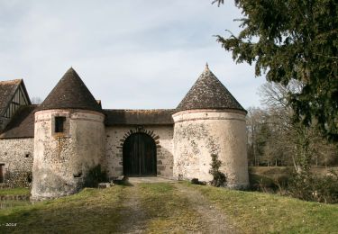
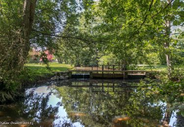
Circuit proposé par la Communauté de communes de l’Orée du Perche et le syndicat d'initiative de Senonches. Le nom des villages de La Puisaye et des Ressuintes évoque l'abondance des eaux de surface. Ils sont reliés par la Meuvette qui traverse les étangs d'Haron et de Rouge. A la bonne saison le chant soutenu des grenouilles vous accompagnera en forêt ! Départ du parking du terrain de boules près de l'église. Retrouvez le circuit et son descriptif sur le site du Comité départemental de l’Eure-et-Loir.

Profil altimétrique

Photos

Localisation

Pays :
France
Région :
Centre-Val de Loire
Département/Province :
Eure-et-Loir
Commune :
La Puisaye
Localité :
Unknown
Départ:(Dec)
Départ:(UTM)
349439 ; 5385952 (31U) N.

Randonnées à proximité

Randonnée Marche La Ferté-Vidame - La Ferté-Vidame - Longny-au-Perche (Longny-les-Villages) 23 km - Photo
Marche

Marche

Très difficile
La Ferté-Vidame, Centre-Val de Loire, Eure-et-Loir, France
23 km | 25 km-effort
5h 35min
Non
Randonnée Marche La Ferté-Vidame - La Ferté-Vidame - Tourouvre (TCP) 29 km - Photo
Marche

Marche

Moyen
La Ferté-Vidame, Centre-Val de Loire, Eure-et-Loir, France
29 km | 33 km-effort
7h 9min
Non
Randonnée Marche La Ferté-Vidame - La Ferté-Vidame - Moutiers-au-Perche (TCP) 28 km - Photo
Marche

Marche

Facile
La Ferté-Vidame, Centre-Val de Loire, Eure-et-Loir, France
28 km | 32 km-effort
7h 1min
Non
Randonnée Marche La Ferté-Vidame - La Ferté-Vidame - Saint-Maurice-lès-Charencey 15 km - Photo
Marche

Marche

Facile
(1)
La Ferté-Vidame, Centre-Val de Loire, Eure-et-Loir, France
15,3 km | 16,9 km-effort
3h 34min
Non
Randonnée Marche Senonches - Tardais 07.22 - Photo
Marche
togolo28

Marche

Facile
(1)
Senonches, Centre-Val de Loire, Eure-et-Loir, France
7,2 km | 8,3 km-effort
1h 50min
Oui
Randonnée Marche La Ferté-Vidame - La Ferté-Vidame - Senonches 17 km - Photo
Marche

Marche

Facile
La Ferté-Vidame, Centre-Val de Loire, Eure-et-Loir, France
16,7 km | 18,5 km-effort
4h 36min
Non
Randonnée V.T.T. La Ferté-Vidame - Autour de la forêt (Etape 1) -  La Ferté-Vidame - Photo
V.T.T.
tracegps

V.T.T.

Moyen
(1)
La Ferté-Vidame, Centre-Val de Loire, Eure-et-Loir, France
19,5 km | 22 km-effort
2h 0min
Non
Randonnée Marche La Ferté-Vidame - Autour de la forêt (Etape 1) -  La Ferté-Vidame - Photo
Marche
tracegps

Marche

Difficile
La Ferté-Vidame, Centre-Val de Loire, Eure-et-Loir, France
19,5 km | 22 km-effort
5h 19min
Non
Randonnée Marche Senonches - Forêt domaniale de Senonches - Photo
Marche
tracegps

Marche

Moyen
Senonches, Centre-Val de Loire, Eure-et-Loir, France
10,6 km | 12,2 km-effort
3h 0min
Oui


Fermer
Mes abonnements