![](/images/other/stat-length.png)
![Randonnée Cheval Saméon - L'Equi-Pévèloise - Saméon - Photo](https://media.geolcdn.com/t/1900/400/ext.pjpeg?maxdim=2&url=https%3A%2F%2Fservices.sitytrail.com%2FGeolivesWS%2FDownloadMedia.ashx%3FTrailID%3D172514%26Media%3D13874_3.jpg)
L'Equi-Pévèloise - Saméon
tracegps
Utilisateur
![Longueur](/images/other/stat-length.png)
![Altitude max](https://static1.geolcdn.com/siteimages/upload/files/1508320355ic_sort_altitude_max_24dp.png)
![Dénivelé positif](https://static1.geolcdn.com/siteimages/upload/files/1508320355ic_sort_den_pos_24dp.png)
![Km-Effort](/images/other/stat-length.png)
![Altitude min](https://static1.geolcdn.com/siteimages/upload/files/1508320355ic_sort_altitude_min_24dp.png)
![Dénivelé négatif](https://static1.geolcdn.com/siteimages/upload/files/1508320355ic_sort_den_neg_24dp.png)
![Boucle](https://static1.geolcdn.com/siteimages/upload/files/16400158638029165_repeat_loop_refresh_sync_direction_icon.png)
![Cheval](https://static1.geolcdn.com/sitytour/trail-icons/300.png)
4h00
Difficulté : Difficile
![Scannez ce code QR pour ouvrir la randonnée dans l'application SityTrail](https://capi.geolives.com/qq0zvz2zws4bq2lad0pu/sitytour/trails/172514/qr.png?size=200)
Application GPS de randonnée GRATUITE
À propos
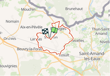
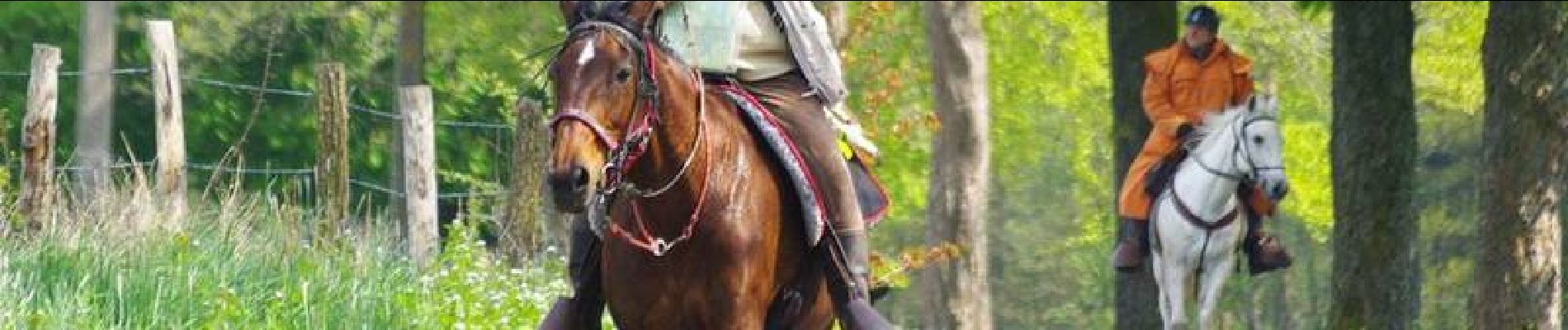
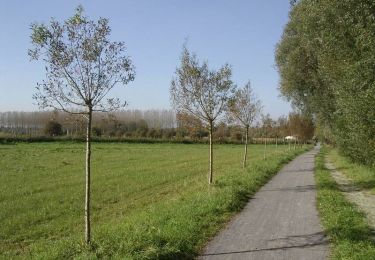
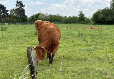
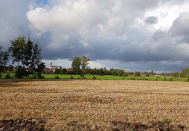
Randonnée Cheval de 24 km à découvrir à Hauts-de-France, Nord, Saméon. Cette randonnée est proposée par tracegps.
Description
Circuit proposé par le Pays Pévèlois. Venez découvrir une boucle équestre au cœur du Pays Pévèlois, au départ du parking de la mairie de Saméon. A 30 minutes des grandes villes du Nord, des kilomètres de sentiers balisés et entretenus sont là pour vous promettre de belles balades. A cheval ou en attelage, tout est fait pour vous accueillir ! Des services mais aussi des professionnels sont à la disposition des randonneurs pour la confection de leur séjour. Téléchargez la carte des boucles équestres (accessibles aux cavaliers et aux meneurs d'attelage).
Localisation
Commentaires
Randonnées à proximité
![Randonnée Vélo Orchies - La voie verte de la plaine de la Scarpe - Orchies à Fenain - Photo](https://media.geolcdn.com/t/375/260/ext.jpg?maxdim=2&url=https%3A%2F%2Fservices.sitytrail.com%2FGeolivesWS%2FDownloadMedia.ashx%3FTrailID%3D112763%26Media%3D12112_6.jpg)
![Vélo Vélo](https://static1.geolcdn.com/sitytour/trail-icons/200.png)
Vélo
![](/images/other/stat-length.png)
![](https://static1.geolcdn.com/siteimages/upload/files/16400158638029165_repeat_loop_refresh_sync_direction_icon.png)
![Randonnée A pied Brunehaut - Circuit des pépinières de Lesdain - Photo](https://media.geolcdn.com/t/375/260/ext.jpg?maxdim=2&url=https%3A%2F%2Fpivotmedia.tourismewallonie.be%2FANX-02-04JM-0024%2FANX-02-04JM-0024.jpg)
![A pied A pied](https://static1.geolcdn.com/sitytour/trail-icons/100.png)
A pied
![](/images/other/stat-length.png)
![](https://static1.geolcdn.com/siteimages/upload/files/16400158638029165_repeat_loop_refresh_sync_direction_icon.png)
![Randonnée Marche Brunehaut - RB - H - 15 Lesdain - Photo](https://media.geolcdn.com/t/375/260/ext.jpg?maxdim=2&url=https%3A%2F%2Fservices.sitytrail.com%2FGeolivesWS%2FDownloadMedia.ashx%3FTrailID%3D617918%26Media%3Dfix__20160820190940.jpg)
![Marche Marche](https://static1.geolcdn.com/sitytour/trail-icons/101.png)
Marche
![](/images/other/stat-length.png)
![](https://static1.geolcdn.com/siteimages/upload/files/16400158638029165_repeat_loop_refresh_sync_direction_icon.png)
![Randonnée Marche Brillon - Brillon 19,5 km - Photo](https://media.geolcdn.com/t/375/260/8348b51e-ddf1-48f9-9840-0c66c1e237c6.jpg&format=jpg&maxdim=2)
![Marche Marche](https://static1.geolcdn.com/sitytour/trail-icons/101.png)
Marche
![](/images/other/stat-length.png)
![](https://static1.geolcdn.com/siteimages/upload/files/16400158638029165_repeat_loop_refresh_sync_direction_icon.png)
![Randonnée Marche Brunehaut - Rongy 11,1 km - Photo](https://media.geolcdn.com/t/375/260/f465c305-b738-40d1-b766-ceee6be80af7.jpg&format=jpg&maxdim=2)
![Marche Marche](https://static1.geolcdn.com/sitytour/trail-icons/101.png)
Marche
![](/images/other/stat-length.png)
![](https://static1.geolcdn.com/siteimages/upload/files/16400158638029165_repeat_loop_refresh_sync_direction_icon.png)
![Randonnée Marche Brunehaut - Les Vergers du Tournaisis - Photo](https://media.geolcdn.com/t/375/260/c9b3196c-a5f5-49bd-9d0f-43b6b6e00d5e.jpg&format=jpg&maxdim=2)
![Marche Marche](https://static1.geolcdn.com/sitytour/trail-icons/101.png)
Marche
![](/images/other/stat-length.png)
![](https://static1.geolcdn.com/siteimages/upload/files/16400158638029165_repeat_loop_refresh_sync_direction_icon.png)
![Randonnée Marche Brunehaut - les vergers de Rongy - Photo](https://media.geolcdn.com/t/375/260/1763f84f-5783-410f-85fb-29df285d6bed.jpg&format=jpg&maxdim=2)
![Marche Marche](https://static1.geolcdn.com/sitytour/trail-icons/101.png)
Marche
![](/images/other/stat-length.png)
![](https://static1.geolcdn.com/siteimages/upload/files/16400158638029165_repeat_loop_refresh_sync_direction_icon.png)
![Randonnée Marche Brunehaut - Les pommes - Photo](https://media.geolcdn.com/t/375/260/11a0d344-3bb3-46d1-83b4-4a3448e1424a.jpg&format=jpg&maxdim=2)
![Marche Marche](https://static1.geolcdn.com/sitytour/trail-icons/101.png)
Marche
![](/images/other/stat-length.png)
![](https://static1.geolcdn.com/siteimages/upload/files/16400158638029165_repeat_loop_refresh_sync_direction_icon.png)
![Randonnée Marche Brunehaut - Circuit des pépinières de Lesdain - Photo](https://media.geolcdn.com/t/375/260/ext.jpg?maxdim=2&url=https%3A%2F%2Fservices.sitytrail.com%2FGeolivesWS%2FDownloadMedia.ashx%3FTrailID%3D202878%26Media%3Df962bf0e-8f32-41ae-9bb2-e715560e964e.jpg)
![Marche Marche](https://static1.geolcdn.com/sitytour/trail-icons/101.png)
Marche
![](/images/other/stat-length.png)
![](https://static1.geolcdn.com/siteimages/upload/files/16400158638029165_repeat_loop_refresh_sync_direction_icon.png)