![](/images/other/stat-length.png)
![Randonnée Marche Carantec - Tour de Carantec - Photo](https://media.geolcdn.com/t/1900/400/ext.pjpeg?maxdim=2&url=https%3A%2F%2Fservices.sitytrail.com%2FGeolivesWS%2FDownloadMedia.ashx%3FTrailID%3D172488%26Media%3D13846_3.jpg)
Tour de Carantec
tracegps
Utilisateur
![Longueur](/images/other/stat-length.png)
Longueur
17,7 km
![Altitude max](https://static1.geolcdn.com/siteimages/upload/files/1508320355ic_sort_altitude_max_24dp.png)
Altitude max
68 m
![Dénivelé positif](https://static1.geolcdn.com/siteimages/upload/files/1508320355ic_sort_den_pos_24dp.png)
Dénivelé positif
306 m
![Km-Effort](/images/other/stat-length.png)
Km-Effort
22 km
![Altitude min](https://static1.geolcdn.com/siteimages/upload/files/1508320355ic_sort_altitude_min_24dp.png)
Altitude min
0 m
![Dénivelé négatif](https://static1.geolcdn.com/siteimages/upload/files/1508320355ic_sort_den_neg_24dp.png)
Dénivelé négatif
304 m
![Boucle](https://static1.geolcdn.com/siteimages/upload/files/16400158638029165_repeat_loop_refresh_sync_direction_icon.png)
Boucle
Oui
Date de création :
2016-03-09 00:00:00.0
Dernière modification :
2016-03-09 00:00:00.0
![Marche](https://static1.geolcdn.com/sitytour/trail-icons/101.png)
4h30
Difficulté : Difficile
![Scannez ce code QR pour ouvrir la randonnée dans l'application SityTrail](https://capi.geolives.com/qq0zvz2zws4bq2lad0pu/sitytour/trails/172488/qr.png?size=200)
Application GPS de randonnée GRATUITE
À propos
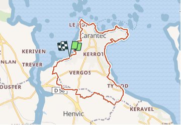
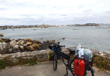
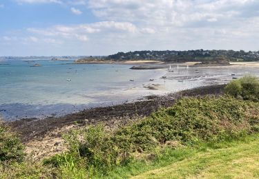
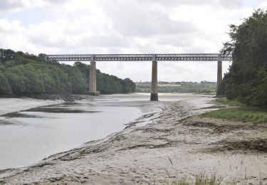
Randonnée Marche de 17,7 km à découvrir à Bretagne, Finistère, Carantec. Cette randonnée est proposée par tracegps.
Description
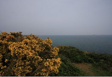
Une partie du circuit emprunte le GR34 le long de la côte et l'autre partie la campagne au milieu des champs de légumes. Topo Guide des Pays de Morlaix FFR.
Localisation
Pays :
France
Région :
Bretagne
Département/Province :
Finistère
Commune :
Carantec
Localité :
Unknown
Départ:(Dec)
Départ:(UTM)
431518 ; 5389902 (30U) N.
Commentaires
Randonnées à proximité
![Randonnée Marche Carantec - N°2 Carantec - Roscoff (30.08.23) - Photo](https://media.geolcdn.com/t/375/260/ext.jpg?maxdim=2&url=https%3A%2F%2Fstatic1.geolcdn.com%2Fsiteimages%2Fupload%2Ffiles%2F1553511878bg_sport_marche.png)
![Marche Marche](https://static1.geolcdn.com/sitytour/trail-icons/101.png)
N°2 Carantec - Roscoff (30.08.23)
Marche
Très difficile
(1)
Carantec,
Bretagne,
Finistère,
France
![](/images/other/stat-length.png)
22 km | 25 km-effort
5h 43min
![](https://static1.geolcdn.com/siteimages/upload/files/16400158638029165_repeat_loop_refresh_sync_direction_icon.png)
Non
![Randonnée Autre activité Carantec - le frout - ile calot 23,km - Photo](https://media.geolcdn.com/t/375/260/ext.jpg?maxdim=2&url=https%3A%2F%2Fservices.sitytrail.com%2FGeolivesWS%2FDownloadMedia.ashx%3FTrailID%3D558971%26Media%3Dfix__20160425130033.jpg)
![Autre activité Autre activité](https://static1.geolcdn.com/sitytour/trail-icons/900.png)
le frout - ile calot 23,km
Autre activité
Très facile
(2)
Carantec,
Bretagne,
Finistère,
France
![](/images/other/stat-length.png)
23 km | 28 km-effort
6h 4min
![](https://static1.geolcdn.com/siteimages/upload/files/16400158638029165_repeat_loop_refresh_sync_direction_icon.png)
Oui
![Randonnée Marche Carantec - 30.08.23 Carantec -- Roscoff - Photo](https://media.geolcdn.com/t/375/260/a939044f-ea50-435a-ad51-7a43207b839a.jpg&format=jpg&maxdim=2)
![Marche Marche](https://static1.geolcdn.com/sitytour/trail-icons/101.png)
30.08.23 Carantec -- Roscoff
Marche
Très difficile
Carantec,
Bretagne,
Finistère,
France
![](/images/other/stat-length.png)
23 km | 26 km-effort
5h 54min
![](https://static1.geolcdn.com/siteimages/upload/files/16400158638029165_repeat_loop_refresh_sync_direction_icon.png)
Non
![Randonnée Marche Plouénan - Bretagne nord J3am - Plouénan - Carantec - Photo](https://media.geolcdn.com/t/375/260/fbfcf502-134b-411d-8e24-e15ad3669ff7.jpg&format=jpg&maxdim=2)
![Marche Marche](https://static1.geolcdn.com/sitytour/trail-icons/101.png)
Bretagne nord J3am - Plouénan - Carantec
Marche
Très facile
Plouénan,
Bretagne,
Finistère,
France
![](/images/other/stat-length.png)
9 km | 10,9 km-effort
2h 10min
![](https://static1.geolcdn.com/siteimages/upload/files/16400158638029165_repeat_loop_refresh_sync_direction_icon.png)
Non
![Randonnée Marche Carantec - Autour de Carantec ( GR34) - Photo](https://media.geolcdn.com/t/375/260/ext.jpg?maxdim=2&url=https%3A%2F%2Fservices.sitytrail.com%2FGeolivesWS%2FDownloadMedia.ashx%3FTrailID%3D577566%26Media%3D4ff25c3a-e18b-4096-9c2b-0ffe1f850942.jpg)
![Marche Marche](https://static1.geolcdn.com/sitytour/trail-icons/101.png)
Autour de Carantec ( GR34)
Marche
Facile
Carantec,
Bretagne,
Finistère,
France
![](/images/other/stat-length.png)
13,3 km | 15,8 km-effort
4h 14min
![](https://static1.geolcdn.com/siteimages/upload/files/16400158638029165_repeat_loop_refresh_sync_direction_icon.png)
Oui
![Randonnée Cyclotourisme Carantec - kermen à Goulven - Photo](https://media.geolcdn.com/t/375/260/1b0896a8-9fcc-41e5-a561-8f07dcc5f01b.jpg&format=jpg&maxdim=2)
![Cyclotourisme Cyclotourisme](https://static1.geolcdn.com/sitytour/trail-icons/204.png)
kermen à Goulven
Cyclotourisme
Difficile
Carantec,
Bretagne,
Finistère,
France
![](/images/other/stat-length.png)
53 km | 59 km-effort
4h 41min
![](https://static1.geolcdn.com/siteimages/upload/files/16400158638029165_repeat_loop_refresh_sync_direction_icon.png)
Non
![Randonnée Marche Henvic - HENVIC - Photo](https://media.geolcdn.com/t/375/260/7054e9a2-6688-4c1c-aa62-f85e7ae2b1d7.jpg&format=jpg&maxdim=2)
![Marche Marche](https://static1.geolcdn.com/sitytour/trail-icons/101.png)
![Randonnée Marche Carantec - Tour de l'île Callot - Photo](https://media.geolcdn.com/t/375/260/81a2c851-db0f-4393-b8b8-d71c962b11f2.jpg&format=jpg&maxdim=2)
![Marche Marche](https://static1.geolcdn.com/sitytour/trail-icons/101.png)
Tour de l'île Callot
Marche
Facile
Carantec,
Bretagne,
Finistère,
France
![](/images/other/stat-length.png)
9,9 km | 11,4 km-effort
3h 9min
![](https://static1.geolcdn.com/siteimages/upload/files/16400158638029165_repeat_loop_refresh_sync_direction_icon.png)
Oui
![Randonnée A pied Henvic - Boucle du Vanneg - Photo](https://media.geolcdn.com/t/375/260/f481ee96-ce92-46e0-b4ad-41ed96dba38e.jpeg&format=jpg&maxdim=2)
![A pied A pied](https://static1.geolcdn.com/sitytour/trail-icons/100.png)
Boucle du Vanneg
A pied
Facile
Henvic,
Bretagne,
Finistère,
France
![](/images/other/stat-length.png)
9,2 km | 11,4 km-effort
2h 34min
![](https://static1.geolcdn.com/siteimages/upload/files/16400158638029165_repeat_loop_refresh_sync_direction_icon.png)
Oui