![](/images/other/stat-length.png)
![Randonnée V.T.T. Sainte-Agathe-en-Donzy - A4 - VTT Montagnes du Matin - Sainte Agathe en Donzy - Photo](https://media.geolcdn.com/t/1900/400/ext.pjpeg?maxdim=2&url=https%3A%2F%2Fservices.sitytrail.com%2FGeolivesWS%2FDownloadMedia.ashx%3FTrailID%3D172322%26Media%3D13645_6.jpg)
A4 - VTT Montagnes du Matin - Sainte Agathe en Donzy
tracegps
Utilisateur
![Longueur](/images/other/stat-length.png)
![Altitude max](https://static1.geolcdn.com/siteimages/upload/files/1508320355ic_sort_altitude_max_24dp.png)
![Dénivelé positif](https://static1.geolcdn.com/siteimages/upload/files/1508320355ic_sort_den_pos_24dp.png)
![Km-Effort](/images/other/stat-length.png)
![Altitude min](https://static1.geolcdn.com/siteimages/upload/files/1508320355ic_sort_altitude_min_24dp.png)
![Dénivelé négatif](https://static1.geolcdn.com/siteimages/upload/files/1508320355ic_sort_den_neg_24dp.png)
![Boucle](https://static1.geolcdn.com/siteimages/upload/files/16400158638029165_repeat_loop_refresh_sync_direction_icon.png)
![V.T.T.](https://static1.geolcdn.com/sitytour/trail-icons/202.png)
2h00
Difficulté : Difficile
![Scannez ce code QR pour ouvrir la randonnée dans l'application SityTrail](https://capi.geolives.com/qq0zvz2zws4bq2lad0pu/sitytour/trails/172322/qr.png?size=200)
Application GPS de randonnée GRATUITE
À propos
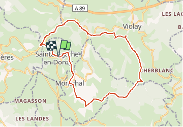
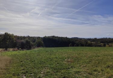
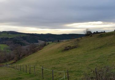
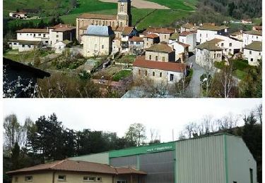
Randonnée V.T.T. de 17,9 km à découvrir à Auvergne-Rhône-Alpes, Loire, Sainte-Agathe-en-Donzy. Cette randonnée est proposée par tracegps.
Description
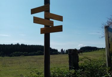
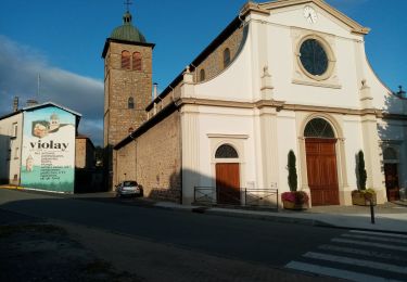
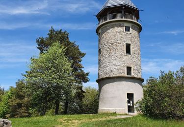
Parking et départ de la marie, remonter en passant devant l'église puis descendre par le «sentier botanique de la Belette». Pour plus d’infos, visitez le site de l' Office de Tourisme des Montagnes du Matin. Les Montagnes du Matin sont situées sur la partie ouest des monts du Lyonnais, côté Loire (42), vers la plaine du Forez. Carte avec le plan du réseau des 26 itinéraires VTT dans les Montagnes du Matin (350 km de sentiers aménagés) disponible dans les OT/SI de la région (Panissières, Violay, Balbigny, Roanne). Autre départ possible : Montchal (42360)
Localisation
Commentaires
Randonnées à proximité
![Randonnée Marche Violay - Randonnée de Violay - Photo](https://media.geolcdn.com/t/375/260/b78157fd-81fd-4bc7-9694-a9bddd2f8a7a.jpg&format=jpg&maxdim=2)
![Marche Marche](https://static1.geolcdn.com/sitytour/trail-icons/101.png)
Marche
![](/images/other/stat-length.png)
![](https://static1.geolcdn.com/siteimages/upload/files/16400158638029165_repeat_loop_refresh_sync_direction_icon.png)
![Randonnée Marche Violay - Randonnée au dessus de Violay - Photo](https://media.geolcdn.com/t/375/260/914fdf13-9068-40b2-8a60-d21e2612afe3.jpg&format=jpg&maxdim=2)
![Marche Marche](https://static1.geolcdn.com/sitytour/trail-icons/101.png)
Marche
![](/images/other/stat-length.png)
![](https://static1.geolcdn.com/siteimages/upload/files/16400158638029165_repeat_loop_refresh_sync_direction_icon.png)
![Randonnée Marche Montchal - randonnée de Montchal - Photo](https://media.geolcdn.com/t/375/260/ca094be3-a112-4258-b8ae-8d5bd31d7ca6.jpg&format=jpg&maxdim=2)
![Marche Marche](https://static1.geolcdn.com/sitytour/trail-icons/101.png)
Marche
![](/images/other/stat-length.png)
![](https://static1.geolcdn.com/siteimages/upload/files/16400158638029165_repeat_loop_refresh_sync_direction_icon.png)
![Randonnée Marche Sainte-Agathe-en-Donzy - Sentier botanique de la Belette - Photo](https://media.geolcdn.com/t/375/260/ext.jpg?maxdim=2&url=https%3A%2F%2Fstatic1.geolcdn.com%2Fsiteimages%2Fupload%2Ffiles%2F1553511878bg_sport_marche.png)
![Marche Marche](https://static1.geolcdn.com/sitytour/trail-icons/101.png)
Marche
![](/images/other/stat-length.png)
![](https://static1.geolcdn.com/siteimages/upload/files/16400158638029165_repeat_loop_refresh_sync_direction_icon.png)
![Randonnée Marche Violay - La Tour de Matagrin avec un départ à Violay - Photo](https://media.geolcdn.com/t/375/260/fa198858-1080-46a0-8e5e-b317e5494583.jpg&format=jpg&maxdim=2)
![Marche Marche](https://static1.geolcdn.com/sitytour/trail-icons/101.png)
Marche
![](/images/other/stat-length.png)
![](https://static1.geolcdn.com/siteimages/upload/files/16400158638029165_repeat_loop_refresh_sync_direction_icon.png)
![Randonnée Marche Violay - Départ de Violay - Photo](https://media.geolcdn.com/t/375/260/133748ea-395d-4ae8-8676-41a51b16fd2c.jpg&format=jpg&maxdim=2)
![Marche Marche](https://static1.geolcdn.com/sitytour/trail-icons/101.png)
Marche
![](/images/other/stat-length.png)
![](https://static1.geolcdn.com/siteimages/upload/files/16400158638029165_repeat_loop_refresh_sync_direction_icon.png)
![Randonnée Marche Violay - Violay - La Tour Matagrin - Photo](https://media.geolcdn.com/t/375/260/9fd45418-c881-4167-b97b-25160dce28f5.jpg&format=jpg&maxdim=2)
![Marche Marche](https://static1.geolcdn.com/sitytour/trail-icons/101.png)
Marche
![](/images/other/stat-length.png)
![](https://static1.geolcdn.com/siteimages/upload/files/16400158638029165_repeat_loop_refresh_sync_direction_icon.png)
![Randonnée Marche Sainte-Colombe-sur-Gand - viaduc du marteau - Photo](https://media.geolcdn.com/t/375/260/ext.jpg?maxdim=2&url=https%3A%2F%2Fservices.sitytrail.com%2FGeolivesWS%2FDownloadMedia.ashx%3FTrailID%3D505449%26Media%3Dfix__20151223160521.jpg)
![Marche Marche](https://static1.geolcdn.com/sitytour/trail-icons/101.png)
Marche
![](/images/other/stat-length.png)
![](https://static1.geolcdn.com/siteimages/upload/files/16400158638029165_repeat_loop_refresh_sync_direction_icon.png)
![Randonnée V.T.T. Sainte-Colombe-sur-Gand - Le viaduc du Pont Marteau - Sainte Colombe sur Gand - Photo](https://media.geolcdn.com/t/375/260/ext.jpg?maxdim=2&url=https%3A%2F%2Fservices.sitytrail.com%2FGeolivesWS%2FDownloadMedia.ashx%3FTrailID%3D317753%26Media%3D17064_6.jpg)
![V.T.T. V.T.T.](https://static1.geolcdn.com/sitytour/trail-icons/202.png)
V.T.T.
![](/images/other/stat-length.png)
![](https://static1.geolcdn.com/siteimages/upload/files/16400158638029165_repeat_loop_refresh_sync_direction_icon.png)