Randonnée Sports d'hiver Saint-Maurice-en-Trièves - Crête du Larchat - Photo
 marc.coste@free.fr
marc.coste@free.fr

Utilisateur

© OpenStreetMap contributors
Longueur
Longueur
10,7 km
Altitude max
Altitude max
1984 m
Dénivelé positif
Dénivelé positif
1034 m
Km-Effort
Km-Effort  
24 km
Altitude min
Altitude min
949 m
Dénivelé négatif
Dénivelé négatif
1034 m
Boucle
Boucle
Oui
Date de création :
2014-12-10 00:00:00.0
Dernière modification :
2014-12-10 00:00:00.0

(0 Avis)

Sports d'hiver
Sports d'hiver
3h20
Difficulté : Facile

Scannez ce code QR pour ouvrir la randonnée dans l'application SityTrail

Application GPS de randonnée GRATUITE

Logo SityTrail SityTrail

IGN / Instituts géographiques

Télécharger SityTrail sur l'App Store Télécharger SityTrail sur Google Play

Logo SityTrail SityTrail World

Le monde est à vous

Télécharger SityTrail sur l'App Store Télécharger SityTrail sur Google Play Télécharger SityTrail sur Huawei AppGallery

À propos

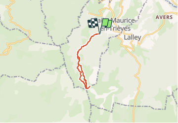
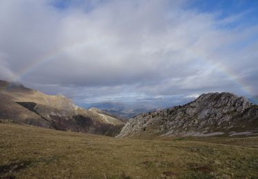
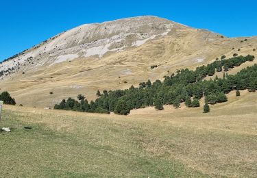
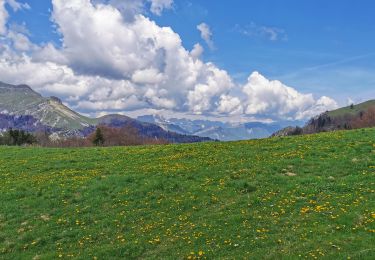
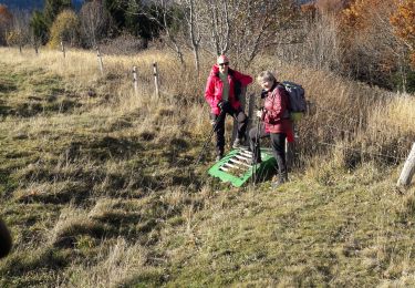
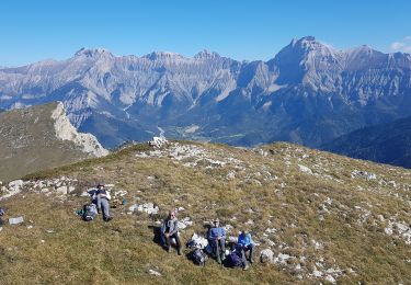
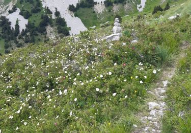
Randonnée Sports d'hiver de 10,7 km à découvrir à Auvergne-Rhône-Alpes, Isère, Saint-Maurice-en-Trièves. Cette randonnée est proposée par marc.coste@free.fr.

Profil altimétrique

Localisation

Pays :
France
Région :
Auvergne-Rhône-Alpes
Département/Province :
Isère
Commune :
Saint-Maurice-en-Trièves
Localité :
Unknown
Départ:(Dec)
Départ:(UTM)
710036 ; 4959650 (31T) N.

Randonnées à proximité

Randonnée Marche Chichilianne - Le Platary - Photo
Marche
patjobou

Marche

Moyen
(2)
Chichilianne, Auvergne-Rhône-Alpes, Isère, France
6,6 km | 12,1 km-effort
2h 29min
Oui
Randonnée Marche Châtillon-en-Diois - La boucle du Mont Barral - Photo
Marche
GUIDE
R@ph

Marche

Difficile
Châtillon-en-Diois, Auvergne-Rhône-Alpes, Drôme, France
7,5 km | 14,9 km-effort
3h 7min
Oui
Randonnée Marche Châtillon-en-Diois - mont barral - Photo
Marche
scalpy

Marche

Difficile
Châtillon-en-Diois, Auvergne-Rhône-Alpes, Drôme, France
7,7 km | 15 km-effort
4h 8min
Oui
Randonnée Marche Châtillon-en-Diois - 26 grimone j1 - Photo
Marche
randodyssée

Marche

Facile
Châtillon-en-Diois, Auvergne-Rhône-Alpes, Drôme, France
14,9 km | 26 km-effort
6h 15min
Non
Randonnée Marche Lalley - Serre Motaire et Lazare - Photo
Marche
PapouBertrand

Marche

Très difficile
Lalley, Auvergne-Rhône-Alpes, Isère, France
14,6 km | 24 km-effort
23h 45min
Oui
Randonnée Marche Lalley - le Rognon depuis le col de Lus - Photo
Marche
cmarit

Marche

Moyen
(1)
Lalley, Auvergne-Rhône-Alpes, Isère, France
14,6 km | 24 km-effort
6h 53min
Oui
Randonnée Marche Lalley - Rognon - Bouturet - Col des Selles - Photo
Marche
patjobou

Marche

Moyen
Lalley, Auvergne-Rhône-Alpes, Isère, France
15 km | 25 km-effort
6h 18min
Oui
Randonnée Marche Châtillon-en-Diois - menée le natal le jocou  - Photo
Marche
Joel26400

Marche

Difficile
Châtillon-en-Diois, Auvergne-Rhône-Alpes, Drôme, France
17,3 km | 34 km-effort
8h 56min
Oui
Randonnée Marche Châtillon-en-Diois - jocou par le mont Barral depuis le col de Menée   - Photo
Marche
cmarit

Marche

Moyen
Châtillon-en-Diois, Auvergne-Rhône-Alpes, Drôme, France
14,5 km | 28 km-effort
8h 35min
Oui


Fermer
Mes abonnements