![](/images/other/stat-length.png)
![Randonnée Marche Roquebrun - Vallon du Rieuberlou - Photo](https://media.geolcdn.com/t/1900/400/ext.pjpeg?maxdim=2&url=https%3A%2F%2Fservices.sitytrail.com%2FGeolivesWS%2FDownloadMedia.ashx%3FTrailID%3D170863%26Media%3D05198a6e-2760-4e52-b26c-bf2c959d96dc.jpg)
Vallon du Rieuberlou
jdelettrez
Utilisateur
![Longueur](/images/other/stat-length.png)
Longueur
13,2 km
![Altitude max](https://static1.geolcdn.com/siteimages/upload/files/1508320355ic_sort_altitude_max_24dp.png)
Altitude max
169 m
![Dénivelé positif](https://static1.geolcdn.com/siteimages/upload/files/1508320355ic_sort_den_pos_24dp.png)
Dénivelé positif
274 m
![Km-Effort](/images/other/stat-length.png)
Km-Effort
16,8 km
![Altitude min](https://static1.geolcdn.com/siteimages/upload/files/1508320355ic_sort_altitude_min_24dp.png)
Altitude min
85 m
![Dénivelé négatif](https://static1.geolcdn.com/siteimages/upload/files/1508320355ic_sort_den_neg_24dp.png)
Dénivelé négatif
274 m
![Boucle](https://static1.geolcdn.com/siteimages/upload/files/16400158638029165_repeat_loop_refresh_sync_direction_icon.png)
Boucle
Oui
Date de création :
2014-12-10 00:00:00.0
Dernière modification :
2014-12-10 00:00:00.0
![Marche](https://static1.geolcdn.com/sitytour/trail-icons/101.png)
3h23
Difficulté : Facile
![Scannez ce code QR pour ouvrir la randonnée dans l'application SityTrail](https://capi.geolives.com/qq0zvz2zws4bq2lad0pu/sitytour/trails/170863/qr.png?size=200)
Application GPS de randonnée GRATUITE
À propos
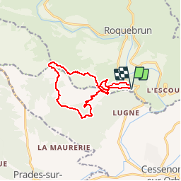
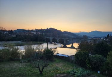
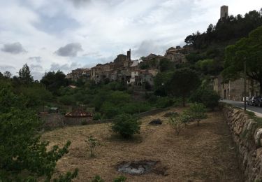
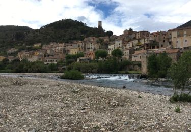
Randonnée Marche de 13,2 km à découvrir à Occitanie, Hérault, Roquebrun. Cette randonnée est proposée par jdelettrez.
Description
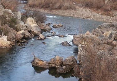
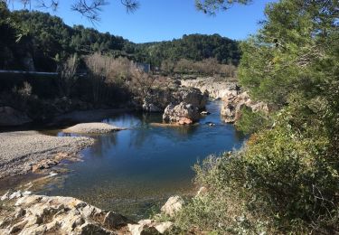
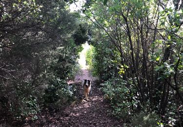
Une Jolie rando dans la vallée du RTEUBERLOU. Attention le passage du ruisseau se fait a gué : utiliser le pont 600m plus loin si besoin.
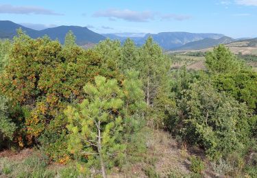
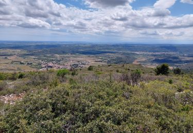
Le chemin manque de balise et,a certains endroits, les vignes ont été replantées entrainant le déplacement de la sente
Localisation
Pays :
France
Région :
Occitanie
Département/Province :
Hérault
Commune :
Roquebrun
Localité :
Unknown
Départ:(Dec)
Départ:(UTM)
502518 ; 4814088 (31T) N.
Commentaires
Randonnées à proximité
![Randonnée Marche Cessenon-sur-Orb - Cessenon Rives de l'Orb - Photo](https://media.geolcdn.com/t/375/260/ext.jpg?maxdim=2&url=https%3A%2F%2Fservices.sitytrail.com%2FGeolivesWS%2FDownloadMedia.ashx%3FTrailID%3D169953%26Media%3D04af9e60-af3a-487e-abf0-9064e60910a7.jpg)
![Marche Marche](https://static1.geolcdn.com/sitytour/trail-icons/101.png)
Cessenon Rives de l'Orb
Marche
Facile
(2)
Cessenon-sur-Orb,
Occitanie,
Hérault,
France
![](/images/other/stat-length.png)
12,5 km | 14,4 km-effort
3h 11min
![](https://static1.geolcdn.com/siteimages/upload/files/16400158638029165_repeat_loop_refresh_sync_direction_icon.png)
Oui
![Randonnée Marche Causses-et-Veyran - Mont Peyroux (Causses et Veyran) - Photo](https://media.geolcdn.com/t/375/260/ext.jpg?maxdim=2&url=https%3A%2F%2Fmedia.geolcdn.com%2Ff%2F9e8358e4-e82b-4fb9-ba94-ec7ad428195d.jpg)
![Marche Marche](https://static1.geolcdn.com/sitytour/trail-icons/101.png)
Mont Peyroux (Causses et Veyran)
Marche
Difficile
Causses-et-Veyran,
Occitanie,
Hérault,
France
![](/images/other/stat-length.png)
14,4 km | 22 km-effort
5h 30min
![](https://static1.geolcdn.com/siteimages/upload/files/16400158638029165_repeat_loop_refresh_sync_direction_icon.png)
Oui
![Randonnée Marche Causses-et-Veyran - Causses-et-Veyran / Chaos de Réals (Gourniès) / Viranel / Combe longue - Photo](https://media.geolcdn.com/t/375/260/ext.jpg?maxdim=2&url=https%3A%2F%2Fmedia.geolcdn.com%2Ff%2F378a0b30-8552-4963-b3d1-65237cb2e100.jpg)
![Marche Marche](https://static1.geolcdn.com/sitytour/trail-icons/101.png)
Causses-et-Veyran / Chaos de Réals (Gourniès) / Viranel / Combe longue
Marche
Moyen
Causses-et-Veyran,
Occitanie,
Hérault,
France
![](/images/other/stat-length.png)
13,3 km | 16,4 km-effort
4h 26min
![](https://static1.geolcdn.com/siteimages/upload/files/16400158638029165_repeat_loop_refresh_sync_direction_icon.png)
Oui
![Randonnée Marche Prades-sur-Vernazobre - Prades sur vernazobres - Photo](https://media.geolcdn.com/t/375/260/ext.jpg?maxdim=2&url=https%3A%2F%2Fservices.sitytrail.com%2FGeolivesWS%2FDownloadMedia.ashx%3FTrailID%3D922044%26Media%3D20180313092227.jpg)
![Marche Marche](https://static1.geolcdn.com/sitytour/trail-icons/101.png)
Prades sur vernazobres
Marche
Facile
(1)
Prades-sur-Vernazobre,
Occitanie,
Hérault,
France
![](/images/other/stat-length.png)
10,3 km | 14,1 km-effort
2h 59min
![](https://static1.geolcdn.com/siteimages/upload/files/16400158638029165_repeat_loop_refresh_sync_direction_icon.png)
Oui
![Randonnée Marche Roquebrun - roquebrun nord - Photo](https://media.geolcdn.com/t/375/260/ext.jpg?maxdim=2&url=https%3A%2F%2Fservices.sitytrail.com%2FGeolivesWS%2FDownloadMedia.ashx%3FTrailID%3D565590%26Media%3D20160507182104.jpg)
![Marche Marche](https://static1.geolcdn.com/sitytour/trail-icons/101.png)
roquebrun nord
Marche
Facile
(1)
Roquebrun,
Occitanie,
Hérault,
France
![](/images/other/stat-length.png)
9,7 km | 14,3 km-effort
2h 58min
![](https://static1.geolcdn.com/siteimages/upload/files/16400158638029165_repeat_loop_refresh_sync_direction_icon.png)
Oui
![Randonnée Marche Roquebrun - roquebrun sud - Photo](https://media.geolcdn.com/t/375/260/ext.jpg?maxdim=2&url=https%3A%2F%2Fservices.sitytrail.com%2FGeolivesWS%2FDownloadMedia.ashx%3FTrailID%3D562223%26Media%3D20160501141828.jpg)
![Marche Marche](https://static1.geolcdn.com/sitytour/trail-icons/101.png)
roquebrun sud
Marche
Très facile
Roquebrun,
Occitanie,
Hérault,
France
![](/images/other/stat-length.png)
9 km | 12,1 km-effort
2h 35min
![](https://static1.geolcdn.com/siteimages/upload/files/16400158638029165_repeat_loop_refresh_sync_direction_icon.png)
Oui
![Randonnée Marche Roquebrun - Les ayrolles depuis Ceps - Photo](https://media.geolcdn.com/t/375/260/ext.jpg?maxdim=2&url=https%3A%2F%2Fmedia.geolcdn.com%2Ff%2Fabae1a60-6e11-4a79-90ef-f0cfb3779c9c.jpg)
![Marche Marche](https://static1.geolcdn.com/sitytour/trail-icons/101.png)
Les ayrolles depuis Ceps
Marche
Facile
Roquebrun,
Occitanie,
Hérault,
France
![](/images/other/stat-length.png)
9,1 km | 13,7 km-effort
2h 45min
![](https://static1.geolcdn.com/siteimages/upload/files/16400158638029165_repeat_loop_refresh_sync_direction_icon.png)
Oui
![Randonnée Marche Roquebrun - 24 p1 - Photo](https://media.geolcdn.com/t/375/260/ext.jpg?maxdim=2&url=https%3A%2F%2Fmedia.geolcdn.com%2Ff%2F7479d1b2-90cb-4e30-ab4e-74ac3778cb70.jpg)
![Marche Marche](https://static1.geolcdn.com/sitytour/trail-icons/101.png)
24 p1
Marche
Très difficile
Roquebrun,
Occitanie,
Hérault,
France
![](/images/other/stat-length.png)
16,8 km | 23 km-effort
4h 52min
![](https://static1.geolcdn.com/siteimages/upload/files/16400158638029165_repeat_loop_refresh_sync_direction_icon.png)
Oui
![Randonnée Marche Saint-Nazaire-de-Ladarez - Saint nazaire de ladarez version 3 - Photo](https://media.geolcdn.com/t/375/260/ext.jpg?maxdim=2&url=https%3A%2F%2Fmedia.geolcdn.com%2Ff%2F6621ac7c-0ab1-4182-94a5-19c081a80a36.jpg)
![Marche Marche](https://static1.geolcdn.com/sitytour/trail-icons/101.png)
Saint nazaire de ladarez version 3
Marche
Difficile
Saint-Nazaire-de-Ladarez,
Occitanie,
Hérault,
France
![](/images/other/stat-length.png)
9,9 km | 14,4 km-effort
4h 33min
![](https://static1.geolcdn.com/siteimages/upload/files/16400158638029165_repeat_loop_refresh_sync_direction_icon.png)
Oui