Randonnée Marche Ballan-Miré - Ballan-Mité - Photo
 LEMENIO
LEMENIO

Utilisateur

© OpenStreetMap contributors
Longueur
Longueur
12,3 km
Altitude max
Altitude max
97 m
Dénivelé positif
Dénivelé positif
113 m
Km-Effort
Km-Effort  
13,8 km
Altitude min
Altitude min
40 m
Dénivelé négatif
Dénivelé négatif
120 m
Boucle
Boucle
Oui
Date de création :
2014-12-10 00:00:00.0
Dernière modification :
2014-12-10 00:00:00.0

(0 Avis)

Marche
Marche
3h03
Difficulté : Facile

Scannez ce code QR pour ouvrir la randonnée dans l'application SityTrail

Application GPS de randonnée GRATUITE

Logo SityTrail SityTrail

IGN / Instituts géographiques

Télécharger SityTrail sur l'App Store Télécharger SityTrail sur Google Play

Logo SityTrail SityTrail World

Le monde est à vous

Télécharger SityTrail sur l'App Store Télécharger SityTrail sur Google Play Télécharger SityTrail sur Huawei AppGallery

À propos

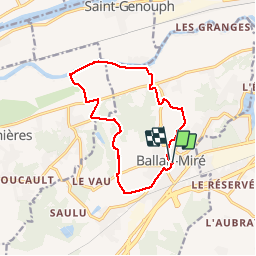
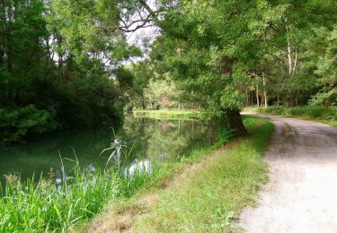
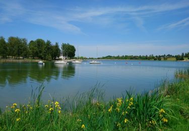
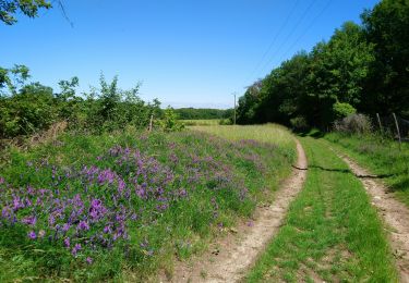
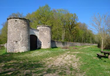
Randonnée Marche de 12,3 km à découvrir à Centre-Val de Loire, Indre-et-Loire, Ballan-Miré. Cette randonnée est proposée par LEMENIO.

Description

Départ place de la mairie
         

Profil altimétrique

Localisation

Pays :
France
Région :
Centre-Val de Loire
Département/Province :
Indre-et-Loire
Commune :
Ballan-Miré
Localité :
Unknown
Départ:(Dec)
Départ:(UTM)
319735 ; 5245834 (31T) N.

Randonnées à proximité

Randonnée Marche Savonnières - Savonnières - Zig zag Villandry - 20.7km 260m 4h25 (40mn) - 2024 06 02 - Photo
Marche
GUIDE
Orcal37

Marche

Facile
Savonnières, Centre-Val de Loire, Indre-et-Loire, France
21 km | 24 km-effort
4h 25min
Oui
Randonnée Marche Ballan-Miré - Ballan-Miré - Parking des Châtaigniers - 8.4km 125m 1h50 - 2024 03 06 - Photo
Marche
GUIDE
Orcal37

Marche

Moyen
Ballan-Miré, Centre-Val de Loire, Indre-et-Loire, France
8,4 km | 10,1 km-effort
1h 50min
Oui
Randonnée Marche Ballan-Miré - Ballan-Miré - Rochefuret - 13.7km 165m 3h05 (40mn) - 2024 03 06 - Photo
Marche
GUIDE
Orcal37

Marche

Moyen
Ballan-Miré, Centre-Val de Loire, Indre-et-Loire, France
13,7 km | 16 km-effort
3h 5min
Oui
Randonnée Marche Monts - Monts - la Horaie Circuit avec routes - 16.6km 130m 3h40 - 2022 06 16 - Photo
Marche
GUIDE
Orcal37

Marche

Facile
Monts, Centre-Val de Loire, Indre-et-Loire, France
16,6 km | 18,3 km-effort
3h 40min
Oui
Randonnée Marche Ballan-Miré - Ballan-Miré - Beau Soleil GR3 Lac des Bretonnières - 13.9km 180m 3h05 - 2022 05 15 - Photo
Marche
GUIDE
Orcal37

Marche

Facile
Ballan-Miré, Centre-Val de Loire, Indre-et-Loire, France
13,9 km | 16,2 km-effort
3h 5min
Oui
Randonnée Marche Savonnières - Savonnières - les Fontaines GR3 et PRs - 20.1km 190m 4h40 - 2022 05 12 - Photo
Marche
GUIDE
Orcal37

Marche

Facile
Savonnières, Centre-Val de Loire, Indre-et-Loire, France
20 km | 23 km-effort
4h 40min
Oui
Randonnée Marche Artannes-sur-Indre - Artannes-sur-Indre - la Mânerie - GRP PR - 14.5km 100m 3h00 - 2021 06 05 - Photo
Marche
GUIDE
Orcal37

Marche

Facile
Artannes-sur-Indre, Centre-Val de Loire, Indre-et-Loire, France
14,5 km | 15,8 km-effort
3h 0min
Oui
Randonnée Marche Joué-lès-Tours - Joué-lès-Tours - 12.9km 100m 2h25 - 2021 04 03 - Photo
Marche
GUIDE
Orcal37

Marche

Facile
Joué-lès-Tours, Centre-Val de Loire, Indre-et-Loire, France
12,9 km | 14,2 km-effort
2h 25min
Oui
Randonnée Marche Luynes - Luynes Buissonnière - Photo
Marche
Patakk

Marche

Moyen
(2)
Luynes, Centre-Val de Loire, Indre-et-Loire, France
18,7 km | 22 km-effort
4h 0min
Oui


Fermer
Mes abonnements