![](/images/other/stat-length.png)
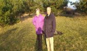
![Randonnée Marche Dormelles - 121231-JLD - Dormelles-TourCliquets - Photo](https://media.geolcdn.com/t/1900/400/ext.pjpeg?maxdim=2&url=https%3A%2F%2Fservices.sitytrail.com%2FGeolivesWS%2FDownloadMedia.ashx%3FTrailID%3D168089%26Media%3Db108da2e-8edd-4bc3-b607-1873956f9c71.jpg)
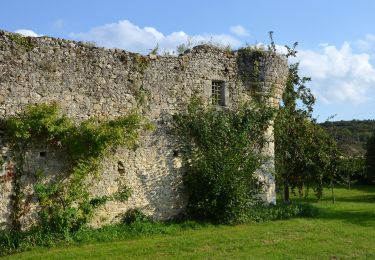
121231-JLD - Dormelles-TourCliquets
randodan
Utilisateur
![Longueur](/images/other/stat-length.png)
Longueur
2,2 km
![Altitude max](https://static1.geolcdn.com/siteimages/upload/files/1508320355ic_sort_altitude_max_24dp.png)
Altitude max
113 m
![Dénivelé positif](https://static1.geolcdn.com/siteimages/upload/files/1508320355ic_sort_den_pos_24dp.png)
Dénivelé positif
38 m
![Km-Effort](/images/other/stat-length.png)
Km-Effort
2,7 km
![Altitude min](https://static1.geolcdn.com/siteimages/upload/files/1508320355ic_sort_altitude_min_24dp.png)
Altitude min
76 m
![Dénivelé négatif](https://static1.geolcdn.com/siteimages/upload/files/1508320355ic_sort_den_neg_24dp.png)
Dénivelé négatif
36 m
![Boucle](https://static1.geolcdn.com/siteimages/upload/files/16400158638029165_repeat_loop_refresh_sync_direction_icon.png)
Boucle
Oui
Date de création :
2014-12-10 00:00:00.0
Dernière modification :
2014-12-10 00:00:00.0
![Marche](https://static1.geolcdn.com/sitytour/trail-icons/101.png)
45m
Difficulté : Très facile
![Scannez ce code QR pour ouvrir la randonnée dans l'application SityTrail](https://capi.geolives.com/qq0zvz2zws4bq2lad0pu/sitytour/trails/168089/qr.png?size=200)
Application GPS de randonnée GRATUITE
À propos
Randonnée Marche de 2,2 km à découvrir à Île-de-France, Seine-et-Marne, Dormelles. Cette randonnée est proposée par randodan.
Description
31 décembre 2012.<br>
Tour des Cliquets, 15h30-16h15.<br>
Coline de la Ronce, retour par derrière les Cliquets.<br>
JL D.
Localisation
Pays :
France
Région :
Île-de-France
Département/Province :
Seine-et-Marne
Commune :
Dormelles
Localité :
Unknown
Départ:(Dec)
Départ:(UTM)
492795 ; 5352099 (31U) N.
Commentaires
Randonnées à proximité
![Randonnée Marche Voulx - Entre Yonne et Orvalle - Photo](https://media.geolcdn.com/t/375/260/8fbb7b12-7e47-4de2-bcc1-b6997308259b.jpg&format=jpg&maxdim=2)
![Marche Marche](https://static1.geolcdn.com/sitytour/trail-icons/101.png)
Entre Yonne et Orvalle
Marche
Facile
Voulx,
Île-de-France,
Seine-et-Marne,
France
![](/images/other/stat-length.png)
17,3 km | 21 km-effort
3h 34min
![](https://static1.geolcdn.com/siteimages/upload/files/16400158638029165_repeat_loop_refresh_sync_direction_icon.png)
Oui
![Randonnée A pied Villemer - Maquis de Roys - Photo](https://media.geolcdn.com/t/375/260/70e58ce3-920c-43a7-ba54-1d0a3c2796ae.jpeg&format=jpg&maxdim=2)
![A pied A pied](https://static1.geolcdn.com/sitytour/trail-icons/100.png)
Maquis de Roys
A pied
Facile
Villemer,
Île-de-France,
Seine-et-Marne,
France
![](/images/other/stat-length.png)
11,1 km | 13 km-effort
2h 56min
![](https://static1.geolcdn.com/siteimages/upload/files/16400158638029165_repeat_loop_refresh_sync_direction_icon.png)
Oui
![Randonnée A pied Ville-Saint-Jacques - Basse vallée de l'Orvanne - Photo](https://media.geolcdn.com/t/375/260/82137b8f-59f6-42a4-8e1b-17c82b952e9a.jpeg&format=jpg&maxdim=2)
![A pied A pied](https://static1.geolcdn.com/sitytour/trail-icons/100.png)
Basse vallée de l'Orvanne
A pied
Facile
Ville-Saint-Jacques,
Île-de-France,
Seine-et-Marne,
France
![](/images/other/stat-length.png)
16 km | 19,1 km-effort
4h 20min
![](https://static1.geolcdn.com/siteimages/upload/files/16400158638029165_repeat_loop_refresh_sync_direction_icon.png)
Oui
![Randonnée Marche nordique Villecerf - Autour de villecerf - Photo](https://media.geolcdn.com/t/375/260/ext.jpg?maxdim=2&url=https%3A%2F%2Fstatic1.geolcdn.com%2Fsiteimages%2Fupload%2Ffiles%2F1545311037marcheuse_200dpi.jpg)
![Marche nordique Marche nordique](https://static1.geolcdn.com/sitytour/trail-icons/102.png)
Autour de villecerf
Marche nordique
(1)
Villecerf,
Île-de-France,
Seine-et-Marne,
France
![](/images/other/stat-length.png)
19,9 km | 23 km-effort
5h 12min
![](https://static1.geolcdn.com/siteimages/upload/files/16400158638029165_repeat_loop_refresh_sync_direction_icon.png)
Oui
![Randonnée Marche Thoury-Férottes - 180111 EnCours - Photo](https://media.geolcdn.com/t/375/260/ext.jpg?maxdim=2&url=https%3A%2F%2Fservices.sitytrail.com%2FGeolivesWS%2FDownloadMedia.ashx%3FTrailID%3D886916%26Media%3Dfix__20180111125543.jpg)
![Marche Marche](https://static1.geolcdn.com/sitytour/trail-icons/101.png)
180111 EnCours
Marche
Très facile
Thoury-Férottes,
Île-de-France,
Seine-et-Marne,
France
![](/images/other/stat-length.png)
16,7 km | 19,7 km-effort
5h 20min
![](https://static1.geolcdn.com/siteimages/upload/files/16400158638029165_repeat_loop_refresh_sync_direction_icon.png)
Oui
![Randonnée Marche Thoury-Férottes - Manu-170218 - Thoury-Dormelles - Photo](https://media.geolcdn.com/t/375/260/ext.jpg?maxdim=2&url=https%3A%2F%2Fservices.sitytrail.com%2FGeolivesWS%2FDownloadMedia.ashx%3FTrailID%3D700727%26Media%3D9d381017-48c9-49db-92ae-a1297989025d.jpg)
![Marche Marche](https://static1.geolcdn.com/sitytour/trail-icons/101.png)
Manu-170218 - Thoury-Dormelles
Marche
Facile
Thoury-Férottes,
Île-de-France,
Seine-et-Marne,
France
![](/images/other/stat-length.png)
15,8 km | 18,8 km-effort
4h 45min
![](https://static1.geolcdn.com/siteimages/upload/files/16400158638029165_repeat_loop_refresh_sync_direction_icon.png)
Oui
![Randonnée Marche Dormelles - M&R-141219 - Dormelles - Photo](https://media.geolcdn.com/t/375/260/ext.jpg?maxdim=2&url=https%3A%2F%2Fservices.sitytrail.com%2FGeolivesWS%2FDownloadMedia.ashx%3FTrailID%3D371467%26Media%3D19e6ba95-3c6b-4ae7-8dc3-f0bbed2e93e0.jpg)
![Marche Marche](https://static1.geolcdn.com/sitytour/trail-icons/101.png)
M&R-141219 - Dormelles
Marche
Facile
Dormelles,
Île-de-France,
Seine-et-Marne,
France
![](/images/other/stat-length.png)
10,9 km | 12,7 km-effort
3h 0min
![](https://static1.geolcdn.com/siteimages/upload/files/16400158638029165_repeat_loop_refresh_sync_direction_icon.png)
Oui
![Randonnée Marche Dormelles - M&R-131210 - Dormelles - Photo](https://media.geolcdn.com/t/375/260/ext.jpg?maxdim=2&url=https%3A%2F%2Fservices.sitytrail.com%2FGeolivesWS%2FDownloadMedia.ashx%3FTrailID%3D237422%26Media%3Dfix__20131210110652.jpg)
![Marche Marche](https://static1.geolcdn.com/sitytour/trail-icons/101.png)
M&R-131210 - Dormelles
Marche
Très facile
Dormelles,
Île-de-France,
Seine-et-Marne,
France
![](/images/other/stat-length.png)
16,1 km | 19,3 km-effort
4h 9min
![](https://static1.geolcdn.com/siteimages/upload/files/16400158638029165_repeat_loop_refresh_sync_direction_icon.png)
Oui
![Randonnée Marche nordique Villecerf - Autour de Villecerf - Photo](https://media.geolcdn.com/t/375/260/cc44b1da-7c5e-480c-9b96-19b5c1cc7302.jpg&format=jpg&maxdim=2)
![Marche nordique Marche nordique](https://static1.geolcdn.com/sitytour/trail-icons/102.png)
Autour de Villecerf
Marche nordique
Villecerf,
Île-de-France,
Seine-et-Marne,
France
![](/images/other/stat-length.png)
19,9 km | 23 km-effort
4h 53min
![](https://static1.geolcdn.com/siteimages/upload/files/16400158638029165_repeat_loop_refresh_sync_direction_icon.png)
Oui