![](/images/other/stat-length.png)
![Randonnée Marche Modave - MODAVE - Linchet - Photo](https://media.geolcdn.com/t/1900/400/ext.pjpeg?maxdim=2&url=https%3A%2F%2Fservices.sitytrail.com%2FGeolivesWS%2FDownloadMedia.ashx%3FTrailID%3D163547%26Media%3D246e0719-e036-4347-8ba8-5ec5db6ee055.jpg)
MODAVE - Linchet
tourcondroz
Utilisateur
![Longueur](/images/other/stat-length.png)
Longueur
5,1 km
![Altitude max](https://static1.geolcdn.com/siteimages/upload/files/1508320355ic_sort_altitude_max_24dp.png)
Altitude max
251 m
![Dénivelé positif](https://static1.geolcdn.com/siteimages/upload/files/1508320355ic_sort_den_pos_24dp.png)
Dénivelé positif
90 m
![Km-Effort](/images/other/stat-length.png)
Km-Effort
6,3 km
![Altitude min](https://static1.geolcdn.com/siteimages/upload/files/1508320355ic_sort_altitude_min_24dp.png)
Altitude min
202 m
![Dénivelé négatif](https://static1.geolcdn.com/siteimages/upload/files/1508320355ic_sort_den_neg_24dp.png)
Dénivelé négatif
90 m
![Boucle](https://static1.geolcdn.com/siteimages/upload/files/16400158638029165_repeat_loop_refresh_sync_direction_icon.png)
Boucle
Oui
![Balise](https://services.sitytrail.com/GeolivesWS/DownloadMedia.ashx?TrailID=163547&Media=balise.png)
Balise
Date de création :
2019-04-01 13:27:38.638
Dernière modification :
2019-04-01 13:27:38.738
![Marche](https://static1.geolcdn.com/sitytour/trail-icons/101.png)
1h26
Difficulté : Facile
![Scannez ce code QR pour ouvrir la randonnée dans l'application SityTrail](https://capi.geolives.com/qq0zvz2zws4bq2lad0pu/sitytour/trails/163547/qr.png?size=200)
Application GPS de randonnée GRATUITE
À propos
Randonnée Marche de 5,1 km à découvrir à Wallonie, Liège, Modave. Cette randonnée est proposée par tourcondroz.
Description
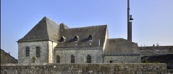
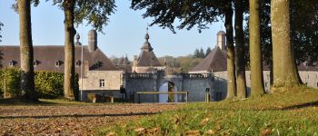
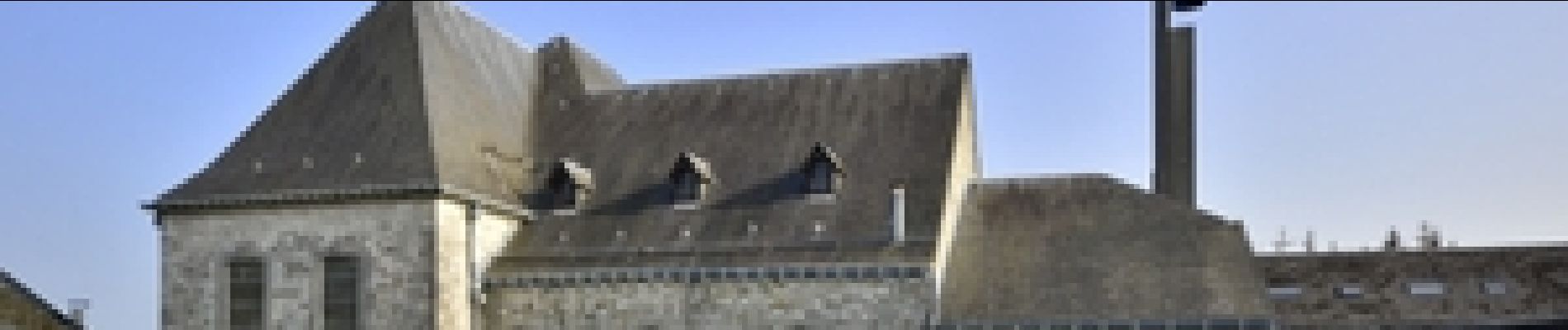
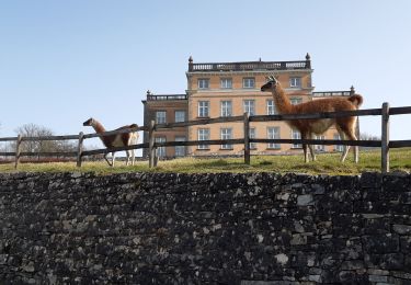
Au départ de l'église de Modave, cette promenade permet de parcourir les campagnes de notre Condroz et de découvrir le village de Modave.
BALISE: rectangle rouge horizontal rectangle blanc vertical
Sources: SIVH
Crédits photographiques: J. Borghoms – SIVH
Points d'intérêt
Localisation
Pays :
Belgique
Région :
Wallonie
Département/Province :
Liège
Commune :
Modave
Localité :
Modave
Départ:(Dec)
Départ:(UTM)
663424 ; 5590359 (31U) N.
Commentaires
Randonnées à proximité
![Randonnée Marche Clavier - RB-Lg-01_Pailhe_via-racc - Photo](https://media.geolcdn.com/t/375/260/ext.jpg?maxdim=2&url=https%3A%2F%2Fservices.sitytrail.com%2FGeolivesWS%2FDownloadMedia.ashx%3FTrailID%3D209390%26Media%3D22266d26-9089-4b3a-b5ae-a6da953afba4.jpg)
![Marche Marche](https://static1.geolcdn.com/sitytour/trail-icons/101.png)
RB-Lg-01_Pailhe_via-racc
Marche
Moyen
(8)
Clavier,
Wallonie,
Liège,
Belgique
![](/images/other/stat-length.png)
17,1 km | 21 km-effort
4h 34min
![](https://static1.geolcdn.com/siteimages/upload/files/16400158638029165_repeat_loop_refresh_sync_direction_icon.png)
Oui
![Randonnée Marche Clavier - RB-Lg-01_Pailhe - Photo](https://media.geolcdn.com/t/375/260/ext.jpg?maxdim=2&url=https%3A%2F%2Fservices.sitytrail.com%2FGeolivesWS%2FDownloadMedia.ashx%3FTrailID%3D179556%26Media%3D22266d26-9089-4b3a-b5ae-a6da953afba4.jpg)
![Marche Marche](https://static1.geolcdn.com/sitytour/trail-icons/101.png)
RB-Lg-01_Pailhe
Marche
Moyen
(12)
Clavier,
Wallonie,
Liège,
Belgique
![](/images/other/stat-length.png)
20 km | 25 km-effort
5h 23min
![](https://static1.geolcdn.com/siteimages/upload/files/16400158638029165_repeat_loop_refresh_sync_direction_icon.png)
Oui
![Randonnée Marche Modave - Modave. Natura 2000, des sites qui valent le détour ! Lg4 - Photo](https://media.geolcdn.com/t/375/260/ext.jpg?maxdim=2&url=https%3A%2F%2Fservices.sitytrail.com%2FGeolivesWS%2FDownloadMedia.ashx%3FTrailID%3D161410%26Media%3Dd7c559bb-fafd-4624-b5f1-8908c3c540dc.JPG)
![Marche Marche](https://static1.geolcdn.com/sitytour/trail-icons/101.png)
Modave. Natura 2000, des sites qui valent le détour ! Lg4
Marche
Moyen
(12)
Modave,
Wallonie,
Liège,
Belgique
![](/images/other/stat-length.png)
8,2 km | 10,1 km-effort
2h 12min
![](https://static1.geolcdn.com/siteimages/upload/files/16400158638029165_repeat_loop_refresh_sync_direction_icon.png)
Oui
![Randonnée Marche Clavier - CLAVIER - La Romantique - Photo](https://media.geolcdn.com/t/375/260/ext.jpg?maxdim=2&url=https%3A%2F%2Fservices.sitytrail.com%2FGeolivesWS%2FDownloadMedia.ashx%3FTrailID%3D162888%26Media%3D9ae93777-447a-4289-aab4-f0814b4e414d.jpg)
![Marche Marche](https://static1.geolcdn.com/sitytour/trail-icons/101.png)
CLAVIER - La Romantique
Marche
Facile
(11)
Clavier,
Wallonie,
Liège,
Belgique
![](/images/other/stat-length.png)
12,6 km | 15,3 km-effort
3h 18min
![](https://static1.geolcdn.com/siteimages/upload/files/16400158638029165_repeat_loop_refresh_sync_direction_icon.png)
Oui
![Randonnée Marche Marchin - MARCHIN - Chemin de la Mémoire - Photo](https://media.geolcdn.com/t/375/260/ext.jpg?maxdim=2&url=https%3A%2F%2Fservices.sitytrail.com%2FGeolivesWS%2FDownloadMedia.ashx%3FTrailID%3D134945%26Media%3D9baec6a8-ffff-4223-8cd2-41c1e7b6afda.jpg)
![Marche Marche](https://static1.geolcdn.com/sitytour/trail-icons/101.png)
MARCHIN - Chemin de la Mémoire
Marche
Moyen
(5)
Marchin,
Wallonie,
Liège,
Belgique
![](/images/other/stat-length.png)
9 km | 11 km-effort
2h 15min
![](https://static1.geolcdn.com/siteimages/upload/files/16400158638029165_repeat_loop_refresh_sync_direction_icon.png)
Oui
![Randonnée Marche Clavier - CLAVIER - Magnifique Hoyoux - Photo](https://media.geolcdn.com/t/375/260/ext.jpg?maxdim=2&url=https%3A%2F%2Fservices.sitytrail.com%2FGeolivesWS%2FDownloadMedia.ashx%3FTrailID%3D161792%26Media%3De8c9d35f-218b-443c-9500-f69ccd009442.jpg)
![Marche Marche](https://static1.geolcdn.com/sitytour/trail-icons/101.png)
CLAVIER - Magnifique Hoyoux
Marche
Moyen
(6)
Clavier,
Wallonie,
Liège,
Belgique
![](/images/other/stat-length.png)
4,1 km | 4,9 km-effort
1h 15min
![](https://static1.geolcdn.com/siteimages/upload/files/16400158638029165_repeat_loop_refresh_sync_direction_icon.png)
Oui
![Randonnée Marche Modave - MODAVE - Petit Modave - Photo](https://media.geolcdn.com/t/375/260/ext.jpg?maxdim=2&url=https%3A%2F%2Fservices.sitytrail.com%2FGeolivesWS%2FDownloadMedia.ashx%3FTrailID%3D211950%26Media%3D225bb37c-a1e6-4f9b-b5fa-27b4f60e72ba.JPG)
![Marche Marche](https://static1.geolcdn.com/sitytour/trail-icons/101.png)
MODAVE - Petit Modave
Marche
Moyen
(21)
Modave,
Wallonie,
Liège,
Belgique
![](/images/other/stat-length.png)
7,6 km | 9,4 km-effort
2h 0min
![](https://static1.geolcdn.com/siteimages/upload/files/16400158638029165_repeat_loop_refresh_sync_direction_icon.png)
Oui
![Randonnée Marche Modave - Balade à Modave - Photo](https://media.geolcdn.com/t/375/260/efa446e4-aa4c-4b7a-afaa-1e1b5351db79.jpeg&format=jpg&maxdim=2)
![Marche Marche](https://static1.geolcdn.com/sitytour/trail-icons/101.png)
Balade à Modave
Marche
Très facile
(2)
Modave,
Wallonie,
Liège,
Belgique
![](/images/other/stat-length.png)
8,9 km | 10,9 km-effort
3h 40min
![](https://static1.geolcdn.com/siteimages/upload/files/16400158638029165_repeat_loop_refresh_sync_direction_icon.png)
Oui
![Randonnée Marche Clavier - st fontaine-tahier-ossogne-st fontaine ac - Photo](https://media.geolcdn.com/t/375/260/ad0e5e7e-7707-40ef-b1db-8690b3354224.jpg&format=jpg&maxdim=2)
![Marche Marche](https://static1.geolcdn.com/sitytour/trail-icons/101.png)
st fontaine-tahier-ossogne-st fontaine ac
Marche
Facile
(3)
Clavier,
Wallonie,
Liège,
Belgique
![](/images/other/stat-length.png)
7,4 km | 9,7 km-effort
2h 25min
![](https://static1.geolcdn.com/siteimages/upload/files/16400158638029165_repeat_loop_refresh_sync_direction_icon.png)
Oui
Belle promenade avec quelques vues inattendues.
Promenade agréable principalement sur routes rurales asphaltées. Parcours facile.
Parcours agréable. Aucune difficulté particulière.