ABC 02 SityTrail > Randonnées > Outdoor > Népal > Inconnu > कास्की > Dangsing SityTrail > Randonnées > Outdoor > Népal > Inconnu > कास्की > Dangsing ABC 02 MickToul Utilisateur 3D © OpenStreetMap contributors Longueur 6 km Altitude max 2547 m Dénivelé positif 1045 m Km-Effort 16,6 km Altitude min 1509 m Dénivelé négatif 38 m Boucle Non Date de création : 2019-03-02 12:20:19.387 Dernière modification : 2019-03-02 12:20:19.398 (0 Avis) Marche 3h53 Difficulté : Difficile Application GPS de randonnée GRATUITE SityTrail IGN / Instituts géographiques SityTrail World Le monde est à vous À propos Randonnée Marche de 6 km à découvrir à Inconnu, कास्की, Dangsing. Cette randonnée est proposée par MickToul. Description 
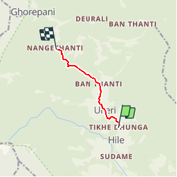
Tikhedunga-Nangethanti Légendes | Plus de détails (PDF) Profil altimétrique Légendes > 15% 15% - 10% 10% - 5% à plat 5% - 10% 10% - 15% 15% - 30% > 30% Points d'intérêt MickToul Poon Hill GHARA MickToul Ulleri DANGSING MickToul Tikhegunda DANGSING MickToul Banthanti DANGSING MickToul Nangethanti DANGSING Localisation Pays : Népal Région : Inconnu Département/Province : कास्की Commune : Dangsing Localité : Unknown Départ:(Dec) 28.349031 / 83.74218 Départ:(UTM) 768801 ; 3138923 (44R) N. Commentaires Veuillez vous connecter pour laisser un commentaire ou une note Randonnées à proximité jpcccb Népal 1 Marche Très facile Dangsing, Inconnu, कास्की, Népal 7,5 km | 15,3 km-effort Inconnu Non MickToul ABC 03 Marche Facile Dangsing, Inconnu, कास्की, Népal 2,7 km | 7,6 km-effort 1h 41min Non