


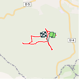


19,2 km | 32 km-effort


Utilisateur


Application GPS de randonnée GRATUITE
 SityTrail
IGN / Instituts géographiques
SityTrail World
Le monde est à vous
Randonnée Marche de 5,3 km à découvrir à Provence-Alpes-Côte d'Azur, Alpes-Maritimes, Saint-Vallier-de-Thiey. Cette randonnée est proposée par MIMA.
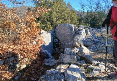
Un petit tour dans le passé:
Puits du 18ème siècle, tumulus néolitique (tombeau ou dolmen de Verdoline), Enceinte Ligure (Castel Abram), Pierre Druidique.

Marche

Marche

Marche

Marche

Marche
Marche
Marche
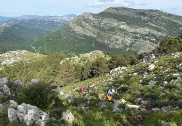
Marche
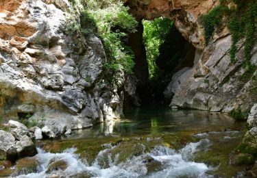
Marche