![](/images/other/stat-length.png)
![Randonnée Marche Auxelles-Haut - Auxelles-Bas - La Planche des Belles-filles - Photo](https://media.geolcdn.com/t/1900/400/ext.pjpeg?maxdim=2&url=https%3A%2F%2Fstatic1.geolcdn.com%2Fsiteimages%2Fupload%2Ffiles%2F1553511878bg_sport_marche.png)
Auxelles-Bas - La Planche des Belles-filles
ballet
Utilisateur
![Longueur](/images/other/stat-length.png)
Longueur
17,1 km
![Altitude max](https://static1.geolcdn.com/siteimages/upload/files/1508320355ic_sort_altitude_max_24dp.png)
Altitude max
1145 m
![Dénivelé positif](https://static1.geolcdn.com/siteimages/upload/files/1508320355ic_sort_den_pos_24dp.png)
Dénivelé positif
737 m
![Km-Effort](/images/other/stat-length.png)
Km-Effort
27 km
![Altitude min](https://static1.geolcdn.com/siteimages/upload/files/1508320355ic_sort_altitude_min_24dp.png)
Altitude min
554 m
![Dénivelé négatif](https://static1.geolcdn.com/siteimages/upload/files/1508320355ic_sort_den_neg_24dp.png)
Dénivelé négatif
734 m
![Boucle](https://static1.geolcdn.com/siteimages/upload/files/16400158638029165_repeat_loop_refresh_sync_direction_icon.png)
Boucle
Oui
Date de création :
2014-12-10 00:00:00.0
Dernière modification :
2014-12-10 00:00:00.0
![Marche](https://static1.geolcdn.com/sitytour/trail-icons/101.png)
4h00
Difficulté : Moyen
![Scannez ce code QR pour ouvrir la randonnée dans l'application SityTrail](https://capi.geolives.com/qq0zvz2zws4bq2lad0pu/sitytour/trails/152232/qr.png?size=200)
Application GPS de randonnée GRATUITE
À propos
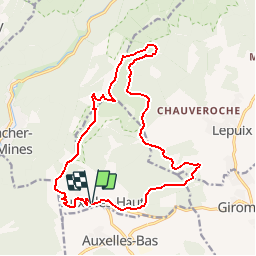
Randonnée Marche de 17,1 km à découvrir à Bourgogne-Franche-Comté, Territoire-de-Belfort, Auxelles-Haut. Cette randonnée est proposée par ballet.
Description
Comporte un opeu de dénivelé pour monter à la Planche des Belles-Filles.
Vous découvrirais même un observatoire astronomique au détour du chemin
Localisation
Pays :
France
Région :
Bourgogne-Franche-Comté
Département/Province :
Territoire-de-Belfort
Commune :
Auxelles-Haut
Localité :
Unknown
Départ:(Dec)
Départ:(UTM)
332867 ; 5290143 (32T) N.
Commentaires
Randonnées à proximité
![Randonnée Marche Auxelles-Haut - Rando-planche belles filles par auxelle haut - Photo](https://media.geolcdn.com/t/375/260/ext.jpg?maxdim=2&url=https%3A%2F%2Fservices.sitytrail.com%2FGeolivesWS%2FDownloadMedia.ashx%3FTrailID%3D305224%26Media%3D10d34718-818e-4b54-8a0e-bb1d508617db.JPG)
![Marche Marche](https://static1.geolcdn.com/sitytour/trail-icons/101.png)
Rando-planche belles filles par auxelle haut
Marche
Moyen
(3)
Auxelles-Haut,
Bourgogne-Franche-Comté,
Territoire-de-Belfort,
France
![](/images/other/stat-length.png)
14,6 km | 23 km-effort
4h 55min
![](https://static1.geolcdn.com/siteimages/upload/files/16400158638029165_repeat_loop_refresh_sync_direction_icon.png)
Oui
![Randonnée Marche Lepuix - Le Tremontkopf - Photo](https://media.geolcdn.com/t/375/260/ext.jpg?maxdim=2&url=https%3A%2F%2Fservices.sitytrail.com%2FGeolivesWS%2FDownloadMedia.ashx%3FTrailID%3D109649%26Media%3D4290_1.jpg)
![Marche Marche](https://static1.geolcdn.com/sitytour/trail-icons/101.png)
Le Tremontkopf
Marche
Moyen
(1)
Lepuix,
Bourgogne-Franche-Comté,
Territoire-de-Belfort,
France
![](/images/other/stat-length.png)
9,1 km | 17,3 km-effort
3h 0min
![](https://static1.geolcdn.com/siteimages/upload/files/16400158638029165_repeat_loop_refresh_sync_direction_icon.png)
Oui
![Randonnée Marche Plancher-les-Mines - 2019-08-07 Balade Plancher des belles filles - Photo](https://media.geolcdn.com/t/375/260/66a371f6-1837-4f48-9b52-0abd1c8fe413.jpg&format=jpg&maxdim=2)
![Marche Marche](https://static1.geolcdn.com/sitytour/trail-icons/101.png)
2019-08-07 Balade Plancher des belles filles
Marche
Très facile
Plancher-les-Mines,
Bourgogne-Franche-Comté,
Haute-Saône,
France
![](/images/other/stat-length.png)
7,8 km | 11,9 km-effort
2h 12min
![](https://static1.geolcdn.com/siteimages/upload/files/16400158638029165_repeat_loop_refresh_sync_direction_icon.png)
Oui
![Randonnée Marche Lepuix - Malvaux - Ballon d'Alsace - La Gentiane - Photo](https://media.geolcdn.com/t/375/260/79578682-d0f3-4956-a014-9b78edebdf9a.jpg&format=jpg&maxdim=2)
![Marche Marche](https://static1.geolcdn.com/sitytour/trail-icons/101.png)
Malvaux - Ballon d'Alsace - La Gentiane
Marche
Très difficile
Lepuix,
Bourgogne-Franche-Comté,
Territoire-de-Belfort,
France
![](/images/other/stat-length.png)
14,2 km | 24 km-effort
5h 23min
![](https://static1.geolcdn.com/siteimages/upload/files/16400158638029165_repeat_loop_refresh_sync_direction_icon.png)
Oui
![Randonnée Marche Lepuix - Malvaux - Ballon d'Alsace (15/12 au 15/7) - Photo](https://media.geolcdn.com/t/375/260/8b5b8e46-b065-4d76-880f-ae90ac7502e3.jpg&format=jpg&maxdim=2)
![Marche Marche](https://static1.geolcdn.com/sitytour/trail-icons/101.png)
Malvaux - Ballon d'Alsace (15/12 au 15/7)
Marche
Très difficile
Lepuix,
Bourgogne-Franche-Comté,
Territoire-de-Belfort,
France
![](/images/other/stat-length.png)
14,8 km | 24 km-effort
5h 33min
![](https://static1.geolcdn.com/siteimages/upload/files/16400158638029165_repeat_loop_refresh_sync_direction_icon.png)
Oui
![Randonnée Marche Plancher-les-Mines - Plancher les mines - sentier des mines - croix du choléra - Planche des Belles Filles - sentier FFI - Mont Menard - Plancher les Mines - Photo](https://media.geolcdn.com/t/375/260/f7fa7cdf-da22-406f-8d96-8f9f07e4fd3d.jpg&format=jpg&maxdim=2)
![Marche Marche](https://static1.geolcdn.com/sitytour/trail-icons/101.png)
Plancher les mines - sentier des mines - croix du choléra - Planche des Belle...
Marche
Très difficile
Plancher-les-Mines,
Bourgogne-Franche-Comté,
Haute-Saône,
France
![](/images/other/stat-length.png)
14,3 km | 25 km-effort
5h 38min
![](https://static1.geolcdn.com/siteimages/upload/files/16400158638029165_repeat_loop_refresh_sync_direction_icon.png)
Oui
![Randonnée Marche Lepuix - Saut de la Truite - cascade du Rummel - Etang du Petit-Haut - Ballon d'alsace - Photo](https://media.geolcdn.com/t/375/260/86bdad0e-488c-4de2-8052-bbc2db6811d9.jpg&format=jpg&maxdim=2)
![Marche Marche](https://static1.geolcdn.com/sitytour/trail-icons/101.png)
Saut de la Truite - cascade du Rummel - Etang du Petit-Haut - Ballon d'alsace
Marche
Très difficile
Lepuix,
Bourgogne-Franche-Comté,
Territoire-de-Belfort,
France
![](/images/other/stat-length.png)
15,5 km | 26 km-effort
5h 57min
![](https://static1.geolcdn.com/siteimages/upload/files/16400158638029165_repeat_loop_refresh_sync_direction_icon.png)
Oui
![Randonnée Marche Plancher-les-Mines - Cascades de la Goutte des Saules - Belvédère - Grotte St Antoine - Photo](https://media.geolcdn.com/t/375/260/675d2d72-2ae5-41bd-abbb-b7f938827506.jpg&format=jpg&maxdim=2)
![Marche Marche](https://static1.geolcdn.com/sitytour/trail-icons/101.png)
Cascades de la Goutte des Saules - Belvédère - Grotte St Antoine
Marche
Moyen
Plancher-les-Mines,
Bourgogne-Franche-Comté,
Haute-Saône,
France
![](/images/other/stat-length.png)
6,6 km | 11,2 km-effort
2h 32min
![](https://static1.geolcdn.com/siteimages/upload/files/16400158638029165_repeat_loop_refresh_sync_direction_icon.png)
Oui
![Randonnée Marche Plancher-les-Mines - 130722 - La planche des belles - au pieds du Ballons d’Alsaces - Photo](https://media.geolcdn.com/t/375/260/63970d70-3d7a-4dbb-88a1-8a2718140e81.jpg&format=jpg&maxdim=2)
![Marche Marche](https://static1.geolcdn.com/sitytour/trail-icons/101.png)
130722 - La planche des belles - au pieds du Ballons d’Alsaces
Marche
Moyen
Plancher-les-Mines,
Bourgogne-Franche-Comté,
Haute-Saône,
France
![](/images/other/stat-length.png)
16,5 km | 24 km-effort
3h 45min
![](https://static1.geolcdn.com/siteimages/upload/files/16400158638029165_repeat_loop_refresh_sync_direction_icon.png)
Oui