![](/images/other/stat-length.png)
![Randonnée V.T.T. Farschviller - Autour du Lehtrisch - Photo](https://media.geolcdn.com/t/1900/400/ext.pjpeg?maxdim=2&url=https%3A%2F%2Fstatic1.geolcdn.com%2Fsiteimages%2Fupload%2Ffiles%2F1524743154velo.jpg)
Autour du Lehtrisch
Renard57
Utilisateur
![Longueur](/images/other/stat-length.png)
Longueur
27 km
![Altitude max](https://static1.geolcdn.com/siteimages/upload/files/1508320355ic_sort_altitude_max_24dp.png)
Altitude max
281 m
![Dénivelé positif](https://static1.geolcdn.com/siteimages/upload/files/1508320355ic_sort_den_pos_24dp.png)
Dénivelé positif
405 m
![Km-Effort](/images/other/stat-length.png)
Km-Effort
32 km
![Altitude min](https://static1.geolcdn.com/siteimages/upload/files/1508320355ic_sort_altitude_min_24dp.png)
Altitude min
210 m
![Dénivelé négatif](https://static1.geolcdn.com/siteimages/upload/files/1508320355ic_sort_den_neg_24dp.png)
Dénivelé négatif
404 m
![Boucle](https://static1.geolcdn.com/siteimages/upload/files/16400158638029165_repeat_loop_refresh_sync_direction_icon.png)
Boucle
Oui
Date de création :
2014-12-10 00:00:00.0
Dernière modification :
2014-12-10 00:00:00.0
![V.T.T.](https://static1.geolcdn.com/sitytour/trail-icons/202.png)
3h02
Difficulté : Moyen
![Scannez ce code QR pour ouvrir la randonnée dans l'application SityTrail](https://capi.geolives.com/qq0zvz2zws4bq2lad0pu/sitytour/trails/147111/qr.png?size=200)
Application GPS de randonnée GRATUITE
À propos
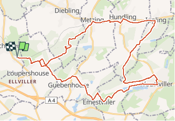
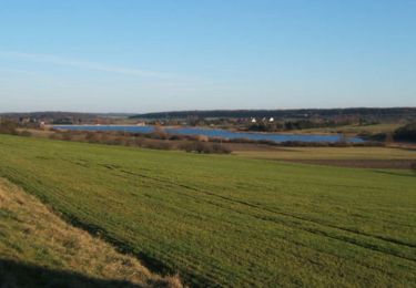
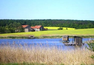
Randonnée V.T.T. de 27 km à découvrir à Grand Est, Moselle, Farschviller. Cette randonnée est proposée par Renard57.
Description
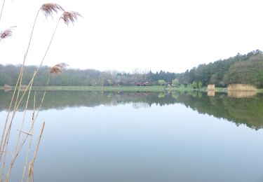
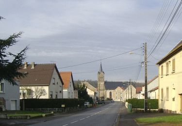
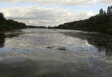
Parcours sympa avec une alternance entre chemin forestier, sentier VTT en forêt et un peu de macadam. Accessible à presque tout le monde.
Localisation
Pays :
France
Région :
Grand Est
Département/Province :
Moselle
Commune :
Farschviller
Localité :
Unknown
Départ:(Dec)
Départ:(UTM)
347100 ; 5439368 (32U) N.
Commentaires
Randonnées à proximité
![Randonnée Marche Metzing - Metzing Loupershouse - Photo](https://media.geolcdn.com/t/375/260/ext.jpg?maxdim=2&url=https%3A%2F%2Fservices.sitytrail.com%2FGeolivesWS%2FDownloadMedia.ashx%3FTrailID%3D263513%26Media%3D367e893c-fc82-4add-aa03-b7ee25465948.JPG)
![Marche Marche](https://static1.geolcdn.com/sitytour/trail-icons/101.png)
Metzing Loupershouse
Marche
Facile
(1)
Metzing,
Grand Est,
Moselle,
France
![](/images/other/stat-length.png)
8,7 km | 10,7 km-effort
2h 18min
![](https://static1.geolcdn.com/siteimages/upload/files/16400158638029165_repeat_loop_refresh_sync_direction_icon.png)
Oui
![Randonnée A pied Hoste - Circuit de Guten Brunnen - Photo](https://media.geolcdn.com/t/375/260/7a25f4ff-22c1-4802-8200-db89b7c4b482.jpeg&format=jpg&maxdim=2)
![A pied A pied](https://static1.geolcdn.com/sitytour/trail-icons/100.png)
Circuit de Guten Brunnen
A pied
Facile
Hoste,
Grand Est,
Moselle,
France
![](/images/other/stat-length.png)
11,5 km | 14 km-effort
3h 11min
![](https://static1.geolcdn.com/siteimages/upload/files/16400158638029165_repeat_loop_refresh_sync_direction_icon.png)
Oui
![Randonnée Marche Loupershouse - Autour de Metzing - Guebenhouse - Photo](https://media.geolcdn.com/t/375/260/ext.jpg?maxdim=2&url=https%3A%2F%2Fstatic1.geolcdn.com%2Fsiteimages%2Fupload%2Ffiles%2F1553511878bg_sport_marche.png)
![Marche Marche](https://static1.geolcdn.com/sitytour/trail-icons/101.png)
Autour de Metzing - Guebenhouse
Marche
Facile
(1)
Loupershouse,
Grand Est,
Moselle,
France
![](/images/other/stat-length.png)
12,3 km | 15,6 km-effort
3h 19min
![](https://static1.geolcdn.com/siteimages/upload/files/16400158638029165_repeat_loop_refresh_sync_direction_icon.png)
Oui
![Randonnée A pied Hoste - Circuit de la ligne Maginot Aquatique - Photo](https://media.geolcdn.com/t/375/260/7a25f4ff-22c1-4802-8200-db89b7c4b482.jpeg&format=jpg&maxdim=2)
![A pied A pied](https://static1.geolcdn.com/sitytour/trail-icons/100.png)
Circuit de la ligne Maginot Aquatique
A pied
Facile
Hoste,
Grand Est,
Moselle,
France
![](/images/other/stat-length.png)
4,7 km | 5,6 km-effort
1h 16min
![](https://static1.geolcdn.com/siteimages/upload/files/16400158638029165_repeat_loop_refresh_sync_direction_icon.png)
Non
![Randonnée Marche Saint-Jean-Rohrbach - lac diefenbach - Photo](https://media.geolcdn.com/t/375/260/ext.jpg?maxdim=2&url=https%3A%2F%2Fservices.sitytrail.com%2FGeolivesWS%2FDownloadMedia.ashx%3FTrailID%3D359422%26Media%3Dfix__20140817174802.jpg)
![Marche Marche](https://static1.geolcdn.com/sitytour/trail-icons/101.png)
lac diefenbach
Marche
Facile
Saint-Jean-Rohrbach,
Grand Est,
Moselle,
France
![](/images/other/stat-length.png)
4,4 km | 5,5 km-effort
1h 14min
![](https://static1.geolcdn.com/siteimages/upload/files/16400158638029165_repeat_loop_refresh_sync_direction_icon.png)
Oui
![Randonnée Marche Hoste - Randonnée de Hoste à Barst - Photo](https://media.geolcdn.com/t/375/260/ext.jpg?maxdim=2&url=https%3A%2F%2Fservices.sitytrail.com%2FGeolivesWS%2FDownloadMedia.ashx%3FTrailID%3D191455%26Media%3D15048_1.jpg)
![Marche Marche](https://static1.geolcdn.com/sitytour/trail-icons/101.png)
Randonnée de Hoste à Barst
Marche
Moyen
Hoste,
Grand Est,
Moselle,
France
![](/images/other/stat-length.png)
13,7 km | 16,1 km-effort
3h 0min
![](https://static1.geolcdn.com/siteimages/upload/files/16400158638029165_repeat_loop_refresh_sync_direction_icon.png)
Oui
![Randonnée V.T.T. Puttelange-aux-Lacs - Randonnée au Pays des Lacs - Puttelange aux Lacs - Photo](https://media.geolcdn.com/t/375/260/ext.jpg?maxdim=2&url=https%3A%2F%2Fservices.sitytrail.com%2FGeolivesWS%2FDownloadMedia.ashx%3FTrailID%3D103623%26Media%3D6013_2.jpg)
![V.T.T. V.T.T.](https://static1.geolcdn.com/sitytour/trail-icons/202.png)
Randonnée au Pays des Lacs - Puttelange aux Lacs
V.T.T.
Difficile
(1)
Puttelange-aux-Lacs,
Grand Est,
Moselle,
France
![](/images/other/stat-length.png)
56 km | 69 km-effort
4h 0min
![](https://static1.geolcdn.com/siteimages/upload/files/16400158638029165_repeat_loop_refresh_sync_direction_icon.png)
Oui
![Randonnée Marche Farschviller - cappel - Photo](https://media.geolcdn.com/t/375/260/ext.jpg?maxdim=2&url=https%3A%2F%2Fstatic1.geolcdn.com%2Fsiteimages%2Fupload%2Ffiles%2F1553511878bg_sport_marche.png)
![Marche Marche](https://static1.geolcdn.com/sitytour/trail-icons/101.png)
![Randonnée Marche Farschviller - cappel - Photo](https://media.geolcdn.com/t/375/260/ext.jpg?maxdim=2&url=https%3A%2F%2Fstatic1.geolcdn.com%2Fsiteimages%2Fupload%2Ffiles%2F1553511878bg_sport_marche.png)
![Marche Marche](https://static1.geolcdn.com/sitytour/trail-icons/101.png)