Randonnée Marche Lamoura - CV&CdM 2012 - 1 - Photo
 PGregoire
PGregoire

Utilisateur

© OpenStreetMap contributors
Longueur
Longueur
11,3 km
Altitude max
Altitude max
1371 m
Dénivelé positif
Dénivelé positif
352 m
Km-Effort
Km-Effort  
16 km
Altitude min
Altitude min
1149 m
Dénivelé négatif
Dénivelé négatif
354 m
Boucle
Boucle
Oui
Date de création :
2014-12-10 00:00:00.0
Dernière modification :
2014-12-10 00:00:00.0

(0 Avis)

Marche
Marche
3h35
Difficulté : Facile

Scannez ce code QR pour ouvrir la randonnée dans l'application SityTrail

Application GPS de randonnée GRATUITE

Logo SityTrail SityTrail

IGN / Instituts géographiques

Télécharger SityTrail sur l'App Store Télécharger SityTrail sur Google Play

Logo SityTrail SityTrail World

Le monde est à vous

Télécharger SityTrail sur l'App Store Télécharger SityTrail sur Google Play Télécharger SityTrail sur Huawei AppGallery

À propos

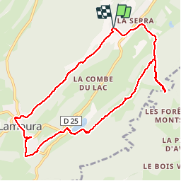
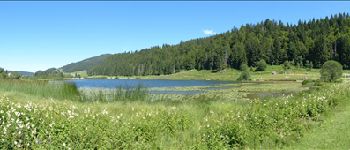
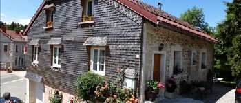
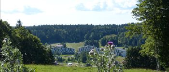
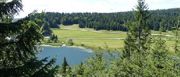
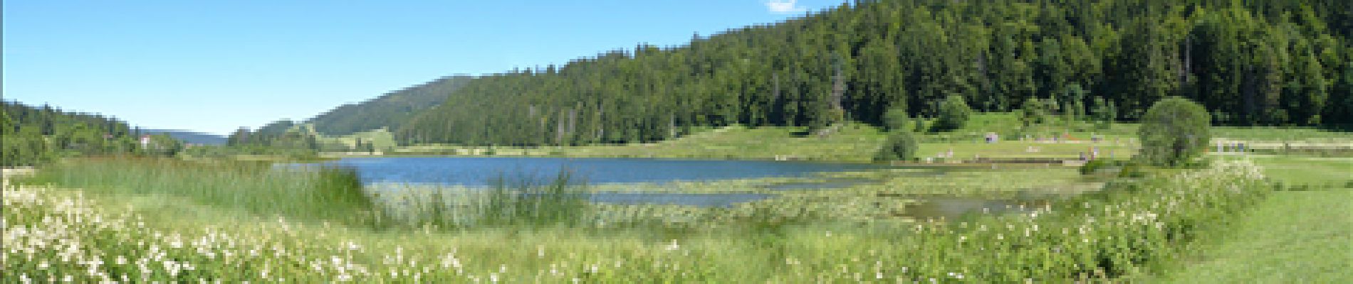
Randonnée Marche de 11,3 km à découvrir à Bourgogne-Franche-Comté, Jura, Lamoura. Cette randonnée est proposée par PGregoire.

Description

Cordes vocales et Chaussures de marche 2012. Ballade n°1 Dimanche 22 Juillet : La Serra

Profil altimétrique

Photos

Points d'intérêt

Point d'intérêt Lajoux - Borne 1362 - Photo
PGregoire
LAJOUX 
Point d'intérêt Lamoura - Le lac de Lamoura - Photo
PGregoire
Point d'intérêt Lamoura - Maison à bardeaux - Photo
PGregoire
Point d'intérêt Lamoura - Chemin - Photo
PGregoire
LAMOURA 
Point d'intérêt Lamoura - Vue du VVL de Lamoura - Photo
PGregoire
Point d'intérêt Lamoura - Vue sur le lac de Lamoura - Photo
PGregoire

Localisation

Pays :
France
Région :
Bourgogne-Franche-Comté
Département/Province :
Jura
Commune :
Lamoura
Localité :
Unknown
Départ:(Dec)
Départ:(UTM)
729797 ; 5144149 (31T) N.

Randonnées à proximité

Randonnée Marche Lamoura - Tresberruy - Lamoura - Photo
Marche
tracegps

Marche

Difficile
(1)
Lamoura, Bourgogne-Franche-Comté, Jura, France
14,5 km | 20 km-effort
4h 0min
Oui
Randonnée Marche Septmoncel les Molunes - mo sentier des lapidaires - Photo
Marche
GUIDE
stef789

Marche

Moyen
Septmoncel les Molunes, Bourgogne-Franche-Comté, Jura, France
10,3 km | 14,4 km-effort
3h 28min
Oui
Randonnée Vélo Lajoux - Lajoux / Bellecombe - Photo
Vélo
daniellebou

Vélo

Très facile
(1)
Lajoux, Bourgogne-Franche-Comté, Jura, France
21 km | 26 km-effort
Inconnu
Oui
Randonnée Course à pied Mijoux - UTTJ 2015-2 - Photo
Course à pied
bourel.jacques

Course à pied

Très difficile
(1)
Mijoux, Auvergne-Rhône-Alpes, Ain, France
57 km | 92 km-effort
18h 13min
Non
Randonnée Marche Lajoux - Le crêt de la vigoureuse (le vrai) - Photo
Marche
GUIDE
stef789

Marche

Facile
Lajoux, Bourgogne-Franche-Comté, Jura, France
10,4 km | 13,4 km-effort
4h 9min
Oui
Randonnée Marche Lajoux - crêt vigoureuse - Photo
Marche
eltonnermou

Marche

Moyen
Lajoux, Bourgogne-Franche-Comté, Jura, France
12,3 km | 16,8 km-effort
5h 0min
Oui
Randonnée Marche Gex - Balade à Col de la Faucille, Gex - Photo
Marche
Gaiato

Marche

Très difficile
Gex, Auvergne-Rhône-Alpes, Ain, France
86 km | 135 km-effort
9h 23min
Non
Randonnée Cyclotourisme Mijoux - LES ROUSSES - COL DE LA FAUCILLE  - Photo
Cyclotourisme
jean-marie.parachini

Cyclotourisme

Très difficile
Mijoux, Auvergne-Rhône-Alpes, Ain, France
54 km | 68 km-effort
4h 57min
Non
Randonnée Marche Lamoura - Autour Lamoura - Photo
Marche
swp648

Marche

Moyen
Lamoura, Bourgogne-Franche-Comté, Jura, France
17,1 km | 25 km-effort
4h 37min
Oui


Fermer
Mes abonnements