Randonnée Marche Carlucet - Carlucet - Photo
 poupartbertrand
poupartbertrand

Utilisateur

© OpenStreetMap contributors
Longueur
Longueur
22 km
Altitude max
Altitude max
382 m
Dénivelé positif
Dénivelé positif
337 m
Km-Effort
Km-Effort  
26 km
Altitude min
Altitude min
235 m
Dénivelé négatif
Dénivelé négatif
340 m
Boucle
Boucle
Oui
Date de création :
2014-12-10 00:00:00.0
Dernière modification :
2014-12-10 00:00:00.0

(0 Avis)

Marche
Marche
4h00
Difficulté : Moyen

Scannez ce code QR pour ouvrir la randonnée dans l'application SityTrail

Application GPS de randonnée GRATUITE

Logo SityTrail SityTrail

IGN / Instituts géographiques

Télécharger SityTrail sur l'App Store Télécharger SityTrail sur Google Play

Logo SityTrail SityTrail World

Le monde est à vous

Télécharger SityTrail sur l'App Store Télécharger SityTrail sur Google Play Télécharger SityTrail sur Huawei AppGallery

À propos

Randonnée Marche de 22 km à découvrir à Occitanie, Lot, Carlucet. Cette randonnée est proposée par poupartbertrand.

Description

BALISAGE JAUNE

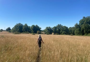
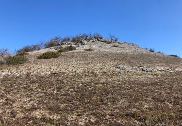
Sentier dans les environs de Carlucet. Pas de dénivelé très abrupt ; la seule difficulté réside dans la longueur de la randonnée.
Quelques passages dans des sous-bois (petits décrochages du GPS). Franchissement de chasses privées mais autorisées (portails, portillons balisés).
Difficile de stationner dans le village ; parking au pied du village sur la D32 (petit parking dans le virage ; un plus grand et aménagé 100 m plus bas).
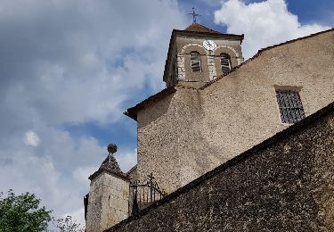
Pour bien débuter, prenez le petit sentier à droite situé tout de suite après l'hôtel de ville (en direction de l'église). Bonne rando !
         

Profil altimétrique

Points d'intérêt

Point d'intérêt Le Bastit - Portail - Photo
poupartbertrand
LE BASTIT 
Point d'intérêt Le Bastit - Intersection - Photo
poupartbertrand
LE BASTIT 
Point d'intérêt Le Bastit - Arrêt pique-nique - Photo
poupartbertrand
Point d'intérêt Le Bastit - Décrochage GPS - Photo
poupartbertrand
LE BASTIT 

Localisation

Pays :
France
Région :
Occitanie
Département/Province :
Lot
Commune :
Carlucet
Localité :
Unknown
Départ:(Dec)
Départ:(UTM)
390197 ; 4953113 (31T) N.

Randonnées à proximité

Randonnée Marche Carlucet - Carlucet  - Photo
Marche
GUIDE
antignacs

Marche

Très facile
Carlucet, Occitanie, Lot, France
6,5 km | 8,1 km-effort
2h 10min
Oui
Randonnée Marche Montfaucon - Le bastit carlucet  - Photo
Marche
GUIDE
antignacs

Marche

Très facile
Montfaucon, Occitanie, Lot, France
20 km | 25 km-effort
4h 11min
Oui
Randonnée Marche Carlucet - Carlucet_le Bastit - Photo
Marche
viam19

Marche

Moyen
Carlucet, Occitanie, Lot, France
15,4 km | 18,4 km-effort
5h 14min
Oui
Randonnée Marche Couzou - Couzou - Photo
Marche
Gaillard Isabelle

Marche

Moyen
Couzou, Occitanie, Lot, France
17 km | 22 km-effort
4h 55min
Oui
Randonnée Vélo de route Le Bastit - Rando-Cyclo6-Rocamadour-63km-Juin21 - Photo
Vélo de route
Patrick2019

Vélo de route

Très difficile
Le Bastit, Occitanie, Lot, France
63 km | 79 km-effort
4h 47min
Oui
Randonnée Vélo de route Le Bastit - Rando-Cyclo14-LeCausse-62km-Juin21 - Photo
Vélo de route
Patrick2019

Vélo de route

Très difficile
Le Bastit, Occitanie, Lot, France
62 km | 75 km-effort
4h 33min
Oui
Randonnée Vélo de route Le Bastit - Rando-Cyclo15-Racamadour-56Km-Juin21 - Photo
Vélo de route
Patrick2019

Vélo de route

Très difficile
Le Bastit, Occitanie, Lot, France
56 km | 70 km-effort
4h 15min
Oui
Randonnée Marche Montfaucon - Étape 4 septembre 2024 - Photo
Marche
Pascal Bernaud

Marche

Très difficile
Montfaucon, Occitanie, Lot, France
18,3 km | 24 km-effort
6h 27min
Non
Randonnée Marche Carlucet - Carlucet - Labastide Murat - Photo
Marche
Bernard Lejeune

Marche

Difficile
Carlucet, Occitanie, Lot, France
14,4 km | 19 km-effort
4h 18min
Non


Fermer
Mes abonnements