Randonnée Cheval Valff - Stotz-Herb - Photo
 xavier.fetzer
xavier.fetzer

Utilisateur

© OpenStreetMap contributors
Longueur
Longueur
19,1 km
Altitude max
Altitude max
162 m
Dénivelé positif
Dénivelé positif
91 m
Km-Effort
Km-Effort  
20 km
Altitude min
Altitude min
149 m
Dénivelé négatif
Dénivelé négatif
95 m
Boucle
Boucle
Non
Date de création :
2014-12-10 00:00:00.0
Dernière modification :
2014-12-10 00:00:00.0

(0 Avis)

Cheval
Cheval
--
Difficulté : Facile

Scannez ce code QR pour ouvrir la randonnée dans l'application SityTrail

Application GPS de randonnée GRATUITE

Logo SityTrail SityTrail

IGN / Instituts géographiques

Télécharger SityTrail sur l'App Store Télécharger SityTrail sur Google Play

Logo SityTrail SityTrail World

Le monde est à vous

Télécharger SityTrail sur l'App Store Télécharger SityTrail sur Google Play Télécharger SityTrail sur Huawei AppGallery

À propos

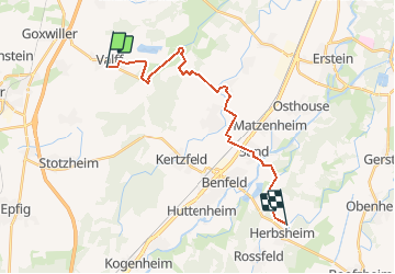
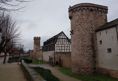
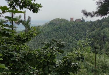
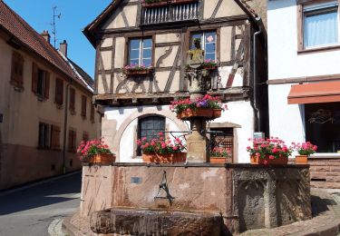
Randonnée Cheval de 19,1 km à découvrir à Grand Est, Bas-Rhin, Valff. Cette randonnée est proposée par xavier.fetzer.

Profil altimétrique

Localisation

Pays :
France
Région :
Grand Est
Département/Province :
Bas-Rhin
Commune :
Valff
Localité :
Unknown
Départ:(Dec)
Départ:(UTM)
390588 ; 5363892 (32U) N.

Randonnées à proximité

Randonnée Marche Obernai - Obernai gare - Mont St Odile - Photo
Marche
tracegps

Marche

Difficile
(2)
Obernai, Grand Est, Bas-Rhin, France
20 km | 29 km-effort
5h 0min
Oui
Randonnée Vélo électrique Gertwiller - Barr  - Photo
Vélo électrique
apa

Vélo électrique

Moyen
Gertwiller, Grand Est, Bas-Rhin, France
58 km | 69 km-effort
3h 48min
Non
Randonnée Randonnée équestre Goxwiller - Mont saint Odile cva tryggur  - Photo
Randonnée équestre
GUIDE
raline

Randonnée équestre

Moyen
Goxwiller, Grand Est, Bas-Rhin, France
19,7 km | 29 km-effort
3h 50min
Oui
Randonnée Marche Goxwiller - Goxwiller-Landsberg-Kapellenhausfelsen-Goxwiller - Photo
Marche
Silke Roth

Marche

Moyen
Goxwiller, Grand Est, Bas-Rhin, France
17,7 km | 26 km-effort
4h 30min
Non
Randonnée Marche Obernai - Obernai - Boersch - Photo
Marche
Bart2015

Marche

Moyen
Obernai, Grand Est, Bas-Rhin, France
12,7 km | 15,6 km-effort
2h 20min
Oui
Randonnée V.T.T. Obernai - Mont St Odile - Photo
V.T.T.
duchaine.nicolas

V.T.T.

Facile
Obernai, Grand Est, Bas-Rhin, France
39 km | 53 km-effort
4h 12min
Non
Randonnée Marche Barr - 3 châteaux depuis Barr - Photo
Marche
Claudele

Marche

Difficile
Barr, Grand Est, Bas-Rhin, France
20 km | 29 km-effort
7h 2min
Oui
Randonnée Randonnée équestre Goxwiller - Boucle Goxwiller-Heiligenstein- Rosenberg-Gox.  - Photo
Randonnée équestre
jmroth

Randonnée équestre

Moyen
Goxwiller, Grand Est, Bas-Rhin, France
9,7 km | 13 km-effort
2h 0min
Oui
Randonnée Marche Barr - 2020-05-16 Marche Acacias Spessbourg Andlau Mittelbergheim - Photo
Marche
GUIDE
holtzv

Marche

Très facile
Barr, Grand Est, Bas-Rhin, France
16,6 km | 24 km-effort
4h 18min
Oui


Fermer
Mes abonnements