![](/images/other/stat-length.png)
![Randonnée Marche Brochon - Combe de Brochon - Photo](https://media.geolcdn.com/t/1900/400/ext.pjpeg?maxdim=2&url=https%3A%2F%2Fservices.sitytrail.com%2FGeolivesWS%2FDownloadMedia.ashx%3FTrailID%3D129810%26Media%3D13359_4.jpg)
Combe de Brochon
tracegps
Utilisateur
![Longueur](/images/other/stat-length.png)
Longueur
8,2 km
![Altitude max](https://static1.geolcdn.com/siteimages/upload/files/1508320355ic_sort_altitude_max_24dp.png)
Altitude max
538 m
![Dénivelé positif](https://static1.geolcdn.com/siteimages/upload/files/1508320355ic_sort_den_pos_24dp.png)
Dénivelé positif
242 m
![Km-Effort](/images/other/stat-length.png)
Km-Effort
10,9 km
![Altitude min](https://static1.geolcdn.com/siteimages/upload/files/1508320355ic_sort_altitude_min_24dp.png)
Altitude min
303 m
![Dénivelé négatif](https://static1.geolcdn.com/siteimages/upload/files/1508320355ic_sort_den_neg_24dp.png)
Dénivelé négatif
92 m
![Boucle](https://static1.geolcdn.com/siteimages/upload/files/16400158638029165_repeat_loop_refresh_sync_direction_icon.png)
Boucle
Non
Date de création :
2014-12-10 00:00:00.0
Dernière modification :
2014-12-10 00:00:00.0
![Marche](https://static1.geolcdn.com/sitytour/trail-icons/101.png)
3h00
Difficulté : Moyen
![Scannez ce code QR pour ouvrir la randonnée dans l'application SityTrail](https://capi.geolives.com/qq0zvz2zws4bq2lad0pu/sitytour/trails/129810/qr.png?size=200)
Application GPS de randonnée GRATUITE
À propos
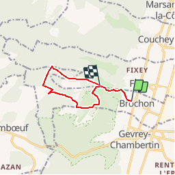
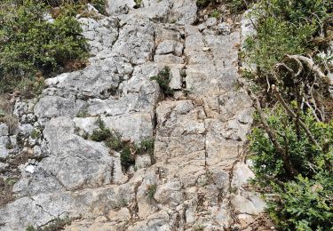
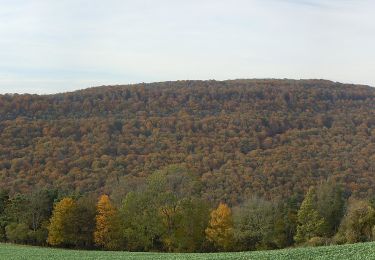
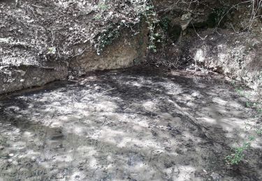
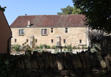
Randonnée Marche de 8,2 km à découvrir à Bourgogne-Franche-Comté, Côte-d'Or, Brochon. Cette randonnée est proposée par tracegps.
Description
Départ parking tout en haut de la rue de Lavaut à Brochon. Ca grimpe un peu au début pendant 20 minutes puis plat tout le long. Retour possible par les 100 marches (prendre petit sentier à droite juste avant la barrière avant la redescente).
Localisation
Pays :
France
Région :
Bourgogne-Franche-Comté
Département/Province :
Côte-d'Or
Commune :
Brochon
Localité :
Unknown
Départ:(Dec)
Départ:(UTM)
649003 ; 5233620 (31T) N.
Commentaires
Randonnées à proximité
![Randonnée Marche Marsannay-la-Côte - Marsannay la Côte 2021-03-02 repérage CAF - Photo](https://media.geolcdn.com/t/375/260/a8946688-d158-4deb-8004-8983d24f20f3.jpg&format=jpg&maxdim=2)
![Marche Marche](https://static1.geolcdn.com/sitytour/trail-icons/101.png)
Marsannay la Côte 2021-03-02 repérage CAF
Marche
Très facile
(1)
Marsannay-la-Côte,
Bourgogne-Franche-Comté,
Côte-d'Or,
France
![](/images/other/stat-length.png)
23 km | 30 km-effort
4h 39min
![](https://static1.geolcdn.com/siteimages/upload/files/16400158638029165_repeat_loop_refresh_sync_direction_icon.png)
Oui
![Randonnée Marche Brochon - falaises et plateau - Photo](https://media.geolcdn.com/t/375/260/ext.jpg?maxdim=2&url=https%3A%2F%2Fservices.sitytrail.com%2FGeolivesWS%2FDownloadMedia.ashx%3FTrailID%3D640375%26Media%3Dfix__20161002163015.jpg)
![Marche Marche](https://static1.geolcdn.com/sitytour/trail-icons/101.png)
falaises et plateau
Marche
Difficile
(1)
Brochon,
Bourgogne-Franche-Comté,
Côte-d'Or,
France
![](/images/other/stat-length.png)
15,9 km | 22 km-effort
4h 45min
![](https://static1.geolcdn.com/siteimages/upload/files/16400158638029165_repeat_loop_refresh_sync_direction_icon.png)
Non
![Randonnée Marche Brochon - Boucle des cent marches et du pavillon de l'empereur - Photo](https://media.geolcdn.com/t/375/260/c945b0b3-6e82-40bf-bac2-b1d204cc41d7.jpg&format=jpg&maxdim=2)
![Marche Marche](https://static1.geolcdn.com/sitytour/trail-icons/101.png)
Boucle des cent marches et du pavillon de l'empereur
Marche
Moyen
Brochon,
Bourgogne-Franche-Comté,
Côte-d'Or,
France
![](/images/other/stat-length.png)
5,5 km | 8,1 km-effort
1h 38min
![](https://static1.geolcdn.com/siteimages/upload/files/16400158638029165_repeat_loop_refresh_sync_direction_icon.png)
Oui
![Randonnée A pied Flavignerot - Du Naizou au Mont Afrique - Photo](https://media.geolcdn.com/t/375/260/37780069-2b1d-4f93-92c0-3e0d6f5857c8.jpeg&format=jpg&maxdim=2)
![A pied A pied](https://static1.geolcdn.com/sitytour/trail-icons/100.png)
Du Naizou au Mont Afrique
A pied
Facile
Flavignerot,
Bourgogne-Franche-Comté,
Côte-d'Or,
France
![](/images/other/stat-length.png)
8,9 km | 11,4 km-effort
2h 35min
![](https://static1.geolcdn.com/siteimages/upload/files/16400158638029165_repeat_loop_refresh_sync_direction_icon.png)
Oui
![Randonnée V.T.T. Curley - raidetoto2017 sam - Photo](https://media.geolcdn.com/t/375/260/ext.jpg?maxdim=2&url=https%3A%2F%2Fstatic1.geolcdn.com%2Fsiteimages%2Fupload%2Ffiles%2F1524743154velo.jpg)
![V.T.T. V.T.T.](https://static1.geolcdn.com/sitytour/trail-icons/202.png)
raidetoto2017 sam
V.T.T.
Difficile
(1)
Curley,
Bourgogne-Franche-Comté,
Côte-d'Or,
France
![](/images/other/stat-length.png)
67 km | 88 km-effort
7h 2min
![](https://static1.geolcdn.com/siteimages/upload/files/16400158638029165_repeat_loop_refresh_sync_direction_icon.png)
Oui
![Randonnée Marche Fixin - nouveaux chemins - Photo](https://media.geolcdn.com/t/375/260/ext.jpg?maxdim=2&url=https%3A%2F%2Fstatic1.geolcdn.com%2Fsiteimages%2Fupload%2Ffiles%2F1553511878bg_sport_marche.png)
![Marche Marche](https://static1.geolcdn.com/sitytour/trail-icons/101.png)
nouveaux chemins
Marche
Moyen
(1)
Fixin,
Bourgogne-Franche-Comté,
Côte-d'Or,
France
![](/images/other/stat-length.png)
12,6 km | 16,5 km-effort
3h 3min
![](https://static1.geolcdn.com/siteimages/upload/files/16400158638029165_repeat_loop_refresh_sync_direction_icon.png)
Oui
![Randonnée Marche Flavignerot - La roche Pompon - Photo](https://media.geolcdn.com/t/375/260/86ae7075-84a3-4369-8eed-7dd5779ede25.jpg&format=jpg&maxdim=2)
![Marche Marche](https://static1.geolcdn.com/sitytour/trail-icons/101.png)
La roche Pompon
Marche
Moyen
Flavignerot,
Bourgogne-Franche-Comté,
Côte-d'Or,
France
![](/images/other/stat-length.png)
15,3 km | 23 km-effort
5h 0min
![](https://static1.geolcdn.com/siteimages/upload/files/16400158638029165_repeat_loop_refresh_sync_direction_icon.png)
Oui
![Randonnée A pied Gevrey-Chambertin - Sentier Bernard Quarteaux - Photo](https://media.geolcdn.com/t/375/260/841522af-1ea0-428a-9257-df0e01d41583.jpeg&format=jpg&maxdim=2)
![A pied A pied](https://static1.geolcdn.com/sitytour/trail-icons/100.png)
Sentier Bernard Quarteaux
A pied
Facile
Gevrey-Chambertin,
Bourgogne-Franche-Comté,
Côte-d'Or,
France
![](/images/other/stat-length.png)
6,4 km | 9,5 km-effort
2h 10min
![](https://static1.geolcdn.com/siteimages/upload/files/16400158638029165_repeat_loop_refresh_sync_direction_icon.png)
Oui
![Randonnée Marche Fixin - fixin - Photo](https://media.geolcdn.com/t/375/260/ext.jpg?maxdim=2&url=https%3A%2F%2Fstatic1.geolcdn.com%2Fsiteimages%2Fupload%2Ffiles%2F1553511878bg_sport_marche.png)
![Marche Marche](https://static1.geolcdn.com/sitytour/trail-icons/101.png)
fixin
Marche
Très facile
(1)
Fixin,
Bourgogne-Franche-Comté,
Côte-d'Or,
France
![](/images/other/stat-length.png)
14,9 km | 19,8 km-effort
3h 49min
![](https://static1.geolcdn.com/siteimages/upload/files/16400158638029165_repeat_loop_refresh_sync_direction_icon.png)
Oui