![](/images/other/stat-length.png)
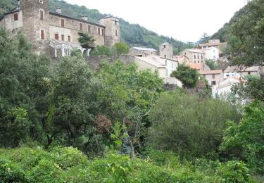
![Randonnée Marche Fournes-Cabardès - Le circuit des Maquisards - Fournes Cabardès - Photo](https://media.geolcdn.com/t/1900/400/ext.pjpeg?maxdim=2&url=https%3A%2F%2Fservices.sitytrail.com%2FGeolivesWS%2FDownloadMedia.ashx%3FTrailID%3D129776%26Media%3D13319_6.jpg)
Le circuit des Maquisards - Fournes Cabardès
tracegps
Utilisateur
![Longueur](/images/other/stat-length.png)
![Altitude max](https://static1.geolcdn.com/siteimages/upload/files/1508320355ic_sort_altitude_max_24dp.png)
![Dénivelé positif](https://static1.geolcdn.com/siteimages/upload/files/1508320355ic_sort_den_pos_24dp.png)
![Km-Effort](/images/other/stat-length.png)
![Altitude min](https://static1.geolcdn.com/siteimages/upload/files/1508320355ic_sort_altitude_min_24dp.png)
![Dénivelé négatif](https://static1.geolcdn.com/siteimages/upload/files/1508320355ic_sort_den_neg_24dp.png)
![Boucle](https://static1.geolcdn.com/siteimages/upload/files/16400158638029165_repeat_loop_refresh_sync_direction_icon.png)
![Marche](https://static1.geolcdn.com/sitytour/trail-icons/101.png)
6h00
Difficulté : Moyen
![Scannez ce code QR pour ouvrir la randonnée dans l'application SityTrail](https://capi.geolives.com/qq0zvz2zws4bq2lad0pu/sitytour/trails/129776/qr.png?size=200)
Application GPS de randonnée GRATUITE
À propos
Randonnée Marche de 16,9 km à découvrir à Occitanie, Aude, Fournes-Cabardès. Cette randonnée est proposée par tracegps.
Description
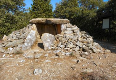
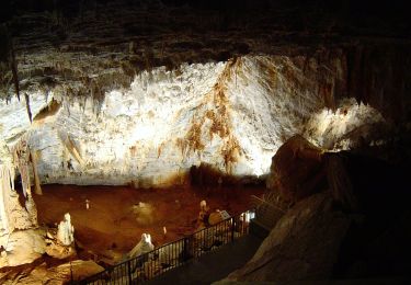
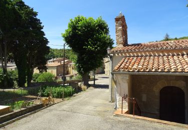
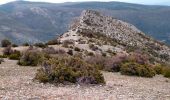
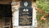
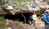
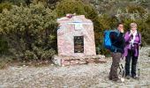
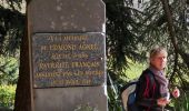
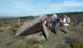
Cette rando a été organisée par Christine, Expérience Randos Haut Cabardès, avec Florence, le Haut Cabardès et aussi la Communauté de Communes du Haut-Cabardès. Départ au lieu-dit "La Pierre Plantée" entre Fournes-Cabardès et le hameau de Seriès sur la D401. Depuis le parking, descendre la petite route de 500m pour récupérer le sentier de Series sur la gauche. Ce circuit ne présente pas de difficultés notables. Tout au long du cheminement dans ce massif de Trassanel, des grottes, stèles et mémorial de la résistance rappellent les tragédies de la guerre en 1944 ou les maquisards ont payés un lourd tribu.
Localisation
Commentaires
Randonnées à proximité
![Randonnée Marche Roquefère - La cascade de Cubserviès - Roquefère - Photo](https://media.geolcdn.com/t/375/260/ext.jpg?maxdim=2&url=https%3A%2F%2Fservices.sitytrail.com%2FGeolivesWS%2FDownloadMedia.ashx%3FTrailID%3D214972%26Media%3D15539_4.jpg)
![Marche Marche](https://static1.geolcdn.com/sitytour/trail-icons/101.png)
Marche
![](/images/other/stat-length.png)
![](https://static1.geolcdn.com/siteimages/upload/files/16400158638029165_repeat_loop_refresh_sync_direction_icon.png)
![Randonnée Marche Villeneuve-Minervois - Un air d'automne - Villeneuve Minervois - Photo](https://media.geolcdn.com/t/375/260/ext.jpg?maxdim=2&url=https%3A%2F%2Fservices.sitytrail.com%2FGeolivesWS%2FDownloadMedia.ashx%3FTrailID%3D107449%26Media%3D12373_6.jpg)
![Marche Marche](https://static1.geolcdn.com/sitytour/trail-icons/101.png)
Marche
![](/images/other/stat-length.png)
![](https://static1.geolcdn.com/siteimages/upload/files/16400158638029165_repeat_loop_refresh_sync_direction_icon.png)
![Randonnée Marche Miraval-Cabardès - Miraval - Lacoste - Roc du Bougre - Photo](https://media.geolcdn.com/t/375/260/ext.jpg?maxdim=2&url=https%3A%2F%2Fstatic1.geolcdn.com%2Fsiteimages%2Fupload%2Ffiles%2F1553511878bg_sport_marche.png)
![Marche Marche](https://static1.geolcdn.com/sitytour/trail-icons/101.png)
Marche
![](/images/other/stat-length.png)
![](https://static1.geolcdn.com/siteimages/upload/files/16400158638029165_repeat_loop_refresh_sync_direction_icon.png)
![Randonnée Marche Lastours - Châteaux de Lastours 27-03-2022 - Photo](https://media.geolcdn.com/t/375/260/095a3ee9-2966-4db1-9ddd-42933aa80bcb.jpg&format=jpg&maxdim=2)
![Marche Marche](https://static1.geolcdn.com/sitytour/trail-icons/101.png)
Marche
![](/images/other/stat-length.png)
![](https://static1.geolcdn.com/siteimages/upload/files/16400158638029165_repeat_loop_refresh_sync_direction_icon.png)
![Randonnée A pied Cabrespine - Les Villages Perchés - Photo](https://media.geolcdn.com/t/375/260/4379f8e7-e0a2-4ee4-810f-0aa42c1f51f8.jpeg&format=jpg&maxdim=2)
![A pied A pied](https://static1.geolcdn.com/sitytour/trail-icons/100.png)
A pied
![](/images/other/stat-length.png)
![](https://static1.geolcdn.com/siteimages/upload/files/16400158638029165_repeat_loop_refresh_sync_direction_icon.png)
![Randonnée A pied Labastide-Esparbaïrenque - Les Villages Perchés - Photo](https://media.geolcdn.com/t/375/260/87afa764-5c51-4a79-b394-b4027bc6ab46.jpeg&format=jpg&maxdim=2)
![A pied A pied](https://static1.geolcdn.com/sitytour/trail-icons/100.png)
A pied
![](/images/other/stat-length.png)
![](https://static1.geolcdn.com/siteimages/upload/files/16400158638029165_repeat_loop_refresh_sync_direction_icon.png)
![Randonnée A pied Cabrespine - Boucle du Gouffre de Cabrespine - Photo](https://media.geolcdn.com/t/375/260/b4f79f08-71e0-4997-b690-a17cfd5f244e.jpeg&format=jpg&maxdim=2)
![A pied A pied](https://static1.geolcdn.com/sitytour/trail-icons/100.png)
A pied
![](/images/other/stat-length.png)
![](https://static1.geolcdn.com/siteimages/upload/files/16400158638029165_repeat_loop_refresh_sync_direction_icon.png)
![Randonnée Marche Les Ilhes - Les Ilhes - Photo](https://media.geolcdn.com/t/375/260/b2a5cfbf-898a-4c81-a829-ea9ff8e0beb4.jpg&format=jpg&maxdim=2)
![Marche Marche](https://static1.geolcdn.com/sitytour/trail-icons/101.png)
![Randonnée A pied Roquefère - Labastide-Espabïrenque, Prat Viel, Picarot haut - Photo](https://media.geolcdn.com/t/375/260/ext.jpg?maxdim=2&url=https%3A%2F%2Fstatic1.geolcdn.com%2Fsiteimages%2Fupload%2Ffiles%2F1545311037marcheuse_200dpi.jpg)
![A pied A pied](https://static1.geolcdn.com/sitytour/trail-icons/100.png)
A pied
![](/images/other/stat-length.png)
![](https://static1.geolcdn.com/siteimages/upload/files/16400158638029165_repeat_loop_refresh_sync_direction_icon.png)
très beau parcour - très beau parcour