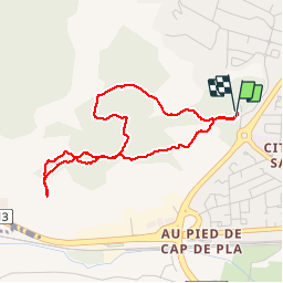
![](/images/other/stat-length.png)
![Randonnée Marche Narbonne - Narbonne campane télégraphe de Montredon - Photo](https://media.geolcdn.com/t/1900/400/ext.pjpeg?maxdim=2&url=https%3A%2F%2Fservices.sitytrail.com%2FGeolivesWS%2FDownloadMedia.ashx%3FTrailID%3D126007%26Media%3D20120507123533.jpg)
Narbonne campane télégraphe de Montredon
marcheur75
Utilisateur
![Longueur](/images/other/stat-length.png)
Longueur
4,1 km
![Altitude max](https://static1.geolcdn.com/siteimages/upload/files/1508320355ic_sort_altitude_max_24dp.png)
Altitude max
119 m
![Dénivelé positif](https://static1.geolcdn.com/siteimages/upload/files/1508320355ic_sort_den_pos_24dp.png)
Dénivelé positif
91 m
![Km-Effort](/images/other/stat-length.png)
Km-Effort
5,3 km
![Altitude min](https://static1.geolcdn.com/siteimages/upload/files/1508320355ic_sort_altitude_min_24dp.png)
Altitude min
34 m
![Dénivelé négatif](https://static1.geolcdn.com/siteimages/upload/files/1508320355ic_sort_den_neg_24dp.png)
Dénivelé négatif
93 m
![Boucle](https://static1.geolcdn.com/siteimages/upload/files/16400158638029165_repeat_loop_refresh_sync_direction_icon.png)
Boucle
Oui
Date de création :
2014-12-10 00:00:00.0
Dernière modification :
2014-12-10 00:00:00.0
![Marche](https://static1.geolcdn.com/sitytour/trail-icons/101.png)
49m
Difficulté : Facile
![Scannez ce code QR pour ouvrir la randonnée dans l'application SityTrail](https://capi.geolives.com/qq0zvz2zws4bq2lad0pu/sitytour/trails/126007/qr.png?size=200)
Application GPS de randonnée GRATUITE
À propos
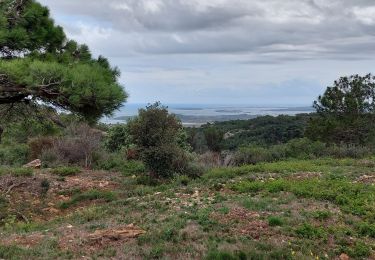
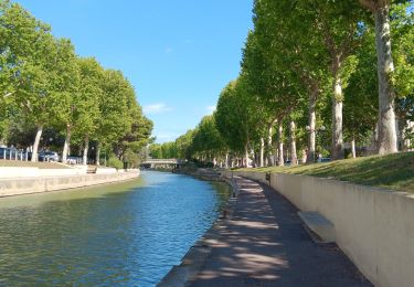
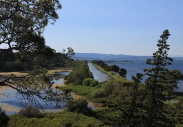
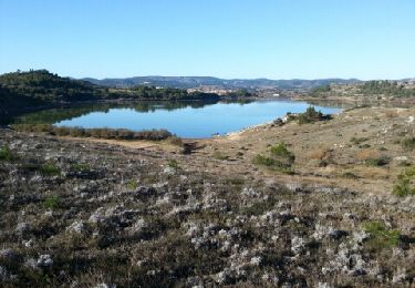
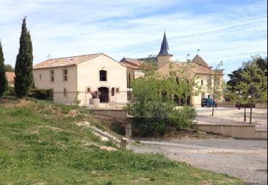
Randonnée Marche de 4,1 km à découvrir à Occitanie, Aude, Narbonne. Cette randonnée est proposée par marcheur75.
Description
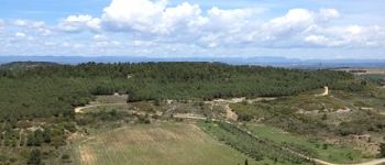
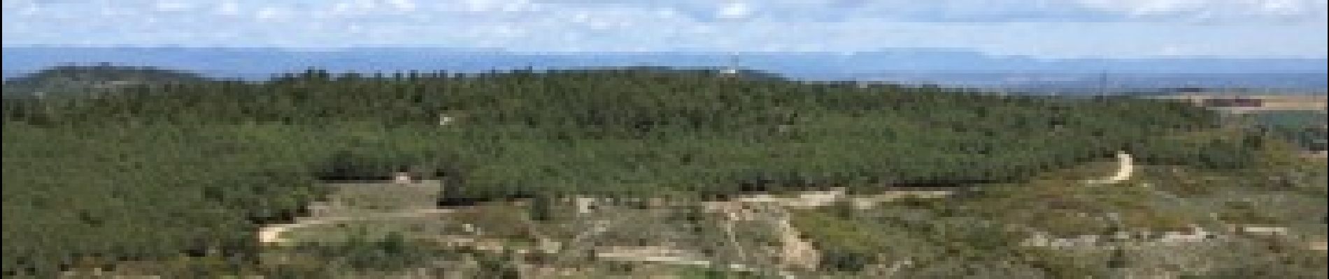
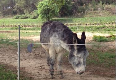
Balade dans le parcs de Campane pas très long mes bonne pour la rééducation des maladie du coeur sa monte et sa descend tous le temps mais cela en vos la chandelle BONNE BALADE
Localisation
Pays :
France
Région :
Occitanie
Département/Province :
Aude
Commune :
Narbonne
Localité :
Unknown
Départ:(Dec)
Départ:(UTM)
497708 ; 4781660 (31T) N.
Commentaires
Randonnées à proximité
![Randonnée Marche Narbonne - Port la Nautique - Photo](https://media.geolcdn.com/t/375/260/f1dc1b5e-e4aa-42a2-b591-bf12619738fc.jpg&format=jpg&maxdim=2)
![Marche Marche](https://static1.geolcdn.com/sitytour/trail-icons/101.png)
![Randonnée Marche Narbonne - Balade urbaine de Narbonne - Photo](https://media.geolcdn.com/t/375/260/37a5e97e-e9ef-4d23-b45c-dd44592c967b.jpg&format=jpg&maxdim=2)
![Marche Marche](https://static1.geolcdn.com/sitytour/trail-icons/101.png)
Balade urbaine de Narbonne
Marche
Facile
Narbonne,
Occitanie,
Aude,
France
![](/images/other/stat-length.png)
4,5 km | 5,2 km-effort
2h 16min
![](https://static1.geolcdn.com/siteimages/upload/files/16400158638029165_repeat_loop_refresh_sync_direction_icon.png)
Oui
![Randonnée Marche Narbonne - La combe d'enfer en Narbonnais - Photo](https://media.geolcdn.com/t/375/260/28cc313a-8a47-482c-81b5-28081d16a224.jpg&format=jpg&maxdim=2)
![Marche Marche](https://static1.geolcdn.com/sitytour/trail-icons/101.png)
La combe d'enfer en Narbonnais
Marche
Facile
Narbonne,
Occitanie,
Aude,
France
![](/images/other/stat-length.png)
15,9 km | 21 km-effort
4h 30min
![](https://static1.geolcdn.com/siteimages/upload/files/16400158638029165_repeat_loop_refresh_sync_direction_icon.png)
Oui
![Randonnée Marche Narbonne - petit tour dans Narbonne - Photo](https://media.geolcdn.com/t/375/260/e3b82c20-be17-42ce-b01a-ebd5b5f64b62.jpg&format=jpg&maxdim=2)
![Marche Marche](https://static1.geolcdn.com/sitytour/trail-icons/101.png)
petit tour dans Narbonne
Marche
Facile
Narbonne,
Occitanie,
Aude,
France
![](/images/other/stat-length.png)
4,6 km | 5,3 km-effort
2h 39min
![](https://static1.geolcdn.com/siteimages/upload/files/16400158638029165_repeat_loop_refresh_sync_direction_icon.png)
Oui
![Randonnée Vélo de route Narbonne - Narbonne - Bages - Port La Nouvelle - Narbonne - Photo](https://media.geolcdn.com/t/375/260/ext.jpg?maxdim=2&url=https%3A%2F%2Fstatic1.geolcdn.com%2Fsiteimages%2Fupload%2Ffiles%2F1524743154velo.jpg)
![Vélo de route Vélo de route](https://static1.geolcdn.com/sitytour/trail-icons/201.png)
Narbonne - Bages - Port La Nouvelle - Narbonne
Vélo de route
Facile
(1)
Narbonne,
Occitanie,
Aude,
France
![](/images/other/stat-length.png)
58 km | 63 km-effort
54min
![](https://static1.geolcdn.com/siteimages/upload/files/16400158638029165_repeat_loop_refresh_sync_direction_icon.png)
Oui
![Randonnée V.T.T. Narbonne - Le Golfe Antique - Narbonne - Photo](https://media.geolcdn.com/t/375/260/ext.jpg?maxdim=2&url=https%3A%2F%2Fservices.sitytrail.com%2FGeolivesWS%2FDownloadMedia.ashx%3FTrailID%3D191523%26Media%3D15127_3.jpg)
![V.T.T. V.T.T.](https://static1.geolcdn.com/sitytour/trail-icons/202.png)
Le Golfe Antique - Narbonne
V.T.T.
Moyen
Narbonne,
Occitanie,
Aude,
France
![](/images/other/stat-length.png)
49 km | 53 km-effort
5h 0min
![](https://static1.geolcdn.com/siteimages/upload/files/16400158638029165_repeat_loop_refresh_sync_direction_icon.png)
Oui
![Randonnée V.T.T. Narbonne - Etangs de Bages - Photo](https://media.geolcdn.com/t/375/260/ext.jpg?maxdim=2&url=https%3A%2F%2Fservices.sitytrail.com%2FGeolivesWS%2FDownloadMedia.ashx%3FTrailID%3D166234%26Media%3D20121216105623.jpeg)
![V.T.T. V.T.T.](https://static1.geolcdn.com/sitytour/trail-icons/202.png)
![Randonnée Marche Narbonne - Montplaisir Balade de l'Éolienne - Photo](https://media.geolcdn.com/t/375/260/ext.jpg?maxdim=2&url=https%3A%2F%2Fservices.sitytrail.com%2FGeolivesWS%2FDownloadMedia.ashx%3FTrailID%3D122188%26Media%3D20120417121300.jpg)
![Marche Marche](https://static1.geolcdn.com/sitytour/trail-icons/101.png)
Montplaisir Balade de l'Éolienne
Marche
Facile
Narbonne,
Occitanie,
Aude,
France
![](/images/other/stat-length.png)
9,1 km | 11,6 km-effort
1h 31min
![](https://static1.geolcdn.com/siteimages/upload/files/16400158638029165_repeat_loop_refresh_sync_direction_icon.png)
Oui
![Randonnée Marche Moussan - Moussan Entre Riviére , canal et Campagne - Photo](https://media.geolcdn.com/t/375/260/ext.jpg?maxdim=2&url=https%3A%2F%2Fservices.sitytrail.com%2FGeolivesWS%2FDownloadMedia.ashx%3FTrailID%3D121194%26Media%3D20120412105622.jpg)
![Marche Marche](https://static1.geolcdn.com/sitytour/trail-icons/101.png)
Moussan Entre Riviére , canal et Campagne
Marche
Très facile
Moussan,
Occitanie,
Aude,
France
![](/images/other/stat-length.png)
9,4 km | 10,6 km-effort
1h 40min
![](https://static1.geolcdn.com/siteimages/upload/files/16400158638029165_repeat_loop_refresh_sync_direction_icon.png)
Oui