![](/images/other/stat-length.png)
![Randonnée Marche Carolles - Projet Champeaux Falaises et Arrière pays - Photo](https://media.geolcdn.com/t/1900/400/ext.pjpeg?maxdim=2&url=https%3A%2F%2Fstatic1.geolcdn.com%2Fsiteimages%2Fupload%2Ffiles%2F1553511878bg_sport_marche.png)
Projet Champeaux Falaises et Arrière pays
mousetik
Utilisateur
![Longueur](/images/other/stat-length.png)
Longueur
14,1 km
![Altitude max](https://static1.geolcdn.com/siteimages/upload/files/1508320355ic_sort_altitude_max_24dp.png)
Altitude max
102 m
![Dénivelé positif](https://static1.geolcdn.com/siteimages/upload/files/1508320355ic_sort_den_pos_24dp.png)
Dénivelé positif
223 m
![Km-Effort](/images/other/stat-length.png)
Km-Effort
17,1 km
![Altitude min](https://static1.geolcdn.com/siteimages/upload/files/1508320355ic_sort_altitude_min_24dp.png)
Altitude min
11 m
![Dénivelé négatif](https://static1.geolcdn.com/siteimages/upload/files/1508320355ic_sort_den_neg_24dp.png)
Dénivelé négatif
217 m
![Boucle](https://static1.geolcdn.com/siteimages/upload/files/16400158638029165_repeat_loop_refresh_sync_direction_icon.png)
Boucle
Oui
Date de création :
2014-12-10 00:00:00.0
Dernière modification :
2014-12-10 00:00:00.0
![Marche](https://static1.geolcdn.com/sitytour/trail-icons/101.png)
--
Difficulté : Moyen
![Scannez ce code QR pour ouvrir la randonnée dans l'application SityTrail](https://capi.geolives.com/qq0zvz2zws4bq2lad0pu/sitytour/trails/119706/qr.png?size=200)
Application GPS de randonnée GRATUITE
À propos
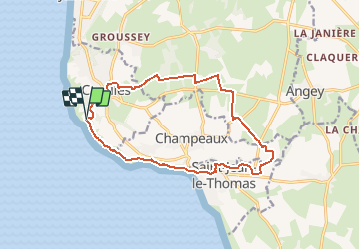
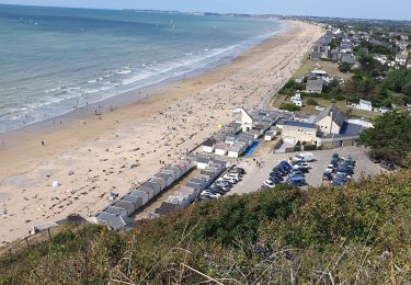
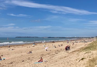
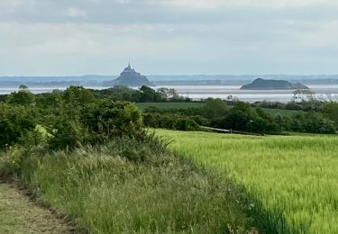
Randonnée Marche de 14,1 km à découvrir à Normandie, Manche, Carolles. Cette randonnée est proposée par mousetik.
Description
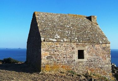
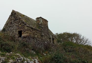
Départ Parking Cabane Vauban
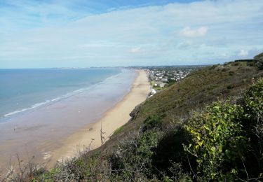
Chemin des douaniers jusqu'à Saint Jean Le Thomas
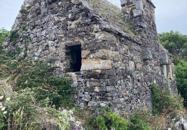
Remontée dans l'arrière pays de Champeaux et de Carolles
Retour au parking
Localisation
Pays :
France
Région :
Normandie
Département/Province :
Manche
Commune :
Carolles
Localité :
Unknown
Départ:(Dec)
Départ:(UTM)
605419 ; 5399854 (30U) N.
Commentaires
Randonnées à proximité
![Randonnée Marche Carolles - La Vallée du Lude - Carolles - Photo](https://media.geolcdn.com/t/375/260/ext.jpg?maxdim=2&url=https%3A%2F%2Fservices.sitytrail.com%2FGeolivesWS%2FDownloadMedia.ashx%3FTrailID%3D111207%26Media%3D6732_2.jpg)
![Marche Marche](https://static1.geolcdn.com/sitytour/trail-icons/101.png)
La Vallée du Lude - Carolles
Marche
Moyen
(1)
Carolles,
Normandie,
Manche,
France
![](/images/other/stat-length.png)
6,7 km | 8,6 km-effort
2h 30min
![](https://static1.geolcdn.com/siteimages/upload/files/16400158638029165_repeat_loop_refresh_sync_direction_icon.png)
Non
![Randonnée Marche Carolles - Falaises de Carolles - Photo](https://media.geolcdn.com/t/375/260/5d1fc960-65ea-42db-9e46-60d9d0864366.jpg&format=jpg&maxdim=2)
![Marche Marche](https://static1.geolcdn.com/sitytour/trail-icons/101.png)
Falaises de Carolles
Marche
Très facile
Carolles,
Normandie,
Manche,
France
![](/images/other/stat-length.png)
4,1 km | 5,4 km-effort
1h 6min
![](https://static1.geolcdn.com/siteimages/upload/files/16400158638029165_repeat_loop_refresh_sync_direction_icon.png)
Oui
![Randonnée Marche Champeaux - les falaises de Carolles - Champeaux - Photo](https://media.geolcdn.com/t/375/260/b4018617-2a83-4486-b109-eba5df37275a.jpg&format=jpg&maxdim=2)
![Marche Marche](https://static1.geolcdn.com/sitytour/trail-icons/101.png)
les falaises de Carolles - Champeaux
Marche
Moyen
Champeaux,
Normandie,
Manche,
France
![](/images/other/stat-length.png)
8,6 km | 10,9 km-effort
2h 13min
![](https://static1.geolcdn.com/siteimages/upload/files/16400158638029165_repeat_loop_refresh_sync_direction_icon.png)
Oui
![Randonnée Marche Carolles - Carolle-plage--Cabane Vauban - Photo](https://media.geolcdn.com/t/375/260/a1294c86-a38d-47df-96a5-f6a609fcfeb5.jpg&format=jpg&maxdim=2)
![Marche Marche](https://static1.geolcdn.com/sitytour/trail-icons/101.png)
Carolle-plage--Cabane Vauban
Marche
Moyen
Carolles,
Normandie,
Manche,
France
![](/images/other/stat-length.png)
5,9 km | 7,8 km-effort
3h 0min
![](https://static1.geolcdn.com/siteimages/upload/files/16400158638029165_repeat_loop_refresh_sync_direction_icon.png)
Oui
![Randonnée Marche Champeaux - La cabane Vauban et ses falaises - Photo](https://media.geolcdn.com/t/375/260/0537bf9f-7396-4153-894c-ff80f4b1c8c9.jpg&format=jpg&maxdim=2)
![Marche Marche](https://static1.geolcdn.com/sitytour/trail-icons/101.png)
La cabane Vauban et ses falaises
Marche
Moyen
Champeaux,
Normandie,
Manche,
France
![](/images/other/stat-length.png)
7,9 km | 9,5 km-effort
2h 54min
![](https://static1.geolcdn.com/siteimages/upload/files/16400158638029165_repeat_loop_refresh_sync_direction_icon.png)
Oui
![Randonnée Marche Carolles - carolles 2 Françoise Chan - Photo](https://media.geolcdn.com/t/375/260/84d08c68-e3bb-40fc-8c58-d13ee2f789eb.jpg&format=jpg&maxdim=2)
![Marche Marche](https://static1.geolcdn.com/sitytour/trail-icons/101.png)
carolles 2 Françoise Chan
Marche
Moyen
Carolles,
Normandie,
Manche,
France
![](/images/other/stat-length.png)
8,5 km | 10,6 km-effort
2h 50min
![](https://static1.geolcdn.com/siteimages/upload/files/16400158638029165_repeat_loop_refresh_sync_direction_icon.png)
Oui
![Randonnée Marche nordique Carolles - Carolles 7 km chantal Françoise - Photo](https://media.geolcdn.com/t/375/260/511e2612-50d0-4984-9fe7-21900970065f.jpg&format=jpg&maxdim=2)
![Marche nordique Marche nordique](https://static1.geolcdn.com/sitytour/trail-icons/102.png)
Carolles 7 km chantal Françoise
Marche nordique
Très facile
Carolles,
Normandie,
Manche,
France
![](/images/other/stat-length.png)
7 km | 9,3 km-effort
2h 33min
![](https://static1.geolcdn.com/siteimages/upload/files/16400158638029165_repeat_loop_refresh_sync_direction_icon.png)
Oui
![Randonnée Marche Jullouville - Jullouville - Carolles - Photo](https://media.geolcdn.com/t/375/260/7a08b560-2c53-4e14-8982-7e1346600440.jpg&format=jpg&maxdim=2)
![Marche Marche](https://static1.geolcdn.com/sitytour/trail-icons/101.png)
Jullouville - Carolles
Marche
Moyen
Jullouville,
Normandie,
Manche,
France
![](/images/other/stat-length.png)
7,4 km | 8,6 km-effort
2h 4min
![](https://static1.geolcdn.com/siteimages/upload/files/16400158638029165_repeat_loop_refresh_sync_direction_icon.png)
Non
![Randonnée Marche Dragey-Ronthon - Le Bec d’Andaine - Photo](https://media.geolcdn.com/t/375/260/9bab126b-7d02-49a6-a8e6-abf4befe4e3f.jpg&format=jpg&maxdim=2)
![Marche Marche](https://static1.geolcdn.com/sitytour/trail-icons/101.png)
Le Bec d’Andaine
Marche
Facile
Dragey-Ronthon,
Normandie,
Manche,
France
![](/images/other/stat-length.png)
10,2 km | 11,2 km-effort
3h 1min
![](https://static1.geolcdn.com/siteimages/upload/files/16400158638029165_repeat_loop_refresh_sync_direction_icon.png)
Oui