![](/images/other/stat-length.png)
![Randonnée Marche Savennes - La Croix de Reillat - Savennes - Photo](https://media.geolcdn.com/t/1900/400/ext.pjpeg?maxdim=2&url=https%3A%2F%2Fservices.sitytrail.com%2FGeolivesWS%2FDownloadMedia.ashx%3FTrailID%3D118665%26Media%3D12828_3.jpg)
La Croix de Reillat - Savennes
tracegps
Utilisateur
![Longueur](/images/other/stat-length.png)
Longueur
6,7 km
![Altitude max](https://static1.geolcdn.com/siteimages/upload/files/1508320355ic_sort_altitude_max_24dp.png)
Altitude max
640 m
![Dénivelé positif](https://static1.geolcdn.com/siteimages/upload/files/1508320355ic_sort_den_pos_24dp.png)
Dénivelé positif
149 m
![Km-Effort](/images/other/stat-length.png)
Km-Effort
8,7 km
![Altitude min](https://static1.geolcdn.com/siteimages/upload/files/1508320355ic_sort_altitude_min_24dp.png)
Altitude min
546 m
![Dénivelé négatif](https://static1.geolcdn.com/siteimages/upload/files/1508320355ic_sort_den_neg_24dp.png)
Dénivelé négatif
147 m
![Boucle](https://static1.geolcdn.com/siteimages/upload/files/16400158638029165_repeat_loop_refresh_sync_direction_icon.png)
Boucle
Oui
Date de création :
2014-12-10 00:00:00.0
Dernière modification :
2014-12-10 00:00:00.0
![Marche](https://static1.geolcdn.com/sitytour/trail-icons/101.png)
2h00
Difficulté : Facile
![Scannez ce code QR pour ouvrir la randonnée dans l'application SityTrail](https://capi.geolives.com/qq0zvz2zws4bq2lad0pu/sitytour/trails/118665/qr.png?size=200)
Application GPS de randonnée GRATUITE
À propos
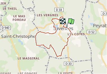
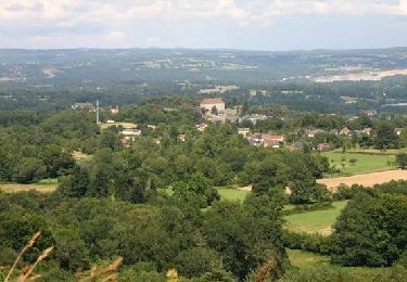
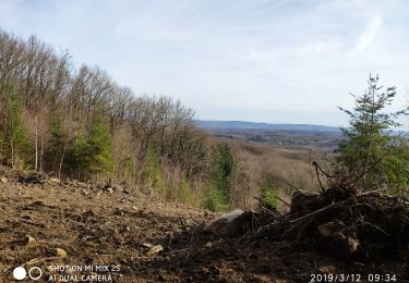
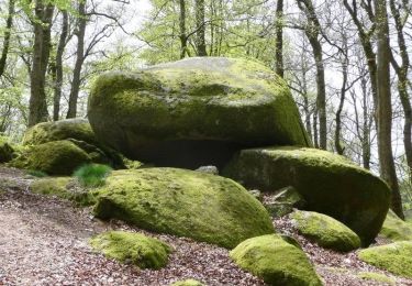
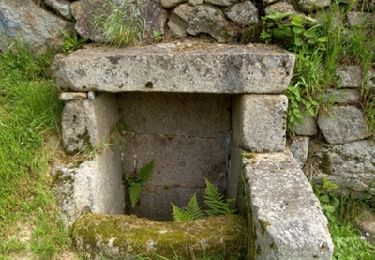
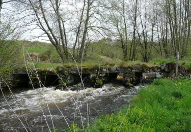
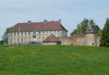
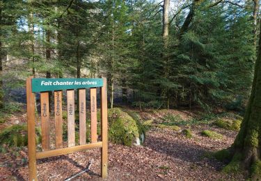
Randonnée Marche de 6,7 km à découvrir à Nouvelle-Aquitaine, Creuse, Savennes. Cette randonnée est proposée par tracegps.
Description
Circuit proposé par l'Office de Tourisme de Guéret. Départ de la place de l'église de Savennes. Retrouvez le circuit et son descriptif sur le site de l'Office de Tourisme de Guéret.
Localisation
Pays :
France
Région :
Nouvelle-Aquitaine
Département/Province :
Creuse
Commune :
Savennes
Localité :
Unknown
Départ:(Dec)
Départ:(UTM)
414217 ; 5106375 (31T) N.
Commentaires
Randonnées à proximité
![Randonnée Marche Sainte-Feyre - Les loups de Chabrières - Sainte Feyre - Photo](https://media.geolcdn.com/t/375/260/ext.jpg?maxdim=2&url=https%3A%2F%2Fservices.sitytrail.com%2FGeolivesWS%2FDownloadMedia.ashx%3FTrailID%3D112878%26Media%3D12773_5.jpg)
![Marche Marche](https://static1.geolcdn.com/sitytour/trail-icons/101.png)
Les loups de Chabrières - Sainte Feyre
Marche
Facile
(2)
Sainte-Feyre,
Nouvelle-Aquitaine,
Creuse,
France
![](/images/other/stat-length.png)
6,5 km | 9,5 km-effort
2h 0min
![](https://static1.geolcdn.com/siteimages/upload/files/16400158638029165_repeat_loop_refresh_sync_direction_icon.png)
Oui
![Randonnée Marche nordique Sainte-Feyre - Meyrat Perabout Parc à Loups 11.1k - Photo](https://media.geolcdn.com/t/375/260/8f473578-907f-4b42-806c-6e595a3ef44a.jpg&format=jpg&maxdim=2)
![Marche nordique Marche nordique](https://static1.geolcdn.com/sitytour/trail-icons/102.png)
Meyrat Perabout Parc à Loups 11.1k
Marche nordique
Difficile
(1)
Sainte-Feyre,
Nouvelle-Aquitaine,
Creuse,
France
![](/images/other/stat-length.png)
11,1 km | 15,4 km-effort
2h 30min
![](https://static1.geolcdn.com/siteimages/upload/files/16400158638029165_repeat_loop_refresh_sync_direction_icon.png)
Oui
![Randonnée Marche Sainte-Feyre - Pierres et Légendes - Sainte-Feyre - Photo](https://media.geolcdn.com/t/375/260/ext.jpg?maxdim=2&url=https%3A%2F%2Fservices.sitytrail.com%2FGeolivesWS%2FDownloadMedia.ashx%3FTrailID%3D118667%26Media%3D12830_5.jpg)
![Marche Marche](https://static1.geolcdn.com/sitytour/trail-icons/101.png)
Pierres et Légendes - Sainte-Feyre
Marche
Difficile
Sainte-Feyre,
Nouvelle-Aquitaine,
Creuse,
France
![](/images/other/stat-length.png)
8,5 km | 11,9 km-effort
3h 0min
![](https://static1.geolcdn.com/siteimages/upload/files/16400158638029165_repeat_loop_refresh_sync_direction_icon.png)
Oui
![Randonnée Marche Savennes - Le chemin des Vergnes - Savennes - Photo](https://media.geolcdn.com/t/375/260/ext.jpg?maxdim=2&url=https%3A%2F%2Fservices.sitytrail.com%2FGeolivesWS%2FDownloadMedia.ashx%3FTrailID%3D118661%26Media%3D12824_3.jpg)
![Marche Marche](https://static1.geolcdn.com/sitytour/trail-icons/101.png)
Le chemin des Vergnes - Savennes
Marche
Moyen
Savennes,
Nouvelle-Aquitaine,
Creuse,
France
![](/images/other/stat-length.png)
8,2 km | 11,5 km-effort
2h 30min
![](https://static1.geolcdn.com/siteimages/upload/files/16400158638029165_repeat_loop_refresh_sync_direction_icon.png)
Oui
![Randonnée Marche La Chapelle-Taillefert - Les cascades de la Rebeyrolle - La Chapelle-Taillefert - Photo](https://media.geolcdn.com/t/375/260/ext.jpg?maxdim=2&url=https%3A%2F%2Fservices.sitytrail.com%2FGeolivesWS%2FDownloadMedia.ashx%3FTrailID%3D112889%26Media%3D12794_5.jpg)
![Marche Marche](https://static1.geolcdn.com/sitytour/trail-icons/101.png)
Les cascades de la Rebeyrolle - La Chapelle-Taillefert
Marche
Très difficile
La Chapelle-Taillefert,
Nouvelle-Aquitaine,
Creuse,
France
![](/images/other/stat-length.png)
15,1 km | 20 km-effort
4h 30min
![](https://static1.geolcdn.com/siteimages/upload/files/16400158638029165_repeat_loop_refresh_sync_direction_icon.png)
Oui
![Randonnée Marche Guéret - Chabrières - Guéret - Photo](https://media.geolcdn.com/t/375/260/ext.jpg?maxdim=2&url=https%3A%2F%2Fservices.sitytrail.com%2FGeolivesWS%2FDownloadMedia.ashx%3FTrailID%3D112885%26Media%3D12789_5.jpg)
![Marche Marche](https://static1.geolcdn.com/sitytour/trail-icons/101.png)
Chabrières - Guéret
Marche
Facile
Guéret,
Nouvelle-Aquitaine,
Creuse,
France
![](/images/other/stat-length.png)
6,6 km | 9,1 km-effort
2h 0min
![](https://static1.geolcdn.com/siteimages/upload/files/16400158638029165_repeat_loop_refresh_sync_direction_icon.png)
Oui
![Randonnée Marche Sainte-Feyre - Le Puy de Gaudy - Sainte Feyre - Photo](https://media.geolcdn.com/t/375/260/ext.jpg?maxdim=2&url=https%3A%2F%2Fservices.sitytrail.com%2FGeolivesWS%2FDownloadMedia.ashx%3FTrailID%3D112879%26Media%3D12774_6.jpg)
![Marche Marche](https://static1.geolcdn.com/sitytour/trail-icons/101.png)
Le Puy de Gaudy - Sainte Feyre
Marche
Facile
Sainte-Feyre,
Nouvelle-Aquitaine,
Creuse,
France
![](/images/other/stat-length.png)
6,8 km | 9,9 km-effort
2h 0min
![](https://static1.geolcdn.com/siteimages/upload/files/16400158638029165_repeat_loop_refresh_sync_direction_icon.png)
Oui
![Randonnée Marche La Chapelle-Taillefert - Le Rocher de la Femme Perdue - La Chapelle-Taillefert - Photo](https://media.geolcdn.com/t/375/260/ext.jpg?maxdim=2&url=https%3A%2F%2Fservices.sitytrail.com%2FGeolivesWS%2FDownloadMedia.ashx%3FTrailID%3D112877%26Media%3D12772_4.jpg)
![Marche Marche](https://static1.geolcdn.com/sitytour/trail-icons/101.png)
Le Rocher de la Femme Perdue - La Chapelle-Taillefert
Marche
Facile
La Chapelle-Taillefert,
Nouvelle-Aquitaine,
Creuse,
France
![](/images/other/stat-length.png)
5,6 km | 7,7 km-effort
1h 25min
![](https://static1.geolcdn.com/siteimages/upload/files/16400158638029165_repeat_loop_refresh_sync_direction_icon.png)
Oui
![Randonnée Marche nordique Guéret - sentier rando santé - Photo](https://media.geolcdn.com/t/375/260/cede7158-cf32-4d4d-8b5b-47e7cb6bfd08.jpg&format=jpg&maxdim=2)
![Marche nordique Marche nordique](https://static1.geolcdn.com/sitytour/trail-icons/102.png)
sentier rando santé
Marche nordique
Très facile
Guéret,
Nouvelle-Aquitaine,
Creuse,
France
![](/images/other/stat-length.png)
4,6 km | 6,3 km-effort
54min
![](https://static1.geolcdn.com/siteimages/upload/files/16400158638029165_repeat_loop_refresh_sync_direction_icon.png)
Oui