


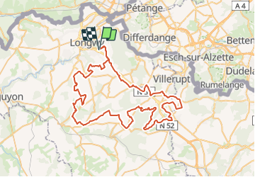

10,8 km | 13,4 km-effort


Utilisateur


Application GPS de randonnée GRATUITE
 SityTrail
IGN / Instituts géographiques
SityTrail World
Le monde est à vous
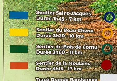
Randonnée Moteur de 80 km à découvrir à Grand Est, Meurthe-et-Moselle, Mexy. Cette randonnée est proposée par ON3LX.
Rando Quad Villerupt Ville Au Montois Crusnes 80km
A pied

A pied

sport

Marche

Marche
Marche

A pied
A pied
Marche