![](/images/other/stat-length.png)
![Randonnée Marche Thèze - La tournée des chênes - Thèze - Photo](https://media.geolcdn.com/t/1900/400/ext.pjpeg?maxdim=2&url=https%3A%2F%2Fservices.sitytrail.com%2FGeolivesWS%2FDownloadMedia.ashx%3FTrailID%3D112813%26Media%3D12505_5.jpg)
La tournée des chênes - Thèze
tracegps
Utilisateur
![Longueur](/images/other/stat-length.png)
![Altitude max](https://static1.geolcdn.com/siteimages/upload/files/1508320355ic_sort_altitude_max_24dp.png)
![Dénivelé positif](https://static1.geolcdn.com/siteimages/upload/files/1508320355ic_sort_den_pos_24dp.png)
![Km-Effort](/images/other/stat-length.png)
![Altitude min](https://static1.geolcdn.com/siteimages/upload/files/1508320355ic_sort_altitude_min_24dp.png)
![Dénivelé négatif](https://static1.geolcdn.com/siteimages/upload/files/1508320355ic_sort_den_neg_24dp.png)
![Boucle](https://static1.geolcdn.com/siteimages/upload/files/16400158638029165_repeat_loop_refresh_sync_direction_icon.png)
![Marche](https://static1.geolcdn.com/sitytour/trail-icons/101.png)
2h30
Difficulté : Moyen
![Scannez ce code QR pour ouvrir la randonnée dans l'application SityTrail](https://capi.geolives.com/qq0zvz2zws4bq2lad0pu/sitytour/trails/112813/qr.png?size=200)
Application GPS de randonnée GRATUITE
À propos
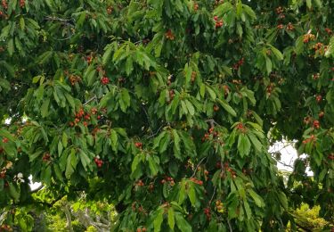
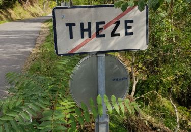
Randonnée Marche de 8,9 km à découvrir à Provence-Alpes-Côte d'Azur, Alpes-de-Haute-Provence, Thèze. Cette randonnée est proposée par tracegps.
Description
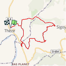
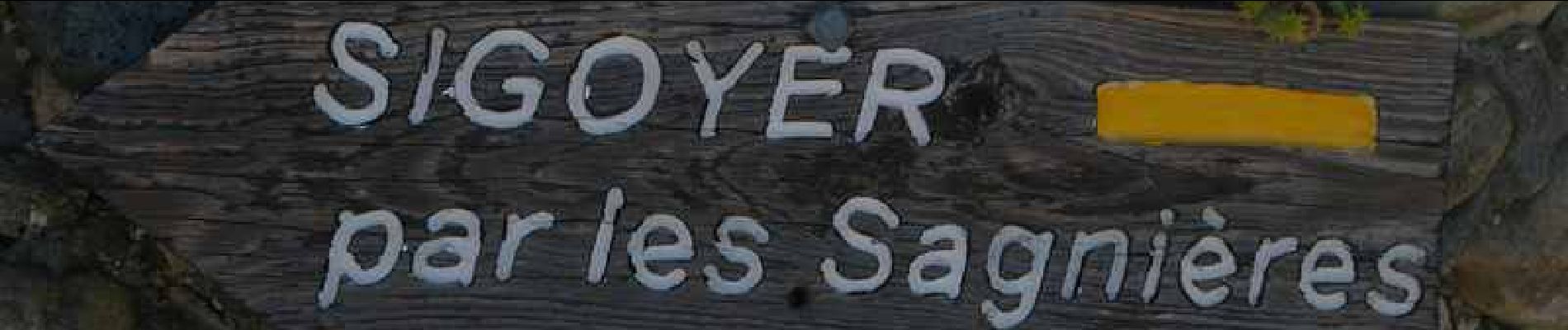
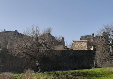
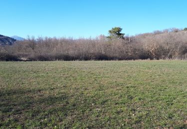
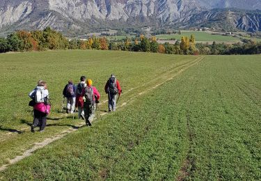
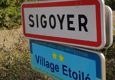
Ce circuit vous est proposé par les Hautes Terres de Provence. Se garer face à la mairie de Thèze. Partir plein Est en direction du Pita, puis s’engager à droite vers les Planes. Après avoir rejoint et emprunté sur 200m la D4, poursuivre son chemin par une belle piste qui longe tout d’abord la bergerie du haut Planet avant de rejoindre celle des Sagnières. Laisser les Sagnières sur votre droite pour poursuivre sur la piste des Vignes. Après être passé à proximité de la Baudonne, vous atteignez le croisement commun avec la boucle du « circuit des fermes ». Si vous choisissez de visiter Sigoyer, comptez une heure aller-retour supplémentaire, sinon prendre la piste puis le sentier en direction du Pita. Dans le bois de pin, le circuit des fermes poursuit son chemin vers les Baudes, tandis que vous poursuivez le vôtre sur le sentier descendant. Après avoir traversé le torrent du Mouson, vous atteignez en peu de temps la ferme du Pita, puis Thèze. Retrouvez cette randonnée sur le site des Hautes Terres de Provence.
Localisation
Commentaires
Randonnées à proximité
![Randonnée Marche Sigoyer - SIGOYER Boucle Croix de la Biousse o l m s - Photo](https://media.geolcdn.com/t/375/260/cc06d09a-5ff2-41a1-9edb-f8368db9ba2d.jpg&format=jpg&maxdim=2)
![Marche Marche](https://static1.geolcdn.com/sitytour/trail-icons/101.png)
Marche
![](/images/other/stat-length.png)
![](https://static1.geolcdn.com/siteimages/upload/files/16400158638029165_repeat_loop_refresh_sync_direction_icon.png)
![Randonnée sport Mison - Du lac de MISON à celui du Poet par les colombettes - Photo](https://media.geolcdn.com/t/375/260/df69e039-d0ac-423d-934e-3b88d4778692.jpg&format=jpg&maxdim=2)
sport
![](/images/other/stat-length.png)
![](https://static1.geolcdn.com/siteimages/upload/files/16400158638029165_repeat_loop_refresh_sync_direction_icon.png)
![Randonnée Marche Le Poët - Reco 1er Rando BF 2022 - Photo](https://media.geolcdn.com/t/375/260/82bf2b90-d75c-4d4a-8b5c-581e7d0aab81.jpg&format=jpg&maxdim=2)
![Marche Marche](https://static1.geolcdn.com/sitytour/trail-icons/101.png)
Marche
![](/images/other/stat-length.png)
![](https://static1.geolcdn.com/siteimages/upload/files/16400158638029165_repeat_loop_refresh_sync_direction_icon.png)
![Randonnée V.T.T. Thèze - 210322 rouviere theze a velo - Photo](https://media.geolcdn.com/t/375/260/11332bd4-f1eb-453a-b568-0b37b31d0a1b.jpg&format=jpg&maxdim=2)
![V.T.T. V.T.T.](https://static1.geolcdn.com/sitytour/trail-icons/202.png)
V.T.T.
![](/images/other/stat-length.png)
![](https://static1.geolcdn.com/siteimages/upload/files/16400158638029165_repeat_loop_refresh_sync_direction_icon.png)
![Randonnée Marche Sigoyer - Sigoyer Les Baudes - Photo](https://media.geolcdn.com/t/375/260/a01c5cb6-bdb8-480b-87fa-564c7d11bb21.jpg&format=jpg&maxdim=2)
![Marche Marche](https://static1.geolcdn.com/sitytour/trail-icons/101.png)
Marche
![](/images/other/stat-length.png)
![](https://static1.geolcdn.com/siteimages/upload/files/16400158638029165_repeat_loop_refresh_sync_direction_icon.png)
![Randonnée Marche Thèze - Boucle Theze Sigoyer depart Theze - Photo](https://media.geolcdn.com/t/375/260/91670e8d-b25b-43eb-b3a3-a9631c3bd51e.jpg&format=jpg&maxdim=2)
![Marche Marche](https://static1.geolcdn.com/sitytour/trail-icons/101.png)
Marche
![](/images/other/stat-length.png)
![](https://static1.geolcdn.com/siteimages/upload/files/16400158638029165_repeat_loop_refresh_sync_direction_icon.png)
![Randonnée Marche Sigoyer - Boucle Croix de la Biousse - Photo](https://media.geolcdn.com/t/375/260/9bf7cebd-6a47-4b2b-a790-11caea904f86.jpg&format=jpg&maxdim=2)
![Marche Marche](https://static1.geolcdn.com/sitytour/trail-icons/101.png)
Marche
![](/images/other/stat-length.png)
![](https://static1.geolcdn.com/siteimages/upload/files/16400158638029165_repeat_loop_refresh_sync_direction_icon.png)
![Randonnée Marche Valernes - ROCHERS DE HONGRIE ( Jabron 02 2025) - Photo](https://media.geolcdn.com/t/375/260/8cced938-ad68-41b9-a956-29760787e4b5.jpg&format=jpg&maxdim=2)
![Marche Marche](https://static1.geolcdn.com/sitytour/trail-icons/101.png)
Marche
![](/images/other/stat-length.png)
![](https://static1.geolcdn.com/siteimages/upload/files/16400158638029165_repeat_loop_refresh_sync_direction_icon.png)
![Randonnée Marche Lazer - Roc de L'Esculier Via Le Lauza - Photo](https://media.geolcdn.com/t/375/260/cb4f9c34-5e6c-4839-86ea-8b005e203066.jpg&format=jpg&maxdim=2)
![Marche Marche](https://static1.geolcdn.com/sitytour/trail-icons/101.png)
Marche
![](/images/other/stat-length.png)
![](https://static1.geolcdn.com/siteimages/upload/files/16400158638029165_repeat_loop_refresh_sync_direction_icon.png)
bien