![](/images/other/stat-length.png)
![Randonnée Marche Boran-sur-Oise - Balingants en bord de l'Oise - Boran-sur-Oise - Photo](https://media.geolcdn.com/t/1900/400/ext.pjpeg?maxdim=2&url=https%3A%2F%2Fservices.sitytrail.com%2FGeolivesWS%2FDownloadMedia.ashx%3FTrailID%3D112754%26Media%3D11975_6.jpg)
Balingants en bord de l'Oise - Boran-sur-Oise
tracegps
Utilisateur
![Longueur](/images/other/stat-length.png)
Longueur
6,1 km
![Altitude max](https://static1.geolcdn.com/siteimages/upload/files/1508320355ic_sort_altitude_max_24dp.png)
Altitude max
39 m
![Dénivelé positif](https://static1.geolcdn.com/siteimages/upload/files/1508320355ic_sort_den_pos_24dp.png)
Dénivelé positif
28 m
![Km-Effort](/images/other/stat-length.png)
Km-Effort
6,5 km
![Altitude min](https://static1.geolcdn.com/siteimages/upload/files/1508320355ic_sort_altitude_min_24dp.png)
Altitude min
22 m
![Dénivelé négatif](https://static1.geolcdn.com/siteimages/upload/files/1508320355ic_sort_den_neg_24dp.png)
Dénivelé négatif
28 m
![Boucle](https://static1.geolcdn.com/siteimages/upload/files/16400158638029165_repeat_loop_refresh_sync_direction_icon.png)
Boucle
Oui
Date de création :
2014-12-10 00:00:00.0
Dernière modification :
2014-12-10 00:00:00.0
![Marche](https://static1.geolcdn.com/sitytour/trail-icons/101.png)
1h30
Difficulté : Facile
![Scannez ce code QR pour ouvrir la randonnée dans l'application SityTrail](https://capi.geolives.com/qq0zvz2zws4bq2lad0pu/sitytour/trails/112754/qr.png?size=200)
Application GPS de randonnée GRATUITE
À propos
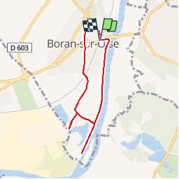
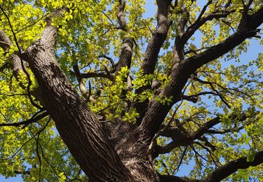
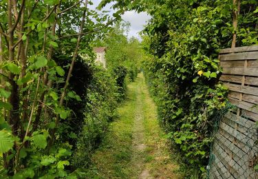
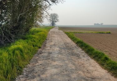
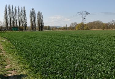
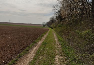
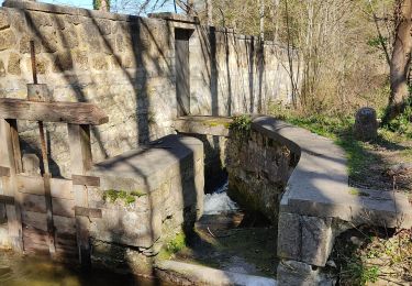
Randonnée Marche de 6,1 km à découvrir à Hauts-de-France, Oise, Boran-sur-Oise. Cette randonnée est proposée par tracegps.
Description
Circuit proposé par le Parc Naturel Régional Oise – Pays de France. Départ de la gare de Boran-sur-l'Oise Retrouvez le circuit circuit sur le site du Parc Naturel Régional Oise – Pays de France.
Localisation
Pays :
France
Région :
Hauts-de-France
Département/Province :
Oise
Commune :
Boran-sur-Oise
Localité :
Unknown
Départ:(Dec)
Départ:(UTM)
453559 ; 5446299 (31U) N.
Commentaires
Randonnées à proximité
![Randonnée Marche Boran-sur-Oise - randonnée abbaye de Royaumont - Photo](https://media.geolcdn.com/t/375/260/ext.jpg?maxdim=2&url=https%3A%2F%2Fmedia.geolcdn.com%2Ff%2F9e39e4a0-eda1-4b72-bd45-4ab1609b4c88.jpg)
![Marche Marche](https://static1.geolcdn.com/sitytour/trail-icons/101.png)
randonnée abbaye de Royaumont
Marche
Difficile
(1)
Boran-sur-Oise,
Hauts-de-France,
Oise,
France
![](/images/other/stat-length.png)
13,2 km | 14,5 km-effort
3h 8min
![](https://static1.geolcdn.com/siteimages/upload/files/16400158638029165_repeat_loop_refresh_sync_direction_icon.png)
Oui
![Randonnée Marche Boran-sur-Oise - boran Le Lys - Photo](https://media.geolcdn.com/t/375/260/ext.jpg?maxdim=2&url=https%3A%2F%2Fmedia.geolcdn.com%2Ff%2F4819a07e-0b5c-4197-bc24-63181ff51320.jpg)
![Marche Marche](https://static1.geolcdn.com/sitytour/trail-icons/101.png)
boran Le Lys
Marche
Très facile
Boran-sur-Oise,
Hauts-de-France,
Oise,
France
![](/images/other/stat-length.png)
11,8 km | 12,8 km-effort
2h 58min
![](https://static1.geolcdn.com/siteimages/upload/files/16400158638029165_repeat_loop_refresh_sync_direction_icon.png)
Oui
![Randonnée Marche Asnières-sur-Oise - Grand tour de L'Abaye de Royaumont - Photo](https://media.geolcdn.com/t/375/260/ext.jpg?maxdim=2&url=https%3A%2F%2Fmedia.geolcdn.com%2Ff%2F748ebf9a-fe1f-4910-8542-5c05e8fce163.jpg)
![Marche Marche](https://static1.geolcdn.com/sitytour/trail-icons/101.png)
Grand tour de L'Abaye de Royaumont
Marche
Facile
Asnières-sur-Oise,
Île-de-France,
Val-d'Oise,
France
![](/images/other/stat-length.png)
12,9 km | 14 km-effort
2h 54min
![](https://static1.geolcdn.com/siteimages/upload/files/16400158638029165_repeat_loop_refresh_sync_direction_icon.png)
Oui
![Randonnée Marche Beaumont-sur-Oise - Beaumont sur oise Noisy sur oise - Photo](https://media.geolcdn.com/t/375/260/ext.jpg?maxdim=2&url=https%3A%2F%2Fmedia.geolcdn.com%2Ff%2F6ac51007-0034-4683-b03e-81d6f9e3780c.jpg)
![Marche Marche](https://static1.geolcdn.com/sitytour/trail-icons/101.png)
Beaumont sur oise Noisy sur oise
Marche
Facile
Beaumont-sur-Oise,
Île-de-France,
Val-d'Oise,
France
![](/images/other/stat-length.png)
11,6 km | 15,6 km-effort
2h 46min
![](https://static1.geolcdn.com/siteimages/upload/files/16400158638029165_repeat_loop_refresh_sync_direction_icon.png)
Oui
![Randonnée Marche Noisy-sur-Oise - forêt de carnelle - Photo](https://media.geolcdn.com/t/375/260/ext.jpg?maxdim=2&url=https%3A%2F%2Fmedia.geolcdn.com%2Ff%2F1d38ae56-1525-4792-8527-98abbf8f2f7b.jpg)
![Marche Marche](https://static1.geolcdn.com/sitytour/trail-icons/101.png)
forêt de carnelle
Marche
Moyen
Noisy-sur-Oise,
Île-de-France,
Val-d'Oise,
France
![](/images/other/stat-length.png)
11,1 km | 14,4 km-effort
2h 49min
![](https://static1.geolcdn.com/siteimages/upload/files/16400158638029165_repeat_loop_refresh_sync_direction_icon.png)
Oui
![Randonnée Marche Précy-sur-Oise - randonnée de precy au bois st Michel - Photo](https://media.geolcdn.com/t/375/260/ext.jpg?maxdim=2&url=https%3A%2F%2Fmedia.geolcdn.com%2Ff%2Fd7a9f220-2cc5-4d20-beb1-6ffb9d61217a.jpg)
![Marche Marche](https://static1.geolcdn.com/sitytour/trail-icons/101.png)
randonnée de precy au bois st Michel
Marche
Moyen
Précy-sur-Oise,
Hauts-de-France,
Oise,
France
![](/images/other/stat-length.png)
11,6 km | 14,2 km-effort
2h 47min
![](https://static1.geolcdn.com/siteimages/upload/files/16400158638029165_repeat_loop_refresh_sync_direction_icon.png)
Oui
![Randonnée Marche Boran-sur-Oise - randonnée de precy entre campagne et le long de l oise - Photo](https://media.geolcdn.com/t/375/260/ext.jpg?maxdim=2&url=https%3A%2F%2Fmedia.geolcdn.com%2Ff%2F6b4b8490-f027-4df3-8fd9-e515b13b2b69.jpg)
![Marche Marche](https://static1.geolcdn.com/sitytour/trail-icons/101.png)
randonnée de precy entre campagne et le long de l oise
Marche
Facile
Boran-sur-Oise,
Hauts-de-France,
Oise,
France
![](/images/other/stat-length.png)
13,6 km | 15,3 km-effort
3h 19min
![](https://static1.geolcdn.com/siteimages/upload/files/16400158638029165_repeat_loop_refresh_sync_direction_icon.png)
Oui
![Randonnée Marche Boran-sur-Oise - randonnée des 3comunnes boran morangle crouy en thelle - Photo](https://media.geolcdn.com/t/375/260/ext.jpg?maxdim=2&url=https%3A%2F%2Fmedia.geolcdn.com%2Ff%2F6ee4300d-fd34-4c60-8703-397721e8b953.jpg)
![Marche Marche](https://static1.geolcdn.com/sitytour/trail-icons/101.png)
randonnée des 3comunnes boran morangle crouy en thelle
Marche
Moyen
Boran-sur-Oise,
Hauts-de-France,
Oise,
France
![](/images/other/stat-length.png)
17,8 km | 19,8 km-effort
3h 46min
![](https://static1.geolcdn.com/siteimages/upload/files/16400158638029165_repeat_loop_refresh_sync_direction_icon.png)
Oui
![Randonnée Marche Asnières-sur-Oise - randonnée en forêt de bâillon et campagne - Photo](https://media.geolcdn.com/t/375/260/ext.jpg?maxdim=2&url=https%3A%2F%2Fmedia.geolcdn.com%2Ff%2F769fba96-b6f6-4b5a-82c1-508c517af6f3.jpg)
![Marche Marche](https://static1.geolcdn.com/sitytour/trail-icons/101.png)
randonnée en forêt de bâillon et campagne
Marche
Moyen
Asnières-sur-Oise,
Île-de-France,
Val-d'Oise,
France
![](/images/other/stat-length.png)
14,1 km | 16,6 km-effort
3h 18min
![](https://static1.geolcdn.com/siteimages/upload/files/16400158638029165_repeat_loop_refresh_sync_direction_icon.png)
Oui