![](/images/other/stat-length.png)
![Randonnée Vélo Romilly-sur-Seine - Balade en bord de Seine - Romilly sur Seine - Photo](https://media.geolcdn.com/t/1900/400/ext.pjpeg?maxdim=2&url=https%3A%2F%2Fservices.sitytrail.com%2FGeolivesWS%2FDownloadMedia.ashx%3FTrailID%3D112593%26Media%3D11040_1.jpg)
Balade en bord de Seine - Romilly sur Seine
tracegps
Utilisateur
![Longueur](/images/other/stat-length.png)
![Altitude max](https://static1.geolcdn.com/siteimages/upload/files/1508320355ic_sort_altitude_max_24dp.png)
![Dénivelé positif](https://static1.geolcdn.com/siteimages/upload/files/1508320355ic_sort_den_pos_24dp.png)
![Km-Effort](/images/other/stat-length.png)
![Altitude min](https://static1.geolcdn.com/siteimages/upload/files/1508320355ic_sort_altitude_min_24dp.png)
![Dénivelé négatif](https://static1.geolcdn.com/siteimages/upload/files/1508320355ic_sort_den_neg_24dp.png)
![Boucle](https://static1.geolcdn.com/siteimages/upload/files/16400158638029165_repeat_loop_refresh_sync_direction_icon.png)
![Vélo](https://static1.geolcdn.com/sitytour/trail-icons/200.png)
2h30
Difficulté : Moyen
![Scannez ce code QR pour ouvrir la randonnée dans l'application SityTrail](https://capi.geolives.com/qq0zvz2zws4bq2lad0pu/sitytour/trails/112593/qr.png?size=200)
Application GPS de randonnée GRATUITE
À propos
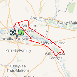
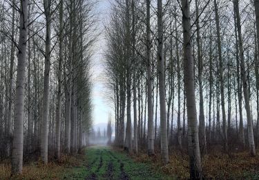
Randonnée Vélo de 58 km à découvrir à Grand Est, Aube, Romilly-sur-Seine. Cette randonnée est proposée par tracegps.
Description
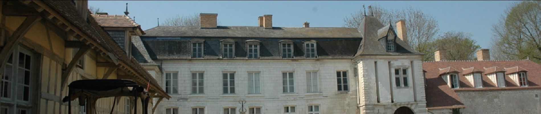
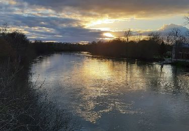
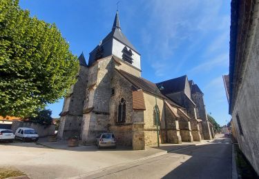
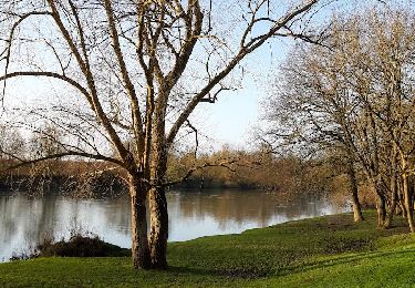
Proposé par le Comité Départemental du Tourisme de l'Aube, un circuit créé et validé par la Fédération Départementale du Cyclotourisme de l’Aube. Balade en bord de Seine – 57 km - Canal de la Haute-Seine - Château de Droupt Saint-Basle - Ferme pédagogique de Romilly-sur-Seine - Église de Maizières la grande paroisse
Localisation
Commentaires
Randonnées à proximité
![Randonnée Marche Gélannes - GÉLANNES, le village et les champs de céréales - Photo](https://media.geolcdn.com/t/375/260/c6ca0f5d-851c-4470-96c9-b68dee3e35f0.jpg&format=jpg&maxdim=2)
![Marche Marche](https://static1.geolcdn.com/sitytour/trail-icons/101.png)
Marche
![](/images/other/stat-length.png)
![](https://static1.geolcdn.com/siteimages/upload/files/16400158638029165_repeat_loop_refresh_sync_direction_icon.png)
![Randonnée Marche Romilly-sur-Seine - ROMILLY SUR SEINE, le Gué de Vailly - Photo](https://media.geolcdn.com/t/375/260/ce7c68bb-31f2-4eb8-8ed5-7930d5a650bf.jpg&format=jpg&maxdim=2)
![Marche Marche](https://static1.geolcdn.com/sitytour/trail-icons/101.png)
Marche
![](/images/other/stat-length.png)
![](https://static1.geolcdn.com/siteimages/upload/files/16400158638029165_repeat_loop_refresh_sync_direction_icon.png)
![Randonnée Marche Conflans-sur-Seine - ENTRE CONFLANS SUR SEINE ET MARCILLY SUR SEINE - Photo](https://media.geolcdn.com/t/375/260/28379627-7295-4da2-9e32-ab26d90c9cc8.jpg&format=jpg&maxdim=2)
![Marche Marche](https://static1.geolcdn.com/sitytour/trail-icons/101.png)
Marche
![](/images/other/stat-length.png)
![](https://static1.geolcdn.com/siteimages/upload/files/16400158638029165_repeat_loop_refresh_sync_direction_icon.png)
![Randonnée Marche Saint-Just-Sauvage - St Just 6km - Photo](https://media.geolcdn.com/t/375/260/5825313c-7a40-476c-be25-f21d1a56f2bc.jpg&format=jpg&maxdim=2)
![Marche Marche](https://static1.geolcdn.com/sitytour/trail-icons/101.png)
Marche
![](/images/other/stat-length.png)
![](https://static1.geolcdn.com/siteimages/upload/files/16400158638029165_repeat_loop_refresh_sync_direction_icon.png)
![Randonnée Marche Conflans-sur-Seine - au départ de CONFLANS sur SEINE - Photo](https://media.geolcdn.com/t/375/260/80485f03-17f7-4558-8dfe-6e48f8164773.jpg&format=jpg&maxdim=2)
![Marche Marche](https://static1.geolcdn.com/sitytour/trail-icons/101.png)
Marche
![](/images/other/stat-length.png)
![](https://static1.geolcdn.com/siteimages/upload/files/16400158638029165_repeat_loop_refresh_sync_direction_icon.png)
![Randonnée Marche nordique Romilly-sur-Seine - la Béchère 6 décembre 2021 - Photo](https://media.geolcdn.com/t/375/260/79798528-45bb-49b6-b50c-3c9d7c85d64a.jpg&format=jpg&maxdim=2)
![Marche nordique Marche nordique](https://static1.geolcdn.com/sitytour/trail-icons/102.png)
Marche nordique
![](/images/other/stat-length.png)
![](https://static1.geolcdn.com/siteimages/upload/files/16400158638029165_repeat_loop_refresh_sync_direction_icon.png)
![Randonnée Marche Esclavolles-Lurey - tournée esclavolles-lurey - Photo](https://media.geolcdn.com/t/375/260/ext.jpg?maxdim=2&url=https%3A%2F%2Fstatic1.geolcdn.com%2Fsiteimages%2Fupload%2Ffiles%2F1553511878bg_sport_marche.png)
![Marche Marche](https://static1.geolcdn.com/sitytour/trail-icons/101.png)
Marche
![](/images/other/stat-length.png)
![](https://static1.geolcdn.com/siteimages/upload/files/16400158638029165_repeat_loop_refresh_sync_direction_icon.png)
![Randonnée Marche Maizières-la-Grande-Paroisse - maiziere - Photo](https://media.geolcdn.com/t/375/260/ext.jpg?maxdim=2&url=https%3A%2F%2Fstatic1.geolcdn.com%2Fsiteimages%2Fupload%2Ffiles%2F1553511878bg_sport_marche.png)
![Marche Marche](https://static1.geolcdn.com/sitytour/trail-icons/101.png)
Marche
![](/images/other/stat-length.png)
![](https://static1.geolcdn.com/siteimages/upload/files/16400158638029165_repeat_loop_refresh_sync_direction_icon.png)
![Randonnée Marche Esclavolles-Lurey - esclavolles-lurey, Périgny - Photo](https://media.geolcdn.com/t/375/260/ext.jpg?maxdim=2&url=https%3A%2F%2Fstatic1.geolcdn.com%2Fsiteimages%2Fupload%2Ffiles%2F1553511878bg_sport_marche.png)
![Marche Marche](https://static1.geolcdn.com/sitytour/trail-icons/101.png)
Marche
![](/images/other/stat-length.png)
![](https://static1.geolcdn.com/siteimages/upload/files/16400158638029165_repeat_loop_refresh_sync_direction_icon.png)