![](/images/other/stat-length.png)
![Randonnée V.T.T. Ambrus - Ambrus, promenade vers le vignoble de Padère - Pays de la vallée du Lot - Photo](https://media.geolcdn.com/t/1900/400/ext.pjpeg?maxdim=2&url=https%3A%2F%2Fservices.sitytrail.com%2FGeolivesWS%2FDownloadMedia.ashx%3FTrailID%3D112383%26Media%3D10513_1.jpg)
Ambrus, promenade vers le vignoble de Padère - Pays de la vallée du Lot
tracegps
Utilisateur
![Longueur](/images/other/stat-length.png)
![Altitude max](https://static1.geolcdn.com/siteimages/upload/files/1508320355ic_sort_altitude_max_24dp.png)
![Dénivelé positif](https://static1.geolcdn.com/siteimages/upload/files/1508320355ic_sort_den_pos_24dp.png)
![Km-Effort](/images/other/stat-length.png)
![Altitude min](https://static1.geolcdn.com/siteimages/upload/files/1508320355ic_sort_altitude_min_24dp.png)
![Dénivelé négatif](https://static1.geolcdn.com/siteimages/upload/files/1508320355ic_sort_den_neg_24dp.png)
![Boucle](https://static1.geolcdn.com/siteimages/upload/files/16400158638029165_repeat_loop_refresh_sync_direction_icon.png)
![V.T.T.](https://static1.geolcdn.com/sitytour/trail-icons/202.png)
1h00
Difficulté : Moyen
![Scannez ce code QR pour ouvrir la randonnée dans l'application SityTrail](https://capi.geolives.com/qq0zvz2zws4bq2lad0pu/sitytour/trails/112383/qr.png?size=200)
Application GPS de randonnée GRATUITE
À propos
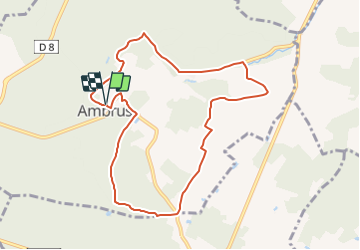
Randonnée V.T.T. de 9,4 km à découvrir à Nouvelle-Aquitaine, Lot-et-Garonne, Ambrus. Cette randonnée est proposée par tracegps.
Description
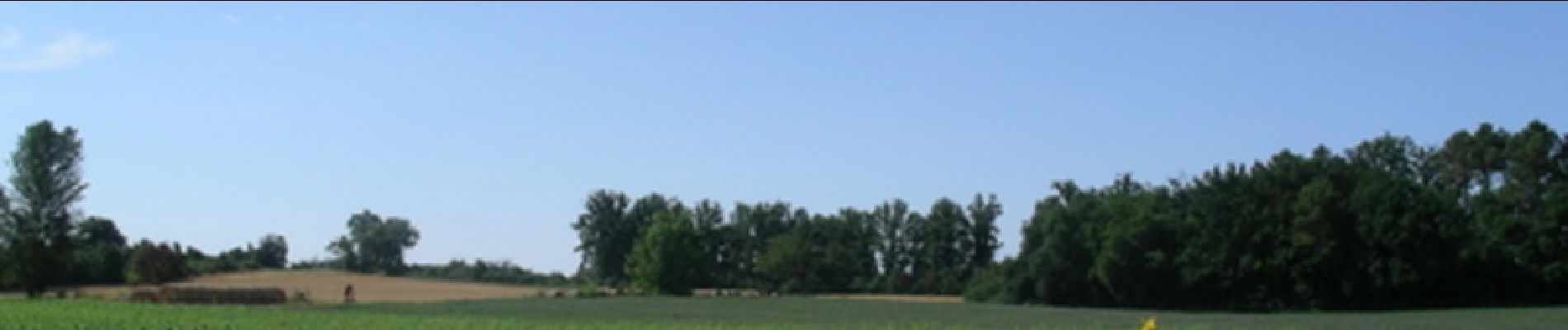
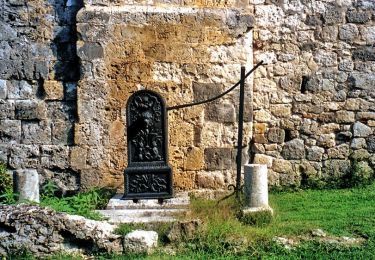
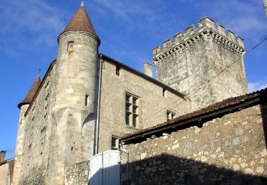
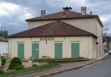
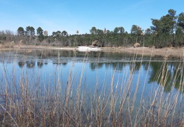
Ambrus, promenade vers le vignoble de Padère - Pays de la vallée du Lot Du petit village d’Ambrus, séparé de son église et de son château, vagabondage à travers les vignobles de Buzet et la forêt landaise où alternent feuillus et résineux. Téléchargez la fiche de cette randonnée sur le site du Tourisme du Lot et Garonne. Padère, un grand vignoble de Buzet : en Gascogne, les noms de lieux-dits ont toujours une signification. Padère, qui veut dire à la fois terroir situé à « la fin de la lande » ou « au début de la terre » en a donc deux. Ce n'est pas sa seule richesse. Ce château, installé à l’orée de la forêt landaise, bénéficie de l’excellence de son souffle océanique. Il se dresse au début de ce qui n’est plus tout à fait du sable mais qui n’est pas encore de la terre. Un sol idéal, en somme, pour la vigne. Ces vins mi-corsés se distinguent par des tannins souples apportant une certaine rondeur. Ils sont souvent dominés par des parfums de fruits mûrs ou des notes boisées (pain grillé, café, vanille). Ils seront excellents en accompagnement de salade landaise, boeuf bourguignon, civet de sanglier, magret grillé, tournedos Rossini, fromage à pâte molle, etc.. Extrait à retrouver sur le site : www.vignerons-buzet.fr
Localisation
Commentaires
Randonnées à proximité
![Randonnée A pied Xaintrailles - Xaintrailles, la balade du château - 4.7 km - Photo](https://media.geolcdn.com/t/375/260/75535c63-675e-4ef6-8d9d-80c286747f30.jpeg&format=jpg&maxdim=2)
![A pied A pied](https://static1.geolcdn.com/sitytour/trail-icons/100.png)
A pied
![](/images/other/stat-length.png)
![](https://static1.geolcdn.com/siteimages/upload/files/16400158638029165_repeat_loop_refresh_sync_direction_icon.png)
![Randonnée A pied Pompiey - De Xaintrailles à Pompiey, lectures de paysage - 10.7 km - Photo](https://media.geolcdn.com/t/375/260/d6c380c5-977d-45a4-8144-58bcb5e670c7.jpeg&format=jpg&maxdim=2)
![A pied A pied](https://static1.geolcdn.com/sitytour/trail-icons/100.png)
A pied
![](/images/other/stat-length.png)
![](https://static1.geolcdn.com/siteimages/upload/files/16400158638029165_repeat_loop_refresh_sync_direction_icon.png)
![Randonnée A pied Buzet-sur-Baïse - Buzet, un port entre Canal et Baïse - 13.1 km - Photo](https://media.geolcdn.com/t/375/260/54f3a69e-3715-4dbc-a60c-ba13ee3ca3fa.jpeg&format=jpg&maxdim=2)
![A pied A pied](https://static1.geolcdn.com/sitytour/trail-icons/100.png)
A pied
![](/images/other/stat-length.png)
![](https://static1.geolcdn.com/siteimages/upload/files/16400158638029165_repeat_loop_refresh_sync_direction_icon.png)
![Randonnée A pied Buzet-sur-Baïse - Buzet-sur-Baïse, randonnée autour du Château - 11.1 km - Photo](https://media.geolcdn.com/t/375/260/54f3a69e-3715-4dbc-a60c-ba13ee3ca3fa.jpeg&format=jpg&maxdim=2)
![A pied A pied](https://static1.geolcdn.com/sitytour/trail-icons/100.png)
A pied
![](/images/other/stat-length.png)
![](https://static1.geolcdn.com/siteimages/upload/files/16400158638029165_repeat_loop_refresh_sync_direction_icon.png)
![Randonnée A pied Saint-Pierre-de-Buzet - Saint-Pierre-de-Buzet, vignes, pins et chênes lièges - 6.5 km - Photo](https://media.geolcdn.com/t/375/260/578f6de7-22c9-4fad-bcf2-ba3640d0910a.jpeg&format=jpg&maxdim=2)
![A pied A pied](https://static1.geolcdn.com/sitytour/trail-icons/100.png)
A pied
![](/images/other/stat-length.png)
![](https://static1.geolcdn.com/siteimages/upload/files/16400158638029165_repeat_loop_refresh_sync_direction_icon.png)
![Randonnée Marche Pompiey - Randonnée Pompiey-Xaintrailles-lac de Lalague-Pompiey - Photo](https://media.geolcdn.com/t/375/260/755c635d-402a-402e-ac42-52b6b44690f3.jpg&format=jpg&maxdim=2)
![Marche Marche](https://static1.geolcdn.com/sitytour/trail-icons/101.png)
Marche
![](/images/other/stat-length.png)
![](https://static1.geolcdn.com/siteimages/upload/files/16400158638029165_repeat_loop_refresh_sync_direction_icon.png)
![Randonnée A pied Mongaillard - Montgaillard, un village perché - 5.2 km - Photo](https://media.geolcdn.com/t/375/260/ext.jpg?maxdim=2&url=https%3A%2F%2Fstatic1.geolcdn.com%2Fsiteimages%2Fupload%2Ffiles%2F1545311037marcheuse_200dpi.jpg)
![A pied A pied](https://static1.geolcdn.com/sitytour/trail-icons/100.png)
A pied
![](/images/other/stat-length.png)
![](https://static1.geolcdn.com/siteimages/upload/files/16400158638029165_repeat_loop_refresh_sync_direction_icon.png)
![Randonnée A pied Xaintrailles - Montgaillard, vers le vignoble de Gache - 9 km - Photo](https://media.geolcdn.com/t/375/260/ext.jpg?maxdim=2&url=https%3A%2F%2Fstatic1.geolcdn.com%2Fsiteimages%2Fupload%2Ffiles%2F1545311037marcheuse_200dpi.jpg)
![A pied A pied](https://static1.geolcdn.com/sitytour/trail-icons/100.png)
A pied
![](/images/other/stat-length.png)
![](https://static1.geolcdn.com/siteimages/upload/files/16400158638029165_repeat_loop_refresh_sync_direction_icon.png)
![Randonnée A pied Caubeyres - Caubeyres, la fontaine bouillonnante - 10.7 km - Photo](https://media.geolcdn.com/t/375/260/ext.jpg?maxdim=2&url=https%3A%2F%2Fstatic1.geolcdn.com%2Fsiteimages%2Fupload%2Ffiles%2F1545311037marcheuse_200dpi.jpg)
![A pied A pied](https://static1.geolcdn.com/sitytour/trail-icons/100.png)
A pied
![](/images/other/stat-length.png)
![](https://static1.geolcdn.com/siteimages/upload/files/16400158638029165_repeat_loop_refresh_sync_direction_icon.png)