![](/images/other/stat-length.png)
![Randonnée Marche Lauterbourg - Lauterbourg - Photo](https://media.geolcdn.com/t/1900/400/ext.pjpeg?maxdim=2&url=https%3A%2F%2Fservices.sitytrail.com%2FGeolivesWS%2FDownloadMedia.ashx%3FTrailID%3D1115676%26Media%3Dfix__20181020091130.jpg)
Lauterbourg
uru2010
Utilisateur
![Longueur](/images/other/stat-length.png)
Longueur
24 km
![Altitude max](https://static1.geolcdn.com/siteimages/upload/files/1508320355ic_sort_altitude_max_24dp.png)
Altitude max
169 m
![Dénivelé positif](https://static1.geolcdn.com/siteimages/upload/files/1508320355ic_sort_den_pos_24dp.png)
Dénivelé positif
182 m
![Km-Effort](/images/other/stat-length.png)
Km-Effort
27 km
![Altitude min](https://static1.geolcdn.com/siteimages/upload/files/1508320355ic_sort_altitude_min_24dp.png)
Altitude min
105 m
![Dénivelé négatif](https://static1.geolcdn.com/siteimages/upload/files/1508320355ic_sort_den_neg_24dp.png)
Dénivelé négatif
181 m
![Boucle](https://static1.geolcdn.com/siteimages/upload/files/16400158638029165_repeat_loop_refresh_sync_direction_icon.png)
Boucle
Oui
Date de création :
2019-02-25 16:04:07.321
Dernière modification :
2019-02-25 16:18:06.561
![Marche](https://static1.geolcdn.com/sitytour/trail-icons/101.png)
6h40
Difficulté : Facile
![Scannez ce code QR pour ouvrir la randonnée dans l'application SityTrail](https://capi.geolives.com/qq0zvz2zws4bq2lad0pu/sitytour/trails/1115676/qr.png?size=200)
Application GPS de randonnée GRATUITE
À propos
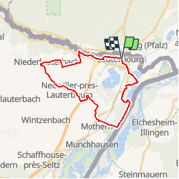
Randonnée Marche de 24 km à découvrir à Grand Est, Bas-Rhin, Lauterbourg. Cette randonnée est proposée par uru2010.
Description
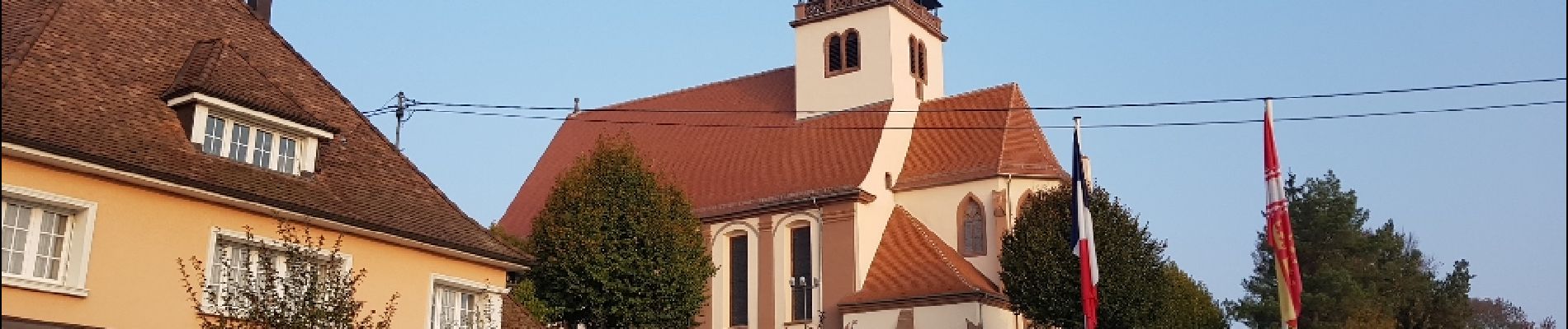
Départ depuis le village de Lauterbourg.
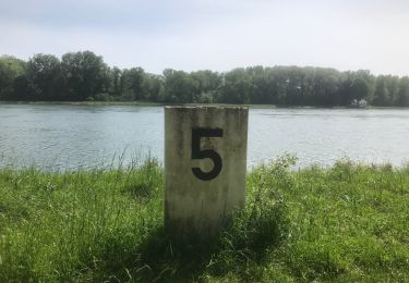
Ballade en boucle le long du Rhin puis dans la campagne et les villages avoisinants pour revenir à Lauterbourg.
Localisation
Pays :
France
Région :
Grand Est
Département/Province :
Bas-Rhin
Commune :
Lauterbourg
Localité :
Unknown
Départ:(Dec)
Départ:(UTM)
439863 ; 5424947 (32U) N.
Commentaires
Randonnées à proximité
![Randonnée Marche Lauterbourg - Port du Rhin - Photo](https://media.geolcdn.com/t/375/260/23eccbf6-707e-4e0f-9621-3cdae1119d2f.jpg&format=jpg&maxdim=2)
![Marche Marche](https://static1.geolcdn.com/sitytour/trail-icons/101.png)
Port du Rhin
Marche
Facile
Lauterbourg,
Grand Est,
Bas-Rhin,
France
![](/images/other/stat-length.png)
4,7 km | 5,2 km-effort
1h 36min
![](https://static1.geolcdn.com/siteimages/upload/files/16400158638029165_repeat_loop_refresh_sync_direction_icon.png)
Non
![Randonnée sport Mothern - 2024-05-01-balade au Rhin à MOTHERN - Photo](https://media.geolcdn.com/t/375/260/84a4d4bd-e5ae-4c5a-9b30-f5ad1592111e.jpg&format=jpg&maxdim=2)
2024-05-01-balade au Rhin à MOTHERN
sport
Très facile
Mothern,
Grand Est,
Bas-Rhin,
France
![](/images/other/stat-length.png)
8,2 km | 9 km-effort
Inconnu
![](https://static1.geolcdn.com/siteimages/upload/files/16400158638029165_repeat_loop_refresh_sync_direction_icon.png)
Oui
![Randonnée Marche Mothern - 2021 08 14 Mothern - Photo](https://media.geolcdn.com/t/375/260/ext.jpg?maxdim=2&url=https%3A%2F%2Fstatic1.geolcdn.com%2Fsiteimages%2Fupload%2Ffiles%2F1553511878bg_sport_marche.png)
![Marche Marche](https://static1.geolcdn.com/sitytour/trail-icons/101.png)
2021 08 14 Mothern
Marche
Facile
Mothern,
Grand Est,
Bas-Rhin,
France
![](/images/other/stat-length.png)
4,5 km | 4,9 km-effort
1h 1min
![](https://static1.geolcdn.com/siteimages/upload/files/16400158638029165_repeat_loop_refresh_sync_direction_icon.png)
Oui
![Randonnée Marche Mothern - Mothern - Photo](https://media.geolcdn.com/t/375/260/ext.jpg?maxdim=2&url=https%3A%2F%2Fstatic1.geolcdn.com%2Fsiteimages%2Fupload%2Ffiles%2F1553511878bg_sport_marche.png)
![Marche Marche](https://static1.geolcdn.com/sitytour/trail-icons/101.png)
![Randonnée Marche Lauterbourg - Transvosgienne Etape 1 - Photo](https://media.geolcdn.com/t/375/260/ext.jpg?maxdim=2&url=https%3A%2F%2Fstatic1.geolcdn.com%2Fsiteimages%2Fupload%2Ffiles%2F1553511878bg_sport_marche.png)
![Marche Marche](https://static1.geolcdn.com/sitytour/trail-icons/101.png)
Transvosgienne Etape 1
Marche
Très difficile
Lauterbourg,
Grand Est,
Bas-Rhin,
France
![](/images/other/stat-length.png)
40 km | 50 km-effort
10h 39min
![](https://static1.geolcdn.com/siteimages/upload/files/16400158638029165_repeat_loop_refresh_sync_direction_icon.png)
Non
![Randonnée Marche Lauterbourg - GR5-1-1 Lauterbourg à Climbach - Photo](https://media.geolcdn.com/t/375/260/ext.jpg?maxdim=2&url=https%3A%2F%2Fstatic1.geolcdn.com%2Fsiteimages%2Fupload%2Ffiles%2F1553511878bg_sport_marche.png)
![Marche Marche](https://static1.geolcdn.com/sitytour/trail-icons/101.png)
GR5-1-1 Lauterbourg à Climbach
Marche
Très difficile
Lauterbourg,
Grand Est,
Bas-Rhin,
France
![](/images/other/stat-length.png)
33 km | 41 km-effort
9h 12min
![](https://static1.geolcdn.com/siteimages/upload/files/16400158638029165_repeat_loop_refresh_sync_direction_icon.png)
Non
![Randonnée Vélo de route Lauterbourg - lautenb - lembacb - Photo](https://media.geolcdn.com/t/375/260/ext.jpg?maxdim=2&url=https%3A%2F%2Fstatic1.geolcdn.com%2Fsiteimages%2Fupload%2Ffiles%2F1524743154velo.jpg)
![Vélo de route Vélo de route](https://static1.geolcdn.com/sitytour/trail-icons/201.png)
lautenb - lembacb
Vélo de route
Très difficile
Lauterbourg,
Grand Est,
Bas-Rhin,
France
![](/images/other/stat-length.png)
63 km | 76 km-effort
8h 38min
![](https://static1.geolcdn.com/siteimages/upload/files/16400158638029165_repeat_loop_refresh_sync_direction_icon.png)
Non
![Randonnée Marche Lauterbourg - GTV - Photo](https://media.geolcdn.com/t/375/260/ext.jpg?maxdim=2&url=https%3A%2F%2Fstatic1.geolcdn.com%2Fsiteimages%2Fupload%2Ffiles%2F1553511878bg_sport_marche.png)
![Marche Marche](https://static1.geolcdn.com/sitytour/trail-icons/101.png)
![Randonnée Marche Lauterbourg - GTV-01 Lauterbourg - Wissembourg - Photo](https://media.geolcdn.com/t/375/260/ext.jpg?maxdim=2&url=https%3A%2F%2Fstatic1.geolcdn.com%2Fsiteimages%2Fupload%2Ffiles%2F1553511878bg_sport_marche.png)
![Marche Marche](https://static1.geolcdn.com/sitytour/trail-icons/101.png)
GTV-01 Lauterbourg - Wissembourg
Marche
Moyen
Lauterbourg,
Grand Est,
Bas-Rhin,
France
![](/images/other/stat-length.png)
24 km | 27 km-effort
5h 35min
![](https://static1.geolcdn.com/siteimages/upload/files/16400158638029165_repeat_loop_refresh_sync_direction_icon.png)
Non