![](/images/other/stat-length.png)
![Randonnée Vélo Belvèze-du-Razès - CCS FFC Aude en Pyrénées - Circuit n°06 - Belvèzes du Razès - Photo](https://media.geolcdn.com/t/1900/400/ext.pjpeg?maxdim=2&url=https%3A%2F%2Fservices.sitytrail.com%2FGeolivesWS%2FDownloadMedia.ashx%3FTrailID%3D111465%26Media%3D7348_2.jpg)
CCS FFC Aude en Pyrénées - Circuit n°06 - Belvèzes du Razès
tracegps
Utilisateur
![Longueur](/images/other/stat-length.png)
![Altitude max](https://static1.geolcdn.com/siteimages/upload/files/1508320355ic_sort_altitude_max_24dp.png)
![Dénivelé positif](https://static1.geolcdn.com/siteimages/upload/files/1508320355ic_sort_den_pos_24dp.png)
![Km-Effort](/images/other/stat-length.png)
![Altitude min](https://static1.geolcdn.com/siteimages/upload/files/1508320355ic_sort_altitude_min_24dp.png)
![Dénivelé négatif](https://static1.geolcdn.com/siteimages/upload/files/1508320355ic_sort_den_neg_24dp.png)
![Boucle](https://static1.geolcdn.com/siteimages/upload/files/16400158638029165_repeat_loop_refresh_sync_direction_icon.png)
![Vélo](https://static1.geolcdn.com/sitytour/trail-icons/200.png)
2h00
Difficulté : Moyen
![Scannez ce code QR pour ouvrir la randonnée dans l'application SityTrail](https://capi.geolives.com/qq0zvz2zws4bq2lad0pu/sitytour/trails/111465/qr.png?size=200)
Application GPS de randonnée GRATUITE
À propos
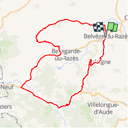
Randonnée Vélo de 39 km à découvrir à Occitanie, Aude, Belvèze-du-Razès. Cette randonnée est proposée par tracegps.
Description
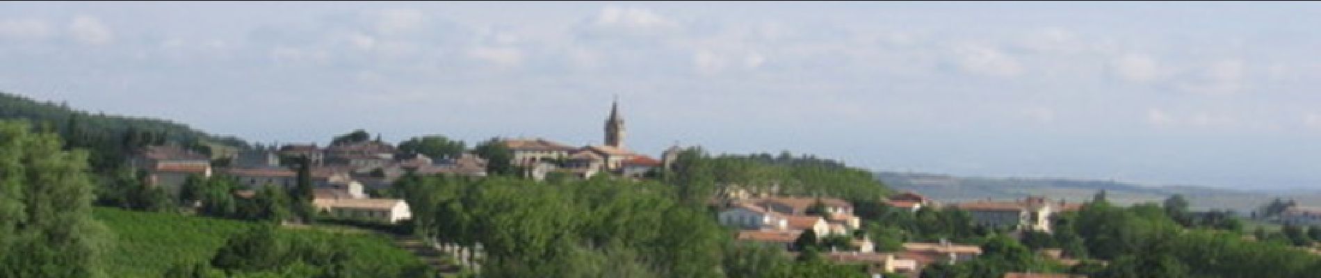
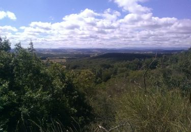
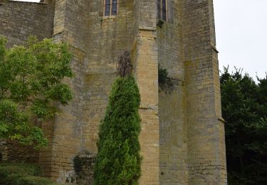
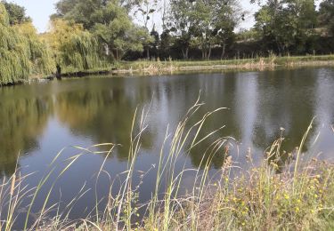
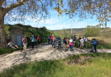
Circuit vallonné, ouvert sur les paysages viticoles des Coteaux du Razès et sur le piémont Pyrénéen. Vous traverserez des villages construits en rond, appelés « circulades » tels qu’Alaigne et Mazerolles-du-Razès, témoignage architectural de l’an mille. En direction de Belvèze, nous vous invitons à vous arrêter un instant à la Maison des Terroirs du Domaine de Cazes, siège du Syndicat du Cru Malepère (AOC). Ce circuit accessible à tous rencontre sa principale difficulté dans la côte de Monthaut, en sortie de la D626. Textes de Patrick Rault et Louis Mounié.
Localisation
Commentaires
Randonnées à proximité
![Randonnée Randonnée équestre Belvèze-du-Razès - Tour du Razès - Photo](https://media.geolcdn.com/t/375/260/0237fd78-773f-4e5d-a6c5-ba99692aed1f.jpg&format=jpg&maxdim=2)
![Randonnée équestre Randonnée équestre](https://static1.geolcdn.com/sitytour/trail-icons/301.png)
Randonnée équestre
![](/images/other/stat-length.png)
![](https://static1.geolcdn.com/siteimages/upload/files/16400158638029165_repeat_loop_refresh_sync_direction_icon.png)
![Randonnée A pied Ferran - À travers Champs et Vignes - Photo](https://media.geolcdn.com/t/375/260/9e662053-82ce-402f-b724-eb1550730902.jpeg&format=jpg&maxdim=2)
![A pied A pied](https://static1.geolcdn.com/sitytour/trail-icons/100.png)
A pied
![](/images/other/stat-length.png)
![](https://static1.geolcdn.com/siteimages/upload/files/16400158638029165_repeat_loop_refresh_sync_direction_icon.png)
![Randonnée Marche Cailhau - papillon cailhau - Photo](https://media.geolcdn.com/t/375/260/e394b989-b64c-4a0a-ba7d-fb5a6cd7972c.jpg&format=jpg&maxdim=2)
![Marche Marche](https://static1.geolcdn.com/sitytour/trail-icons/101.png)
Marche
![](/images/other/stat-length.png)
![](https://static1.geolcdn.com/siteimages/upload/files/16400158638029165_repeat_loop_refresh_sync_direction_icon.png)
![Randonnée Marche Cailhau - Sur les pas d'Achille Laugé - Photo](https://media.geolcdn.com/t/375/260/ext.jpg?maxdim=2&url=https%3A%2F%2Fstatic1.geolcdn.com%2Fsiteimages%2Fupload%2Ffiles%2F1553511878bg_sport_marche.png)
![Marche Marche](https://static1.geolcdn.com/sitytour/trail-icons/101.png)
Marche
![](/images/other/stat-length.png)
![](https://static1.geolcdn.com/siteimages/upload/files/16400158638029165_repeat_loop_refresh_sync_direction_icon.png)
![Randonnée Marche Belvèze-du-Razès - beleveze - Photo](https://media.geolcdn.com/t/375/260/ext.jpg?maxdim=2&url=https%3A%2F%2Fstatic1.geolcdn.com%2Fsiteimages%2Fupload%2Ffiles%2F1553511878bg_sport_marche.png)
![Marche Marche](https://static1.geolcdn.com/sitytour/trail-icons/101.png)
![Randonnée Marche Cailhau - Le papillon de Cailhau - Photo](https://media.geolcdn.com/t/375/260/ext.jpg?maxdim=2&url=https%3A%2F%2Fstatic1.geolcdn.com%2Fsiteimages%2Fupload%2Ffiles%2F1553511878bg_sport_marche.png)
![Marche Marche](https://static1.geolcdn.com/sitytour/trail-icons/101.png)
Marche
![](/images/other/stat-length.png)
![](https://static1.geolcdn.com/siteimages/upload/files/16400158638029165_repeat_loop_refresh_sync_direction_icon.png)
![Randonnée Marche Brugairolles - Brugairolle - Photo](https://media.geolcdn.com/t/375/260/dddbaf37-24f4-47d6-aa16-6df1d41f0605.jpg&format=jpg&maxdim=2)
![Marche Marche](https://static1.geolcdn.com/sitytour/trail-icons/101.png)
Marche
![](/images/other/stat-length.png)
![](https://static1.geolcdn.com/siteimages/upload/files/16400158638029165_repeat_loop_refresh_sync_direction_icon.png)
![Randonnée Marche Belvèze-du-Razès - Belvèze - Photo](https://media.geolcdn.com/t/375/260/88e1a823-2bcb-4fbd-b5e9-911b7f883e16.jpg&format=jpg&maxdim=2)
![Marche Marche](https://static1.geolcdn.com/sitytour/trail-icons/101.png)
![Randonnée Marche Cailhau - papillon de Cailhau - Photo](https://media.geolcdn.com/t/375/260/ext.jpg?maxdim=2&url=https%3A%2F%2Fstatic1.geolcdn.com%2Fsiteimages%2Fupload%2Ffiles%2F1553511878bg_sport_marche.png)
![Marche Marche](https://static1.geolcdn.com/sitytour/trail-icons/101.png)
Marche
![](/images/other/stat-length.png)
![](https://static1.geolcdn.com/siteimages/upload/files/16400158638029165_repeat_loop_refresh_sync_direction_icon.png)