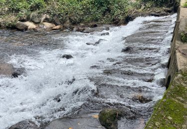
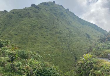
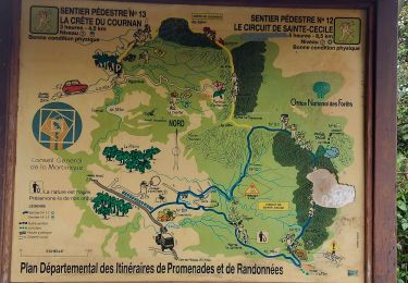
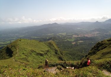
Randonnée A pied L'Ajoupa-Bouillon - La Pelée depuis l'Ajoupa Bouillon (Martinique) - Photo

La Pelée depuis l'Ajoupa Bouillon (Martinique)

 ETMU5496
ETMU5496

Utilisateur

© OpenStreetMap contributors
Longueur
Longueur
7 km
Altitude max
Altitude max
1380 m
Dénivelé positif
Dénivelé positif
673 m
Km-Effort
Km-Effort  
16 km
Altitude min
Altitude min
826 m
Dénivelé négatif
Dénivelé négatif
675 m
Boucle
Boucle
Oui
Date de création :
2019-03-25 13:02:47.347
Dernière modification :
2019-12-28 17:01:50.76

(0 Avis)

A pied
A pied
5h00
Difficulté : Difficile

Scannez ce code QR pour ouvrir la randonnée dans l'application SityTrail

Application GPS de randonnée GRATUITE

Logo SityTrail SityTrail

IGN / Instituts géographiques

Télécharger SityTrail sur l'App Store Télécharger SityTrail sur Google Play

Logo SityTrail SityTrail World

Le monde est à vous

Télécharger SityTrail sur l'App Store Télécharger SityTrail sur Google Play Télécharger SityTrail sur Huawei AppGallery

À propos

Randonnée A pied de 7 km à découvrir à Martinique, Inconnu, L'Ajoupa-Bouillon. Cette randonnée est proposée par ETMU5496.

Description

L'ascension d'un mythe "La Pelée". Celle-ci se fait depuis le 1er refuge.
Pas évident d'avoir un temps clair au sommet !

Profil altimétrique

Points d'intérêt

Point d'intérêt L'Ajoupa-Bouillon - Parking Morne Rouge - Photo
ETMU5496
L'AJOUPA-BOUILLON 
Point d'intérêt L'Ajoupa-Bouillon - Plateau des Palmistes - Photo
ETMU5496
L'AJOUPA-BOUILLON 
Point d'intérêt L'Ajoupa-Bouillon - Intersection à gauche - Photo
ETMU5496
L'AJOUPA-BOUILLON 
Point d'intérêt Saint-Pierre - Intersection à gauche et monter - Photo
ETMU5496
Point d'intérêt Saint-Pierre - Le sommet de l'île - Photo
ETMU5496
SAINT-PIERRE 
Point d'intérêt Saint-Pierre - Intersection.A gauche pour contourner le cratère - Photo
ETMU5496
Point d'intérêt L'Ajoupa-Bouillon - Parking Morne Rouge - Photo
ETMU5496
L'AJOUPA-BOUILLON 

Localisation

Pays :
France
Région :
Martinique
Département/Province :
Inconnu
Commune :
L'Ajoupa-Bouillon
Localité :
Unknown
Départ:(UTM)
698939 ; 1637726 (20P) N.

Randonnées à proximité

Randonnée Marche Le Morne-Rouge - Sainte Cécile/crête du Cournan/Beauvallon  - Photo
Marche
GUIDE
Jean-Luc Farant

Marche

Moyen
(1)
Le Morne-Rouge, Martinique, Inconnu, France
7,2 km | 11 km-effort
2h 29min
Oui
Randonnée Marche Le Morne-Rouge - Mac Intoch - Morne Capot - Photo
Marche
GUIDE
Lamartiniere

Marche

Moyen
(1)
Le Morne-Rouge, Martinique, Inconnu, France
9,4 km | 14,9 km-effort
4h 53min
Non
Randonnée Marche L'Ajoupa-Bouillon - Cascade Dany  - Photo
Marche
GUIDE
Jean-Luc Farant

Marche

Facile
L'Ajoupa-Bouillon, Martinique, Inconnu, France
3,8 km | 5,3 km-effort
1h 12min
Non
Randonnée Marche L'Ajoupa-Bouillon - Montagne pelée  - Photo
Marche
GUIDE
Alizée.pee

Marche

Difficile
L'Ajoupa-Bouillon, Martinique, Inconnu, France
7,5 km | 16,5 km-effort
6h 2min
Oui
Randonnée Marche Le Morne-Rouge - Crête du Cournan boucle - Photo
Marche
GUIDE
Lamartiniere

Marche

Moyen
Le Morne-Rouge, Martinique, Inconnu, France
4,2 km | 8,2 km-effort
2h 15min
Oui
Randonnée Marche L'Ajoupa-Bouillon - Montagne Pelée - Photo
Marche
GUIDE
David25400

Marche

Moyen
(1)
L'Ajoupa-Bouillon, Martinique, Inconnu, France
7,8 km | 16,8 km-effort
4h 49min
Oui
Randonnée Marche Le Morne-Rouge - Domaine de la vallée via Hbt Pecoul - Photo
Marche
GUIDE
Lamartiniere

Marche

Difficile
Le Morne-Rouge, Martinique, Inconnu, France
15,6 km | 26 km-effort
6h 0min
Non
Randonnée Marche L'Ajoupa-Bouillon - Refuge Aileron - Gorges de La Falaise - Photo
Marche
GUIDE
Lamartiniere

Marche

Facile
L'Ajoupa-Bouillon, Martinique, Inconnu, France
3,7 km | 5,1 km-effort
1h 10min
Non
Randonnée Marche L'Ajoupa-Bouillon - Gorges de la Falaise - 1er Refuge Pele - Photo
Marche
GUIDE
Lamartiniere

Marche

Moyen
L'Ajoupa-Bouillon, Martinique, Inconnu, France
3,5 km | 7,5 km-effort
1h 0min
Non


Fermer
Mes abonnements