![](/images/other/stat-length.png)
![Randonnée Marche Saint-Louet-sur-Vire - Circuit de St Louet sur Vire - 6 II - Photo](https://media.geolcdn.com/t/1900/400/ext.pjpeg?maxdim=2&url=https%3A%2F%2Fservices.sitytrail.com%2FGeolivesWS%2FDownloadMedia.ashx%3FTrailID%3D111243%26Media%3D6816_3.jpg)
Circuit de St Louet sur Vire - 6 II
tracegps
Utilisateur
![Longueur](/images/other/stat-length.png)
Longueur
4,6 km
![Altitude max](https://static1.geolcdn.com/siteimages/upload/files/1508320355ic_sort_altitude_max_24dp.png)
Altitude max
135 m
![Dénivelé positif](https://static1.geolcdn.com/siteimages/upload/files/1508320355ic_sort_den_pos_24dp.png)
Dénivelé positif
90 m
![Km-Effort](/images/other/stat-length.png)
Km-Effort
5,8 km
![Altitude min](https://static1.geolcdn.com/siteimages/upload/files/1508320355ic_sort_altitude_min_24dp.png)
Altitude min
86 m
![Dénivelé négatif](https://static1.geolcdn.com/siteimages/upload/files/1508320355ic_sort_den_neg_24dp.png)
Dénivelé négatif
90 m
![Boucle](https://static1.geolcdn.com/siteimages/upload/files/16400158638029165_repeat_loop_refresh_sync_direction_icon.png)
Boucle
Oui
Date de création :
2014-12-10 00:00:00.0
Dernière modification :
2014-12-10 00:00:00.0
![Marche](https://static1.geolcdn.com/sitytour/trail-icons/101.png)
1h10
Difficulté : Facile
![Scannez ce code QR pour ouvrir la randonnée dans l'application SityTrail](https://capi.geolives.com/qq0zvz2zws4bq2lad0pu/sitytour/trails/111243/qr.png?size=200)
Application GPS de randonnée GRATUITE
À propos
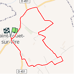
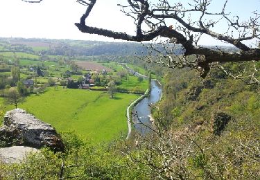
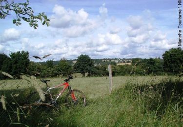
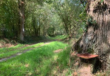
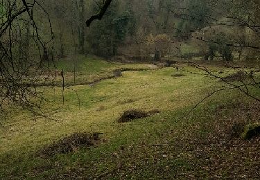
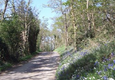
Randonnée Marche de 4,6 km à découvrir à Normandie, Manche, Saint-Louet-sur-Vire. Cette randonnée est proposée par tracegps.
Description
Circuit proposé par la Communauté de Communes de Tessy sur Vire. Départ de la salle des fêtes de St Louet-sur-Vire. Retrouvez le descriptif et les commentaires du circuit sur le site de la Communauté de Communes de Tessy sur Vire.
Localisation
Pays :
France
Région :
Normandie
Département/Province :
Manche
Commune :
Saint-Louet-sur-Vire
Localité :
Unknown
Départ:(Dec)
Départ:(UTM)
646903 ; 5428552 (30U) N.
Commentaires
Randonnées à proximité
![Randonnée Marche Condé-sur-Vire - Roches de ham - Photo](https://media.geolcdn.com/t/375/260/ext.jpg?maxdim=2&url=https%3A%2F%2Fservices.sitytrail.com%2FGeolivesWS%2FDownloadMedia.ashx%3FTrailID%3D267550%26Media%3Dfix__20140417152802.jpg)
![Marche Marche](https://static1.geolcdn.com/sitytour/trail-icons/101.png)
Roches de ham
Marche
Facile
(1)
Condé-sur-Vire,
Normandie,
Manche,
France
![](/images/other/stat-length.png)
11,1 km | 13,5 km-effort
2h 58min
![](https://static1.geolcdn.com/siteimages/upload/files/16400158638029165_repeat_loop_refresh_sync_direction_icon.png)
Oui
![Randonnée V.T.T. Domjean - Au coeur de la vallée de la Vire - Photo](https://media.geolcdn.com/t/375/260/ext.jpg?maxdim=2&url=https%3A%2F%2Fservices.sitytrail.com%2FGeolivesWS%2FDownloadMedia.ashx%3FTrailID%3D109294%26Media%3D3496_1.jpg)
![V.T.T. V.T.T.](https://static1.geolcdn.com/sitytour/trail-icons/202.png)
Au coeur de la vallée de la Vire
V.T.T.
Difficile
(2)
Domjean,
Normandie,
Manche,
France
![](/images/other/stat-length.png)
32 km | 39 km-effort
4h 0min
![](https://static1.geolcdn.com/siteimages/upload/files/16400158638029165_repeat_loop_refresh_sync_direction_icon.png)
Oui
![Randonnée Marche Domjean - Rando gorge de la Vire - Photo](https://media.geolcdn.com/t/375/260/078dd238-3b4c-4f3c-9933-8f29f8ae0807.jpg&format=jpg&maxdim=2)
![Marche Marche](https://static1.geolcdn.com/sitytour/trail-icons/101.png)
Rando gorge de la Vire
Marche
Facile
Domjean,
Normandie,
Manche,
France
![](/images/other/stat-length.png)
35 km | 42 km-effort
10h 25min
![](https://static1.geolcdn.com/siteimages/upload/files/16400158638029165_repeat_loop_refresh_sync_direction_icon.png)
Oui
![Randonnée Marche Souleuvre-en-Bocage - Campeaux - Photo](https://media.geolcdn.com/t/375/260/ext.jpg?maxdim=2&url=https%3A%2F%2Fservices.sitytrail.com%2FGeolivesWS%2FDownloadMedia.ashx%3FTrailID%3D701127%26Media%3Dfix__20170219141411.jpg)
![Marche Marche](https://static1.geolcdn.com/sitytour/trail-icons/101.png)
Campeaux
Marche
Moyen
Souleuvre-en-Bocage,
Normandie,
Calvados,
France
![](/images/other/stat-length.png)
18,4 km | 24 km-effort
4h 24min
![](https://static1.geolcdn.com/siteimages/upload/files/16400158638029165_repeat_loop_refresh_sync_direction_icon.png)
Oui
![Randonnée Marche Tessy-Bocage - Tessy-sur-Vire - C 13-V - Photo](https://media.geolcdn.com/t/375/260/ext.jpg?maxdim=2&url=https%3A%2F%2Fservices.sitytrail.com%2FGeolivesWS%2FDownloadMedia.ashx%3FTrailID%3D111302%26Media%3D6947_5.jpg)
![Marche Marche](https://static1.geolcdn.com/sitytour/trail-icons/101.png)
Tessy-sur-Vire - C 13-V
Marche
Facile
Tessy-Bocage,
Normandie,
Manche,
France
![](/images/other/stat-length.png)
3,4 km | 4,1 km-effort
1h 0min
![](https://static1.geolcdn.com/siteimages/upload/files/16400158638029165_repeat_loop_refresh_sync_direction_icon.png)
Oui
![Randonnée V.T.T. Tessy-Bocage - Tessy-sur-Vire - C 13-II - Photo](https://media.geolcdn.com/t/375/260/ext.jpg?maxdim=2&url=https%3A%2F%2Fservices.sitytrail.com%2FGeolivesWS%2FDownloadMedia.ashx%3FTrailID%3D111296%26Media%3D6939_4.jpg)
![V.T.T. V.T.T.](https://static1.geolcdn.com/sitytour/trail-icons/202.png)
Tessy-sur-Vire - C 13-II
V.T.T.
Facile
Tessy-Bocage,
Normandie,
Manche,
France
![](/images/other/stat-length.png)
8,8 km | 10,5 km-effort
1h 0min
![](https://static1.geolcdn.com/siteimages/upload/files/16400158638029165_repeat_loop_refresh_sync_direction_icon.png)
Oui
![Randonnée Marche Tessy-Bocage - Tessy-sur-Vire - C 13-II - Photo](https://media.geolcdn.com/t/375/260/ext.jpg?maxdim=2&url=https%3A%2F%2Fservices.sitytrail.com%2FGeolivesWS%2FDownloadMedia.ashx%3FTrailID%3D111295%26Media%3D6939_4.jpg)
![Marche Marche](https://static1.geolcdn.com/sitytour/trail-icons/101.png)
Tessy-sur-Vire - C 13-II
Marche
Moyen
Tessy-Bocage,
Normandie,
Manche,
France
![](/images/other/stat-length.png)
8,8 km | 10,5 km-effort
2h 15min
![](https://static1.geolcdn.com/siteimages/upload/files/16400158638029165_repeat_loop_refresh_sync_direction_icon.png)
Oui
![Randonnée Marche Tessy-Bocage - Tessy-sur-Vire - C 13-I - Photo](https://media.geolcdn.com/t/375/260/ext.jpg?maxdim=2&url=https%3A%2F%2Fservices.sitytrail.com%2FGeolivesWS%2FDownloadMedia.ashx%3FTrailID%3D111294%26Media%3D6938_3.jpg)
![Marche Marche](https://static1.geolcdn.com/sitytour/trail-icons/101.png)
Tessy-sur-Vire - C 13-I
Marche
Facile
Tessy-Bocage,
Normandie,
Manche,
France
![](/images/other/stat-length.png)
3,6 km | 4,7 km-effort
1h 0min
![](https://static1.geolcdn.com/siteimages/upload/files/16400158638029165_repeat_loop_refresh_sync_direction_icon.png)
Oui
![Randonnée V.T.T. Fourneaux - Circuit de Fourneaux - C11-I - Photo](https://media.geolcdn.com/t/375/260/ext.jpg?maxdim=2&url=https%3A%2F%2Fservices.sitytrail.com%2FGeolivesWS%2FDownloadMedia.ashx%3FTrailID%3D111262%26Media%3D6868_2.jpg)
![V.T.T. V.T.T.](https://static1.geolcdn.com/sitytour/trail-icons/202.png)
Circuit de Fourneaux - C11-I
V.T.T.
Facile
Fourneaux,
Normandie,
Manche,
France
![](/images/other/stat-length.png)
5,6 km | 6,9 km-effort
30min
![](https://static1.geolcdn.com/siteimages/upload/files/16400158638029165_repeat_loop_refresh_sync_direction_icon.png)
Oui