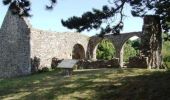
Randonnée Marche Lestre - Le circuit du Bouillon - Lestre - Photo

Le circuit du Bouillon - Lestre

 tracegps
tracegps

Utilisateur

© OpenStreetMap contributors
Longueur
Longueur
7 km
Altitude max
Altitude max
44 m
Dénivelé positif
Dénivelé positif
86 m
Km-Effort
Km-Effort  
8,1 km
Altitude min
Altitude min
8 m
Dénivelé négatif
Dénivelé négatif
85 m
Boucle
Boucle
Oui
Date de création :
2014-12-10 00:00:00.0
Dernière modification :
2014-12-10 00:00:00.0

(1 Avis)

Marche
Marche
2h00
Difficulté : Moyen

Scannez ce code QR pour ouvrir la randonnée dans l'application SityTrail

Application GPS de randonnée GRATUITE

Logo SityTrail SityTrail

IGN / Instituts géographiques

Télécharger SityTrail sur l'App Store Télécharger SityTrail sur Google Play

Logo SityTrail SityTrail World

Le monde est à vous

Télécharger SityTrail sur l'App Store Télécharger SityTrail sur Google Play Télécharger SityTrail sur Huawei AppGallery

À propos

Randonnée Marche de 7 km à découvrir à Normandie, Manche, Lestre. Cette randonnée est proposée par tracegps.

Description

Le circuit du Bouillon - Lestre. Que d’eau, que d’eau !! Entre mer et bocage, l’eau est omniprésente, a gauche, a droite, devant, derrière… Prévoyez des bottes pour ce charmant sentier facile, jalonné de délicieux ponts sur des ruisseaux et de patrimoines bâtis variés. Plus de détails sur le circuit (balisage, difficulté…), les points remarquables à proximité et téléchargements sur Manche Tourisme – Loisirs Randonnée GPS.

Profil altimétrique

Photos

Localisation

Pays :
France
Région :
Normandie
Département/Province :
Manche
Commune :
Lestre
Localité :
Unknown
Départ:(Dec)
Départ:(UTM)
620485 ; 5487279 (30U) N.

Commentaires

Veuillez vous connecter pour laisser un commentaire ou une note


Randonnées à proximité

Randonnée Marche Quettehou - Morsalines ( Boucle ) - Photo
Marche
neitag61

Marche

Facile
(1)
Quettehou, Normandie, Manche, France
4,3 km | 5,1 km-effort
1h 15min
Oui
Randonnée Marche Saint-Germain-de-Tournebut - Saint Germain de tournebut - Photo
Marche
clrunavot

Marche

Moyen
Saint-Germain-de-Tournebut, Normandie, Manche, France
7,8 km | 9 km-effort
2h 3min
Oui
Randonnée Marche Quinéville - mardicotentin - Photo
Marche
dehondt

Marche

Très facile
Quinéville, Normandie, Manche, France
10,3 km | 11,3 km-effort
2h 48min
Oui
Randonnée Marche Quinéville - Normandie  etape 1 - Photo
Marche
mdeclemy

Marche

Moyen
(1)
Quinéville, Normandie, Manche, France
28 km | 29 km-effort
6h 26min
Non
Randonnée V.T.T. Saint-Floxel - Vtt tickets sports - Photo
V.T.T.
lud50

V.T.T.

Très facile
Saint-Floxel, Normandie, Manche, France
7,9 km | 8,5 km-effort
41min
Oui
Randonnée Marche Montebourg - Montebourg  - Photo
Marche
Yvon59

Marche

Moyen
Montebourg, Normandie, Manche, France
10,4 km | 11,6 km-effort
4h 43min
Oui
Randonnée Marche Quinéville - De Quinéville à Saint-Vaast-la-Hougue - Photo
Marche
Annick Vanherzeeke

Marche

Difficile
Quinéville, Normandie, Manche, France
13,5 km | 14,1 km-effort
3h 12min
Non
Randonnée A pied Crasville - Morsaline GR223 - Photo
A pied
a_pascale

A pied

Facile
Crasville, Normandie, Manche, France
3,1 km | 3,2 km-effort
43min
Non
Randonnée Marche Quinéville - Tour cotentin 3 - Photo
Marche
ben2705

Marche

Quinéville, Normandie, Manche, France
10,7 km | 11 km-effort
4h 55min
Non


Fermer
Mes abonnements