![](/images/other/stat-length.png)
![Randonnée Marche Saint-Barthélemy - Coteaux et Barthes de St Barthélemy - Photo](https://media.geolcdn.com/t/1900/400/ext.pjpeg?maxdim=2&url=https%3A%2F%2Fservices.sitytrail.com%2FGeolivesWS%2FDownloadMedia.ashx%3FTrailID%3D110308%26Media%3D5736_1.jpg)
Coteaux et Barthes de St Barthélemy
tracegps
Utilisateur
![Longueur](/images/other/stat-length.png)
Longueur
6,6 km
![Altitude max](https://static1.geolcdn.com/siteimages/upload/files/1508320355ic_sort_altitude_max_24dp.png)
Altitude max
54 m
![Dénivelé positif](https://static1.geolcdn.com/siteimages/upload/files/1508320355ic_sort_den_pos_24dp.png)
Dénivelé positif
112 m
![Km-Effort](/images/other/stat-length.png)
Km-Effort
8,1 km
![Altitude min](https://static1.geolcdn.com/siteimages/upload/files/1508320355ic_sort_altitude_min_24dp.png)
Altitude min
0 m
![Dénivelé négatif](https://static1.geolcdn.com/siteimages/upload/files/1508320355ic_sort_den_neg_24dp.png)
Dénivelé négatif
111 m
![Boucle](https://static1.geolcdn.com/siteimages/upload/files/16400158638029165_repeat_loop_refresh_sync_direction_icon.png)
Boucle
Oui
Date de création :
2014-12-10 00:00:00.0
Dernière modification :
2014-12-10 00:00:00.0
![Marche](https://static1.geolcdn.com/sitytour/trail-icons/101.png)
1h40
Difficulté : Moyen
![Scannez ce code QR pour ouvrir la randonnée dans l'application SityTrail](https://capi.geolives.com/qq0zvz2zws4bq2lad0pu/sitytour/trails/110308/qr.png?size=200)
Application GPS de randonnée GRATUITE
À propos
Randonnée Marche de 6,6 km à découvrir à Nouvelle-Aquitaine, Landes, Saint-Barthélemy. Cette randonnée est proposée par tracegps.
Description
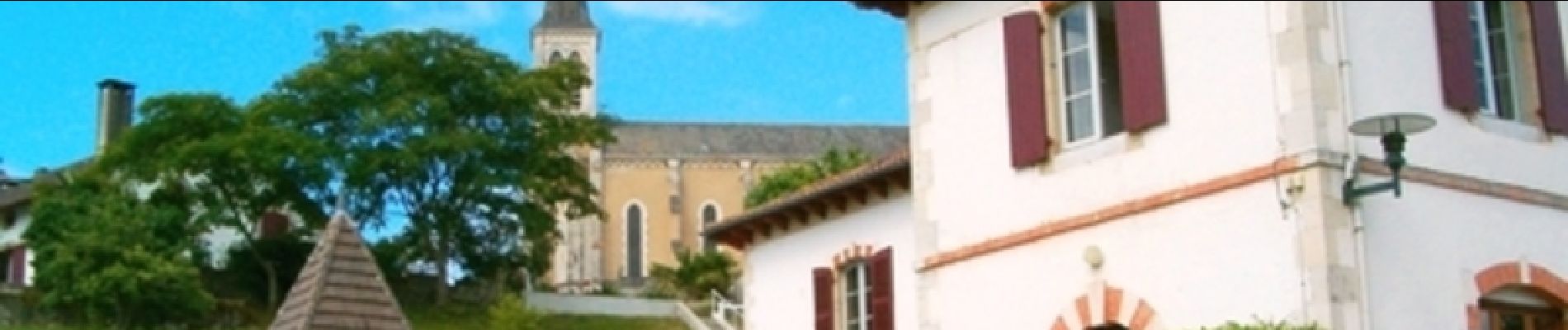
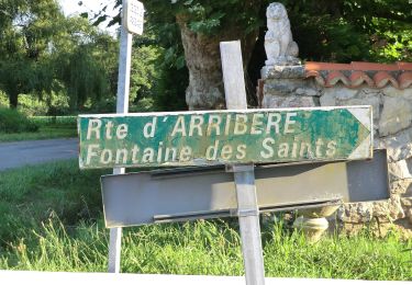
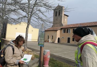
Randonnez dans cette commune rurale qui a su garder son authenticité grâce à son environnement et son patrimoine historique. Grâce à une table d'orientation, vous pourrez admirer la vue spledide de la vallée de l'Adour sur fond de chaîne pyrénéenne.
Localisation
Pays :
France
Région :
Nouvelle-Aquitaine
Département/Province :
Landes
Commune :
Saint-Barthélemy
Localité :
Unknown
Départ:(Dec)
Départ:(UTM)
634743 ; 4819512 (30T) N.
Commentaires
Randonnées à proximité
![Randonnée Marche Urt - Les Barthes d'Etchepette - Photo](https://media.geolcdn.com/t/375/260/ext.jpg?maxdim=2&url=https%3A%2F%2Fservices.sitytrail.com%2FGeolivesWS%2FDownloadMedia.ashx%3FTrailID%3D111955%26Media%3D9138_2.jpg)
![Marche Marche](https://static1.geolcdn.com/sitytour/trail-icons/101.png)
Les Barthes d'Etchepette
Marche
Facile
(3)
Urt,
Nouvelle-Aquitaine,
Pyrénées-Atlantiques,
France
![](/images/other/stat-length.png)
5,3 km | 5,8 km-effort
1h 40min
![](https://static1.geolcdn.com/siteimages/upload/files/16400158638029165_repeat_loop_refresh_sync_direction_icon.png)
Oui
![Randonnée V.T.T. Biarrotte - Fetes Biarrotte 2013 - Photo](https://media.geolcdn.com/t/375/260/ext.jpg?maxdim=2&url=https%3A%2F%2Fstatic1.geolcdn.com%2Fsiteimages%2Fupload%2Ffiles%2F1524743154velo.jpg)
![V.T.T. V.T.T.](https://static1.geolcdn.com/sitytour/trail-icons/202.png)
Fetes Biarrotte 2013
V.T.T.
Moyen
(1)
Biarrotte,
Nouvelle-Aquitaine,
Landes,
France
![](/images/other/stat-length.png)
37 km | 45 km-effort
2h 39min
![](https://static1.geolcdn.com/siteimages/upload/files/16400158638029165_repeat_loop_refresh_sync_direction_icon.png)
Non
![Randonnée sport Urcuit - Urcuit les barrages de Ardanavy - Photo](https://media.geolcdn.com/t/375/260/7e650e70-2451-44cc-b1bf-6b490201a452.jpg&format=jpg&maxdim=2)
Urcuit les barrages de Ardanavy
sport
Très facile
Urcuit,
Nouvelle-Aquitaine,
Pyrénées-Atlantiques,
France
![](/images/other/stat-length.png)
7,8 km | 8,7 km-effort
Inconnu
![](https://static1.geolcdn.com/siteimages/upload/files/16400158638029165_repeat_loop_refresh_sync_direction_icon.png)
Oui
![Randonnée Marche Urcuit - Section GR8 Urcuit / Lahonce en A/R - Photo](https://media.geolcdn.com/t/375/260/28a98a27-9434-4729-832e-86d41fb57c84.jpg&format=jpg&maxdim=2)
![Marche Marche](https://static1.geolcdn.com/sitytour/trail-icons/101.png)
Section GR8 Urcuit / Lahonce en A/R
Marche
Facile
Urcuit,
Nouvelle-Aquitaine,
Pyrénées-Atlantiques,
France
![](/images/other/stat-length.png)
5,2 km | 5,8 km-effort
1h 55min
![](https://static1.geolcdn.com/siteimages/upload/files/16400158638029165_repeat_loop_refresh_sync_direction_icon.png)
Oui
![Randonnée A pied Saint-Martin-de-Seignanx - Riston - Photo](https://media.geolcdn.com/t/375/260/dacce4ba-1781-41e5-8f98-ae27ddcd6c1c.jpeg&format=jpg&maxdim=2)
![A pied A pied](https://static1.geolcdn.com/sitytour/trail-icons/100.png)
Riston
A pied
Facile
Saint-Martin-de-Seignanx,
Nouvelle-Aquitaine,
Landes,
France
![](/images/other/stat-length.png)
8,6 km | 10,4 km-effort
2h 21min
![](https://static1.geolcdn.com/siteimages/upload/files/16400158638029165_repeat_loop_refresh_sync_direction_icon.png)
Oui
![Randonnée Marche Urt - Barthes Échelepette; Ardanavy - Photo](https://media.geolcdn.com/t/375/260/51b10e8b-a7ed-4223-a579-f531a76b4718.jpg&format=jpg&maxdim=2)
![Marche Marche](https://static1.geolcdn.com/sitytour/trail-icons/101.png)
Barthes Échelepette; Ardanavy
Marche
Facile
(1)
Urt,
Nouvelle-Aquitaine,
Pyrénées-Atlantiques,
France
![](/images/other/stat-length.png)
8,8 km | 9,7 km-effort
2h 19min
![](https://static1.geolcdn.com/siteimages/upload/files/16400158638029165_repeat_loop_refresh_sync_direction_icon.png)
Oui
![Randonnée V.T.T. Saint-Martin-de-Seignanx - boucle vtt lande - Photo](https://media.geolcdn.com/t/375/260/ext.jpg?maxdim=2&url=https%3A%2F%2Fstatic1.geolcdn.com%2Fsiteimages%2Fupload%2Ffiles%2F1524743154velo.jpg)
![V.T.T. V.T.T.](https://static1.geolcdn.com/sitytour/trail-icons/202.png)
boucle vtt lande
V.T.T.
Facile
(1)
Saint-Martin-de-Seignanx,
Nouvelle-Aquitaine,
Landes,
France
![](/images/other/stat-length.png)
13,1 km | 14,9 km-effort
Inconnu
![](https://static1.geolcdn.com/siteimages/upload/files/16400158638029165_repeat_loop_refresh_sync_direction_icon.png)
Oui
![Randonnée Marche Lahonce - LAHONCE sentier de labaye formation balisage miden](https://media.geolcdn.com/t/375/260/f63e681c-6cc8-4f9a-9e8e-03d62260586c.jpg&format=jpg&maxdim=2)
![Marche Marche](https://static1.geolcdn.com/sitytour/trail-icons/101.png)
LAHONCE sentier de labaye formation balisage miden "3560100"
Marche
Facile
Lahonce,
Nouvelle-Aquitaine,
Pyrénées-Atlantiques,
France
![](/images/other/stat-length.png)
2,3 km | 3,1 km-effort
1h 30min
![](https://static1.geolcdn.com/siteimages/upload/files/16400158638029165_repeat_loop_refresh_sync_direction_icon.png)
Oui
![Randonnée V.T.T. Lahonce - Rando mitounico - Photo](https://media.geolcdn.com/t/375/260/248f6dd3-e97e-4ede-a817-afb243c5d1be.jpg&format=jpg&maxdim=2)
![V.T.T. V.T.T.](https://static1.geolcdn.com/sitytour/trail-icons/202.png)
Rando mitounico
V.T.T.
Moyen
Lahonce,
Nouvelle-Aquitaine,
Pyrénées-Atlantiques,
France
![](/images/other/stat-length.png)
23 km | 25 km-effort
3h 4min
![](https://static1.geolcdn.com/siteimages/upload/files/16400158638029165_repeat_loop_refresh_sync_direction_icon.png)
Oui