![](/images/other/stat-length.png)
![Randonnée Marche Asnières-sur-Oise - Par la route de la Chaussée du Roi, autour de l'abbaye de Royaumont - Photo](https://media.geolcdn.com/t/1900/400/ext.pjpeg?maxdim=2&url=https%3A%2F%2Fservices.sitytrail.com%2FGeolivesWS%2FDownloadMedia.ashx%3FTrailID%3D110135%26Media%3D5333_1.jpg)
Par la route de la Chaussée du Roi, autour de l'abbaye de Royaumont
tracegps
Utilisateur
![Longueur](/images/other/stat-length.png)
![Altitude max](https://static1.geolcdn.com/siteimages/upload/files/1508320355ic_sort_altitude_max_24dp.png)
![Dénivelé positif](https://static1.geolcdn.com/siteimages/upload/files/1508320355ic_sort_den_pos_24dp.png)
![Km-Effort](/images/other/stat-length.png)
![Altitude min](https://static1.geolcdn.com/siteimages/upload/files/1508320355ic_sort_altitude_min_24dp.png)
![Dénivelé négatif](https://static1.geolcdn.com/siteimages/upload/files/1508320355ic_sort_den_neg_24dp.png)
![Boucle](https://static1.geolcdn.com/siteimages/upload/files/16400158638029165_repeat_loop_refresh_sync_direction_icon.png)
![Marche](https://static1.geolcdn.com/sitytour/trail-icons/101.png)
5h00
Difficulté : Difficile
![Scannez ce code QR pour ouvrir la randonnée dans l'application SityTrail](https://capi.geolives.com/qq0zvz2zws4bq2lad0pu/sitytour/trails/110135/qr.png?size=200)
Application GPS de randonnée GRATUITE
À propos
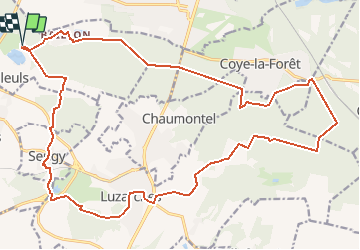
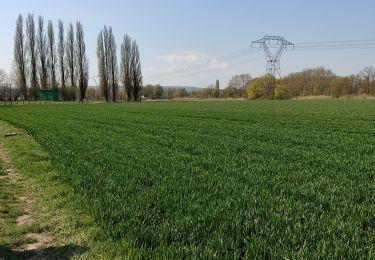
Randonnée Marche de 25 km à découvrir à Île-de-France, Val-d'Oise, Asnières-sur-Oise. Cette randonnée est proposée par tracegps.
Description
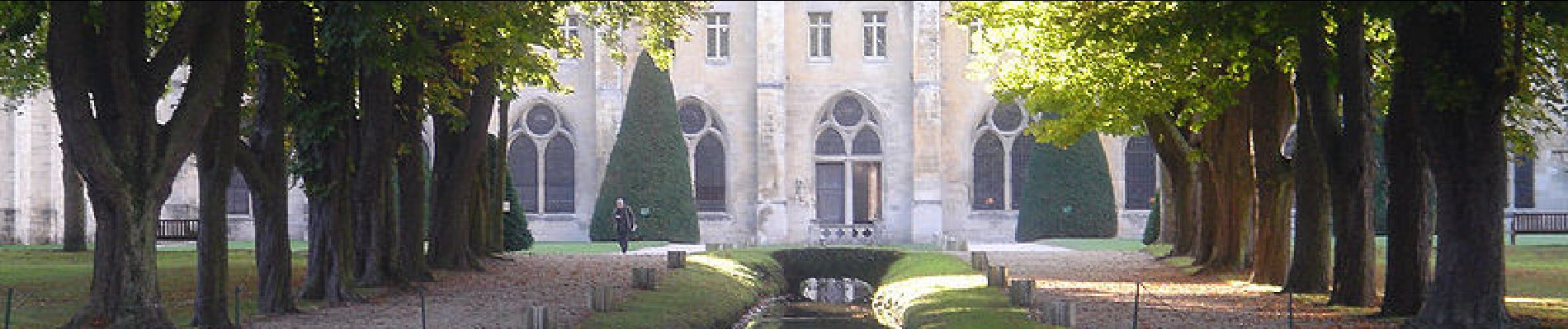
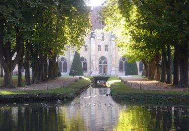
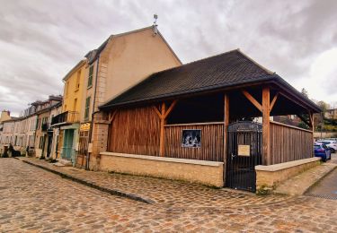
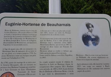
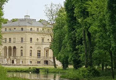
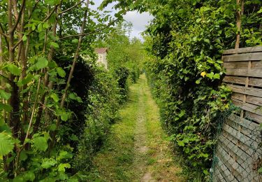
Parking : Abbaye de Royaumont. Seule l'église ayant été détruite, Royaumont constitue l'ensemble cistercien le plus grand et le plus complet en Île-de-France. L'abbaye est ouverte au public tous les jours, toute l'année. (visite libre ou guidée) Descriptif : GR, Baillon, route de la Chaussée-du-Roi ... nb, poteau de Bertinval, carrefour de Lamorlaye, carrefour du Bois-Brandin, carrefour des Ecouteurs, route des bordures de la Charmée, carrefour du crochet de Coye .... GR1carrefour du Chène Sec, carrefour des Moines, carrefour de Luzarche, carrefour de la Ménagerie, Mare des Quatorze Arpents, Luzarches (18), le Fort à Faire .... nb, Golf .... GR1 Seugy .... PR17, Royaumont. Des sentiers ont pu être modifiés depuis la dernière validation et les itinéraires proposés n’engagent pas la responsabilité du Comité. Signalez-nous les modifications rencontrées pour mise à jour de la randothèque.
Localisation
Commentaires
Randonnées à proximité
![Randonnée Marche Boran-sur-Oise - randonnée abbaye de Royaumont - Photo](https://media.geolcdn.com/t/375/260/9e39e4a0-eda1-4b72-bd45-4ab1609b4c88.jpg&format=jpg&maxdim=2)
![Marche Marche](https://static1.geolcdn.com/sitytour/trail-icons/101.png)
Marche
![](/images/other/stat-length.png)
![](https://static1.geolcdn.com/siteimages/upload/files/16400158638029165_repeat_loop_refresh_sync_direction_icon.png)
![Randonnée Marche Luzarches - Autour d'Orry la Ville - Photo](https://media.geolcdn.com/t/375/260/ext.jpg?maxdim=2&url=https%3A%2F%2Fservices.sitytrail.com%2FGeolivesWS%2FDownloadMedia.ashx%3FTrailID%3D110190%26Media%3D5411_1.jpg)
![Marche Marche](https://static1.geolcdn.com/sitytour/trail-icons/101.png)
Marche
![](/images/other/stat-length.png)
![](https://static1.geolcdn.com/siteimages/upload/files/16400158638029165_repeat_loop_refresh_sync_direction_icon.png)
![Randonnée Marche Viarmes - Autour de l'Abbaye de Royaumont en bord de l'Oise - Photo](https://media.geolcdn.com/t/375/260/ext.jpg?maxdim=2&url=https%3A%2F%2Fservices.sitytrail.com%2FGeolivesWS%2FDownloadMedia.ashx%3FTrailID%3D102743%26Media%3D3879_1.jpg)
![Marche Marche](https://static1.geolcdn.com/sitytour/trail-icons/101.png)
Marche
![](/images/other/stat-length.png)
![](https://static1.geolcdn.com/siteimages/upload/files/16400158638029165_repeat_loop_refresh_sync_direction_icon.png)
![Randonnée Marche Luzarches - Boucle 30 km le trèfle de Luzarches - Photo](https://media.geolcdn.com/t/375/260/a3bd6216-c6bc-4af1-9eae-87e3706e4d02.jpg&format=jpg&maxdim=2)
![Marche Marche](https://static1.geolcdn.com/sitytour/trail-icons/101.png)
Marche
![](/images/other/stat-length.png)
![](https://static1.geolcdn.com/siteimages/upload/files/16400158638029165_repeat_loop_refresh_sync_direction_icon.png)
![Randonnée Marche Boran-sur-Oise - boran Le Lys - Photo](https://media.geolcdn.com/t/375/260/4819a07e-0b5c-4197-bc24-63181ff51320.jpg&format=jpg&maxdim=2)
![Marche Marche](https://static1.geolcdn.com/sitytour/trail-icons/101.png)
Marche
![](/images/other/stat-length.png)
![](https://static1.geolcdn.com/siteimages/upload/files/16400158638029165_repeat_loop_refresh_sync_direction_icon.png)
![Randonnée Marche Viarmes - VIARMES BOUCLE 14 KM - Photo](https://media.geolcdn.com/t/375/260/ext.jpg?maxdim=2&url=https%3A%2F%2Fstatic1.geolcdn.com%2Fsiteimages%2Fupload%2Ffiles%2F1553511878bg_sport_marche.png)
![Marche Marche](https://static1.geolcdn.com/sitytour/trail-icons/101.png)
Marche
![](/images/other/stat-length.png)
![](https://static1.geolcdn.com/siteimages/upload/files/16400158638029165_repeat_loop_refresh_sync_direction_icon.png)
![Randonnée Marche Asnières-sur-Oise - Grand tour de L'Abaye de Royaumont - Photo](https://media.geolcdn.com/t/375/260/748ebf9a-fe1f-4910-8542-5c05e8fce163.jpg&format=jpg&maxdim=2)
![Marche Marche](https://static1.geolcdn.com/sitytour/trail-icons/101.png)
Marche
![](/images/other/stat-length.png)
![](https://static1.geolcdn.com/siteimages/upload/files/16400158638029165_repeat_loop_refresh_sync_direction_icon.png)
![Randonnée Marche Noisy-sur-Oise - forêt de carnelle - Photo](https://media.geolcdn.com/t/375/260/1d38ae56-1525-4792-8527-98abbf8f2f7b.jpg&format=jpg&maxdim=2)
![Marche Marche](https://static1.geolcdn.com/sitytour/trail-icons/101.png)
Marche
![](/images/other/stat-length.png)
![](https://static1.geolcdn.com/siteimages/upload/files/16400158638029165_repeat_loop_refresh_sync_direction_icon.png)
![Randonnée Marche Boran-sur-Oise - randonnée de precy entre campagne et le long de l oise - Photo](https://media.geolcdn.com/t/375/260/6b4b8490-f027-4df3-8fd9-e515b13b2b69.jpg&format=jpg&maxdim=2)
![Marche Marche](https://static1.geolcdn.com/sitytour/trail-icons/101.png)
Marche
![](/images/other/stat-length.png)
![](https://static1.geolcdn.com/siteimages/upload/files/16400158638029165_repeat_loop_refresh_sync_direction_icon.png)
Novembre 2017 joli ballade en mode trail