![](/images/other/stat-length.png)
![Randonnée Vélo Villefort - Granite Mont Lozère édition 2009 - 98 km - Photo](https://media.geolcdn.com/t/1900/400/ext.pjpeg?maxdim=2&url=https%3A%2F%2Fservices.sitytrail.com%2FGeolivesWS%2FDownloadMedia.ashx%3FTrailID%3D109796%26Media%3D4730_1.jpg)
Granite Mont Lozère édition 2009 - 98 km
tracegps
Utilisateur
![Longueur](/images/other/stat-length.png)
![Altitude max](https://static1.geolcdn.com/siteimages/upload/files/1508320355ic_sort_altitude_max_24dp.png)
![Dénivelé positif](https://static1.geolcdn.com/siteimages/upload/files/1508320355ic_sort_den_pos_24dp.png)
![Km-Effort](/images/other/stat-length.png)
![Altitude min](https://static1.geolcdn.com/siteimages/upload/files/1508320355ic_sort_altitude_min_24dp.png)
![Dénivelé négatif](https://static1.geolcdn.com/siteimages/upload/files/1508320355ic_sort_den_neg_24dp.png)
![Boucle](https://static1.geolcdn.com/siteimages/upload/files/16400158638029165_repeat_loop_refresh_sync_direction_icon.png)
![Vélo](https://static1.geolcdn.com/sitytour/trail-icons/200.png)
4h00
Difficulté : Très difficile
![Scannez ce code QR pour ouvrir la randonnée dans l'application SityTrail](https://capi.geolives.com/qq0zvz2zws4bq2lad0pu/sitytour/trails/109796/qr.png?size=200)
Application GPS de randonnée GRATUITE
À propos
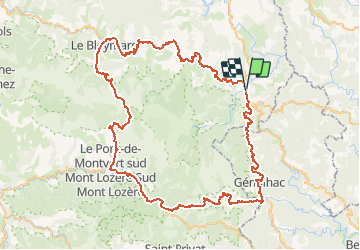
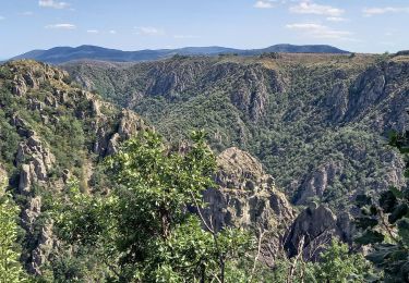
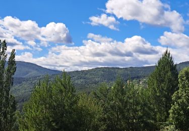
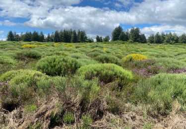
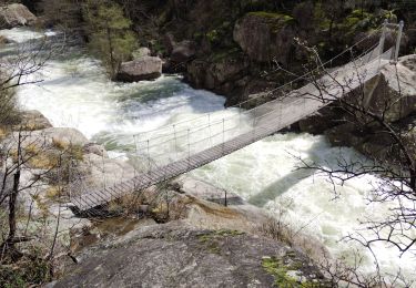
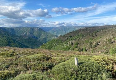
Randonnée Vélo de 96 km à découvrir à Occitanie, Lozère, Villefort. Cette randonnée est proposée par tracegps.
Description
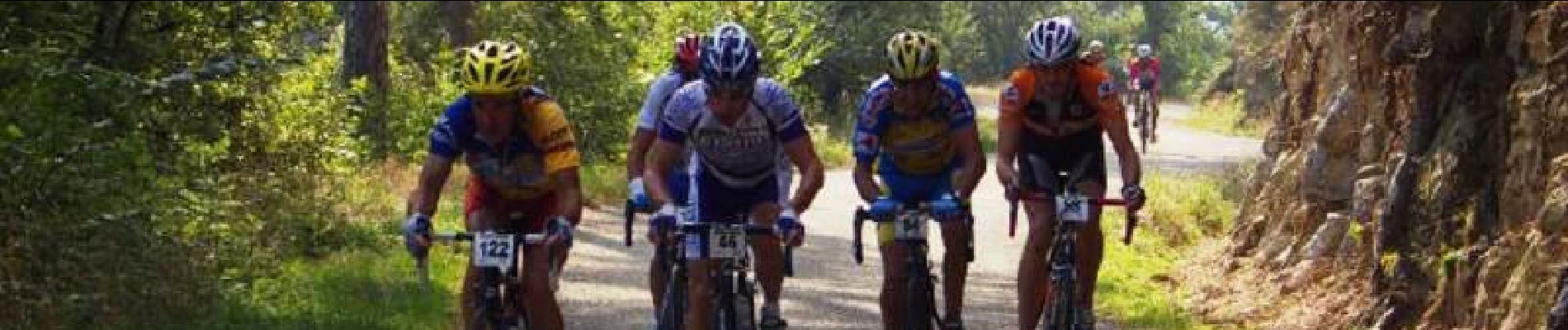
Granite Mont Lozère édition 2009 – 98 km Les 23 et 24 Mai 2009 L’évènement est repris depuis 2008 par LVO (Ludovic Valentin Organisation), structure professionnelle de l’évènementiel sportif spécialisé dans le cyclisme (Transmaurienne-Sybelles, Arvan Villards, Arabian Trophy). L’année 2009 sera l’année de la confirmation pour la Granite Mont Lozère. Le premier objectif sera de continuer à relancer cette épreuve qui enregistre déjà une augmentation intéressante entre 2006 et 2008. L’épreuve est inscrite au calendrier du challenge national « Cyclo’tour » et y figure comme la troisième manche, après l’ouverture de saison faite dans le Vaucluse, et la Lozérienne qui aura eu lieu le mois précédent. En continuant de baser l’épreuve en centre ville de Villefort (place du Bosquet) le 14 Juin prochain, l’accueil des coureurs sera à son meilleur niveau : un site accessible, au coeur de la vie du village. La collaboration avec l’AASCL, association locale de Villefort, sera bien entendue toujours à l’ordre du jour.
Localisation
Commentaires
Randonnées à proximité
![Randonnée Marche Pied-de-Borne - GRP Tour du Chassezac en 2 jours - Photo](https://media.geolcdn.com/t/375/260/4939cb41-dd3b-4cb9-aebc-74687e919567.jpg&format=jpg&maxdim=2)
![Marche Marche](https://static1.geolcdn.com/sitytour/trail-icons/101.png)
Marche
![](/images/other/stat-length.png)
![](https://static1.geolcdn.com/siteimages/upload/files/16400158638029165_repeat_loop_refresh_sync_direction_icon.png)
![Randonnée A pied Malons-et-Elze - GR 44 - Photo](https://media.geolcdn.com/t/375/260/f0c265fe-7de1-43be-8da0-90c630caf3a2.jpeg&format=jpg&maxdim=2)
![A pied A pied](https://static1.geolcdn.com/sitytour/trail-icons/100.png)
![Randonnée Marche Pourcharesses - au coeur des gorges du chassezac au départ de Villefort - Photo](https://media.geolcdn.com/t/375/260/648a2635-721c-411c-9b65-d15697fb8c14.jpg&format=jpg&maxdim=2)
![Marche Marche](https://static1.geolcdn.com/sitytour/trail-icons/101.png)
Marche
![](/images/other/stat-length.png)
![](https://static1.geolcdn.com/siteimages/upload/files/16400158638029165_repeat_loop_refresh_sync_direction_icon.png)
![Randonnée Marche Ponteils-et-Brésis - Nord haute Vallee de la Cèze - Photo](https://media.geolcdn.com/t/375/260/a0978cc5-8b4f-4e02-8320-6c6f5bf7123f.jpg&format=jpg&maxdim=2)
![Marche Marche](https://static1.geolcdn.com/sitytour/trail-icons/101.png)
Marche
![](/images/other/stat-length.png)
![](https://static1.geolcdn.com/siteimages/upload/files/16400158638029165_repeat_loop_refresh_sync_direction_icon.png)
![Randonnée Marche Ponteils-et-Brésis - Bour a es - Photo](https://media.geolcdn.com/t/375/260/33860b35-ef26-4087-9dbf-1e7324b8575e.jpg&format=jpg&maxdim=2)
![Marche Marche](https://static1.geolcdn.com/sitytour/trail-icons/101.png)
Marche
![](/images/other/stat-length.png)
![](https://static1.geolcdn.com/siteimages/upload/files/16400158638029165_repeat_loop_refresh_sync_direction_icon.png)
![Randonnée Marche Prévenchères - Gorges de Chassezac - Photo](https://media.geolcdn.com/t/375/260/49ddc4e4-e66c-491b-9c51-4f66b0d6413a.jpg&format=jpg&maxdim=2)
![Marche Marche](https://static1.geolcdn.com/sitytour/trail-icons/101.png)
Marche
![](/images/other/stat-length.png)
![](https://static1.geolcdn.com/siteimages/upload/files/16400158638029165_repeat_loop_refresh_sync_direction_icon.png)
![Randonnée Marche Pied-de-Borne - Le tour du Chassezac - Photo](https://media.geolcdn.com/t/375/260/befb1c71-a310-40db-8e8f-df4d5ec91bd5.jpg&format=jpg&maxdim=2)
![Marche Marche](https://static1.geolcdn.com/sitytour/trail-icons/101.png)
Marche
![](/images/other/stat-length.png)
![](https://static1.geolcdn.com/siteimages/upload/files/16400158638029165_repeat_loop_refresh_sync_direction_icon.png)
![Randonnée Marche Pied-de-Borne - Le tour du chassezac - Photo](https://media.geolcdn.com/t/375/260/34d1863b-5946-4591-908e-d59df5d48945.jpg&format=jpg&maxdim=2)
![Marche Marche](https://static1.geolcdn.com/sitytour/trail-icons/101.png)
Marche
![](/images/other/stat-length.png)
![](https://static1.geolcdn.com/siteimages/upload/files/16400158638029165_repeat_loop_refresh_sync_direction_icon.png)
![Randonnée Marche Prévenchères - La garde guerin - Photo](https://media.geolcdn.com/t/375/260/f4d5d102-7541-4721-bc49-35572d8c8339.jpg&format=jpg&maxdim=2)
![Marche Marche](https://static1.geolcdn.com/sitytour/trail-icons/101.png)
Marche
![](/images/other/stat-length.png)
![](https://static1.geolcdn.com/siteimages/upload/files/16400158638029165_repeat_loop_refresh_sync_direction_icon.png)