![](/images/other/stat-length.png)
![Randonnée Marche Faverges-Seythenex - D'Albertville à Thônes 2/4 - La Dent de Cons - Photo](https://media.geolcdn.com/t/1900/400/ext.pjpeg?maxdim=2&url=https%3A%2F%2Fservices.sitytrail.com%2FGeolivesWS%2FDownloadMedia.ashx%3FTrailID%3D109631%26Media%3D4272_1.jpg)
D'Albertville à Thônes 2/4 - La Dent de Cons
tracegps
Utilisateur
![Longueur](/images/other/stat-length.png)
![Altitude max](https://static1.geolcdn.com/siteimages/upload/files/1508320355ic_sort_altitude_max_24dp.png)
![Dénivelé positif](https://static1.geolcdn.com/siteimages/upload/files/1508320355ic_sort_den_pos_24dp.png)
![Km-Effort](/images/other/stat-length.png)
![Altitude min](https://static1.geolcdn.com/siteimages/upload/files/1508320355ic_sort_altitude_min_24dp.png)
![Dénivelé négatif](https://static1.geolcdn.com/siteimages/upload/files/1508320355ic_sort_den_neg_24dp.png)
![Boucle](https://static1.geolcdn.com/siteimages/upload/files/16400158638029165_repeat_loop_refresh_sync_direction_icon.png)
![Marche](https://static1.geolcdn.com/sitytour/trail-icons/101.png)
8h30
Difficulté : Très difficile
![Scannez ce code QR pour ouvrir la randonnée dans l'application SityTrail](https://capi.geolives.com/qq0zvz2zws4bq2lad0pu/sitytour/trails/109631/qr.png?size=200)
Application GPS de randonnée GRATUITE
À propos
Randonnée Marche de 16,7 km à découvrir à Auvergne-Rhône-Alpes, Haute-Savoie, Faverges-Seythenex. Cette randonnée est proposée par tracegps.
Description
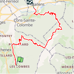
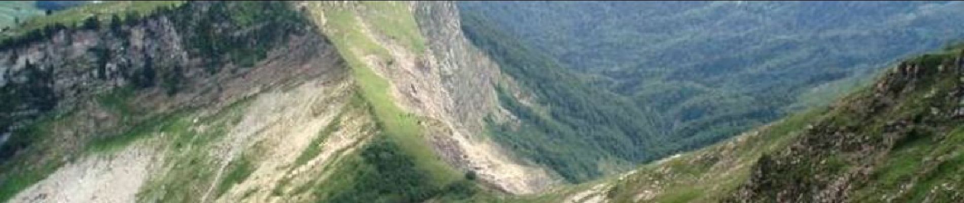
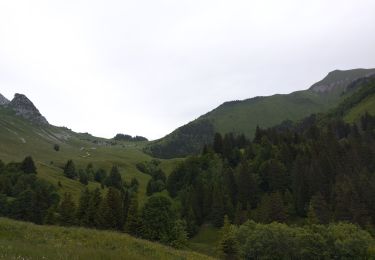
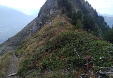
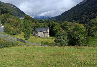
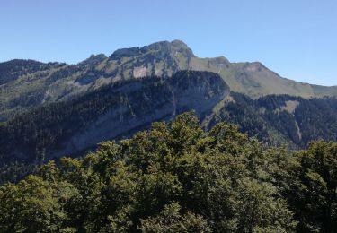
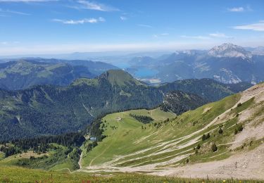
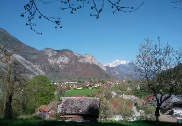
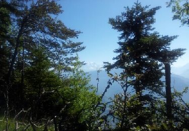
D'Albertville à Thônes 2/4 - La Dent de Cons. L'étape 2 de notre périple, un départ depuis le camping du hameau "Les combes" sur la commune de Seythenex, pour une arrivée au camping Champ Tillet situé sur la commune de Marlens. L'objectif de notre journée est l'ascension de la Dents de Cons, un sommet du massif des Bauges culminant à 2062 m d'altitude. Retrouvez toutes les informations nécessaires sur le site de la Communauté des Crapahuteurs.
Localisation
Commentaires
Randonnées à proximité
![Randonnée Marche Plancherine - chalet de Drison à nant fourchu - Photo](https://media.geolcdn.com/t/375/260/6cfabcdf-e1f7-4c6d-be83-f3ce4d597931.jpg&format=jpg&maxdim=2)
![Marche Marche](https://static1.geolcdn.com/sitytour/trail-icons/101.png)
Marche
![](/images/other/stat-length.png)
![](https://static1.geolcdn.com/siteimages/upload/files/16400158638029165_repeat_loop_refresh_sync_direction_icon.png)
![Randonnée Ski de randonnée Faverges-Seythenex - Petite et Grande Chaurionde - Photo](https://media.geolcdn.com/t/375/260/eb9a44ae-0646-4386-b2a9-3c1353bf0112.jpg&format=jpg&maxdim=2)
![Ski de randonnée Ski de randonnée](https://static1.geolcdn.com/sitytour/trail-icons/503.png)
Ski de randonnée
![](/images/other/stat-length.png)
![](https://static1.geolcdn.com/siteimages/upload/files/16400158638029165_repeat_loop_refresh_sync_direction_icon.png)
![Randonnée Marche Marthod - Dent de Cons en boucle depuis Raffort - Photo](https://media.geolcdn.com/t/375/260/539a6901-e25f-4c28-a19b-41b061e5bac8.jpg&format=jpg&maxdim=2)
![Marche Marche](https://static1.geolcdn.com/sitytour/trail-icons/101.png)
Marche
![](/images/other/stat-length.png)
![](https://static1.geolcdn.com/siteimages/upload/files/16400158638029165_repeat_loop_refresh_sync_direction_icon.png)
![Randonnée Marche Plancherine - Abbaye de Tamié - Photo](https://media.geolcdn.com/t/375/260/7088dfc5-4e98-4cdc-8284-f4a0e9c46a34.jpg&format=jpg&maxdim=2)
![Marche Marche](https://static1.geolcdn.com/sitytour/trail-icons/101.png)
Marche
![](/images/other/stat-length.png)
![](https://static1.geolcdn.com/siteimages/upload/files/16400158638029165_repeat_loop_refresh_sync_direction_icon.png)
![Randonnée Marche Faverges-Seythenex - POINTE DU VELAN - Photo](https://media.geolcdn.com/t/375/260/a7685b36-8822-42a5-a226-95faacbc8e99.jpg&format=jpg&maxdim=2)
![Marche Marche](https://static1.geolcdn.com/sitytour/trail-icons/101.png)
Marche
![](/images/other/stat-length.png)
![](https://static1.geolcdn.com/siteimages/upload/files/16400158638029165_repeat_loop_refresh_sync_direction_icon.png)
![Randonnée Marche Faverges-Seythenex - tour de Sambuy - Photo](https://media.geolcdn.com/t/375/260/cc7bad7b-614b-4f7f-8c28-27e1bf83f8f4.jpg&format=jpg&maxdim=2)
![Marche Marche](https://static1.geolcdn.com/sitytour/trail-icons/101.png)
Marche
![](/images/other/stat-length.png)
![](https://static1.geolcdn.com/siteimages/upload/files/16400158638029165_repeat_loop_refresh_sync_direction_icon.png)
![Randonnée Marche Faverges-Seythenex - la fosse a l'ours depuis Prafeu - Photo](https://media.geolcdn.com/t/375/260/ext.jpg?maxdim=2&url=https%3A%2F%2Fservices.sitytrail.com%2FGeolivesWS%2FDownloadMedia.ashx%3FTrailID%3D728462%26Media%3Dfix__20170407155905.jpg)
![Marche Marche](https://static1.geolcdn.com/sitytour/trail-icons/101.png)
Marche
![](/images/other/stat-length.png)
![](https://static1.geolcdn.com/siteimages/upload/files/16400158638029165_repeat_loop_refresh_sync_direction_icon.png)
![Randonnée Marche Marthod - Le fort de la batterie - Photo](https://media.geolcdn.com/t/375/260/ext.jpg?maxdim=2&url=https%3A%2F%2Fservices.sitytrail.com%2FGeolivesWS%2FDownloadMedia.ashx%3FTrailID%3D216091%26Media%3Dfix__20130821104335.jpg)
![Marche Marche](https://static1.geolcdn.com/sitytour/trail-icons/101.png)
Marche
![](/images/other/stat-length.png)
![](https://static1.geolcdn.com/siteimages/upload/files/16400158638029165_repeat_loop_refresh_sync_direction_icon.png)
![Randonnée Autre activité Mercury - très vite - Photo](https://media.geolcdn.com/t/375/260/ext.jpg?maxdim=2&url=https%3A%2F%2Fservices.sitytrail.com%2FGeolivesWS%2FDownloadMedia.ashx%3FTrailID%3D168379%26Media%3D20130102150348.jpeg)
![Autre activité Autre activité](https://static1.geolcdn.com/sitytour/trail-icons/900.png)
Autre activité
![](/images/other/stat-length.png)
![](https://static1.geolcdn.com/siteimages/upload/files/16400158638029165_repeat_loop_refresh_sync_direction_icon.png)