![](/images/other/stat-length.png)
![Randonnée Marche Sainte-Foy-d'Aigrefeuille - Ste Foy d'Aigrefeuille - Photo](https://media.geolcdn.com/t/1900/400/ext.pjpeg?maxdim=2&url=https%3A%2F%2Fservices.sitytrail.com%2FGeolivesWS%2FDownloadMedia.ashx%3FTrailID%3D109615%26Media%3D4237_2.jpg)
Ste Foy d'Aigrefeuille
tracegps
Utilisateur
![Longueur](/images/other/stat-length.png)
![Altitude max](https://static1.geolcdn.com/siteimages/upload/files/1508320355ic_sort_altitude_max_24dp.png)
![Dénivelé positif](https://static1.geolcdn.com/siteimages/upload/files/1508320355ic_sort_den_pos_24dp.png)
![Km-Effort](/images/other/stat-length.png)
![Altitude min](https://static1.geolcdn.com/siteimages/upload/files/1508320355ic_sort_altitude_min_24dp.png)
![Dénivelé négatif](https://static1.geolcdn.com/siteimages/upload/files/1508320355ic_sort_den_neg_24dp.png)
![Boucle](https://static1.geolcdn.com/siteimages/upload/files/16400158638029165_repeat_loop_refresh_sync_direction_icon.png)
![Marche](https://static1.geolcdn.com/sitytour/trail-icons/101.png)
1h19
Difficulté : Facile
![Scannez ce code QR pour ouvrir la randonnée dans l'application SityTrail](https://capi.geolives.com/qq0zvz2zws4bq2lad0pu/sitytour/trails/109615/qr.png?size=200)
Application GPS de randonnée GRATUITE
À propos
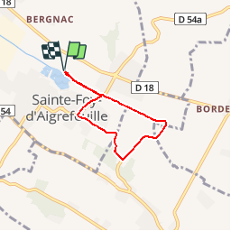
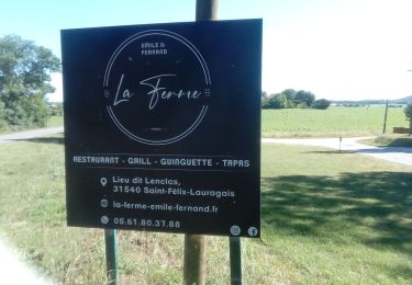
Randonnée Marche de 5,1 km à découvrir à Occitanie, Haute-Garonne, Sainte-Foy-d'Aigrefeuille. Cette randonnée est proposée par tracegps.
Description
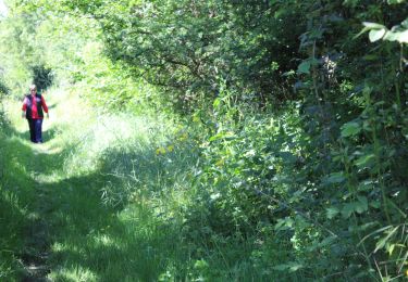
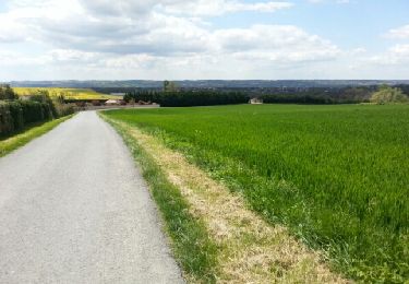
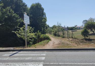
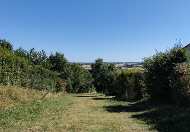
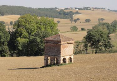
Depuis le parking, monter sur la butte verdoyante pour découvrir le Lac du Val de Saune et partir vers l'extrémité Est pour passer rive gauche et suivre la Saune. Après 500m, passer sur l'autre rive du ruisseau puis longer le Stade et les cultures. En arrivant vers une habitation, on doit s'écarter de la Saune en longeant les cultures pour arriver sur un chemin goudronné en face d'un ancien moulin (0:35). Prendre à droite et passer le pont puis continuer sur le goudron. On passe vers En Farines, Le Pastre puis on tourne à droite au niveau de Borde Blanche (0:45). On passe Fréchin puis on tourne à droite à Vianey sur la D54a pour rejoindre les bords de la Saune. On revient sur le Lac et on retrouve le parking de départ (1:15).
Localisation
Commentaires
Randonnées à proximité
![Randonnée V.T.T. Escalquens - Rando VTT Escalquens Odars Fourquevaux - Photo](https://media.geolcdn.com/t/375/260/c355d7da-b006-4ed5-9c42-8be1387ee52a.jpg&format=jpg&maxdim=2)
![V.T.T. V.T.T.](https://static1.geolcdn.com/sitytour/trail-icons/202.png)
V.T.T.
![](/images/other/stat-length.png)
![](https://static1.geolcdn.com/siteimages/upload/files/16400158638029165_repeat_loop_refresh_sync_direction_icon.png)
![Randonnée Marche Vallesvilles - 18/02/20 - Photo](https://media.geolcdn.com/t/375/260/6fe1ca48-6ffe-45d3-bef9-c097c5027feb.jpg&format=jpg&maxdim=2)
![Marche Marche](https://static1.geolcdn.com/sitytour/trail-icons/101.png)
Marche
![](/images/other/stat-length.png)
![](https://static1.geolcdn.com/siteimages/upload/files/16400158638029165_repeat_loop_refresh_sync_direction_icon.png)
![Marche Marche](https://static1.geolcdn.com/sitytour/trail-icons/101.png)
Marche
![](/images/other/stat-length.png)
![](https://static1.geolcdn.com/siteimages/upload/files/16400158638029165_repeat_loop_refresh_sync_direction_icon.png)
![Randonnée V.T.T. Escalquens - Escalquens Auzielle - Photo](https://media.geolcdn.com/t/375/260/ext.jpg?maxdim=2&url=https%3A%2F%2Fservices.sitytrail.com%2FGeolivesWS%2FDownloadMedia.ashx%3FTrailID%3D186730%26Media%3D20130422140246.jpeg)
![V.T.T. V.T.T.](https://static1.geolcdn.com/sitytour/trail-icons/202.png)
V.T.T.
![](/images/other/stat-length.png)
![](https://static1.geolcdn.com/siteimages/upload/files/16400158638029165_repeat_loop_refresh_sync_direction_icon.png)
![Randonnée Marche Odars - Un beau paquet d'Auzielle - Photo](https://media.geolcdn.com/t/375/260/ext.jpg?maxdim=2&url=https%3A%2F%2Fstatic1.geolcdn.com%2Fsiteimages%2Fupload%2Ffiles%2F1553511878bg_sport_marche.png)
![Marche Marche](https://static1.geolcdn.com/sitytour/trail-icons/101.png)
Marche
![](/images/other/stat-length.png)
![](https://static1.geolcdn.com/siteimages/upload/files/16400158638029165_repeat_loop_refresh_sync_direction_icon.png)
![Randonnée V.T.T. Escalquens - Randonnée Odars Auzielle Escalquens Jacques Prévert - Photo](https://media.geolcdn.com/t/375/260/8b13d648-9efa-4380-bca9-d4b87a24e7f9.jpg&format=jpg&maxdim=2)
![V.T.T. V.T.T.](https://static1.geolcdn.com/sitytour/trail-icons/202.png)
V.T.T.
![](/images/other/stat-length.png)
![](https://static1.geolcdn.com/siteimages/upload/files/16400158638029165_repeat_loop_refresh_sync_direction_icon.png)
![Randonnée V.T.T. Escalquens - VTT Escalquens Odars - Photo](https://media.geolcdn.com/t/375/260/968a61f0-b043-4ff6-a00b-27ccaa1edb4c.jpg&format=jpg&maxdim=2)
![V.T.T. V.T.T.](https://static1.geolcdn.com/sitytour/trail-icons/202.png)
V.T.T.
![](/images/other/stat-length.png)
![](https://static1.geolcdn.com/siteimages/upload/files/16400158638029165_repeat_loop_refresh_sync_direction_icon.png)
![Randonnée Marche Préserville - c2pa_lenclas_280622 - Photo](https://media.geolcdn.com/t/375/260/5a949175-3eb1-4659-a64c-5f487403fb5a.jpg&format=jpg&maxdim=2)
![Marche Marche](https://static1.geolcdn.com/sitytour/trail-icons/101.png)
Marche
![](/images/other/stat-length.png)
![](https://static1.geolcdn.com/siteimages/upload/files/16400158638029165_repeat_loop_refresh_sync_direction_icon.png)
![Randonnée A pied Odars - Boucle de la Marcaissonne - Photo](https://media.geolcdn.com/t/375/260/fbb94ecb-2fe3-49f4-8e5d-0f94bab4ff9b.jpeg&format=jpg&maxdim=2)
![A pied A pied](https://static1.geolcdn.com/sitytour/trail-icons/100.png)
A pied
![](/images/other/stat-length.png)
![](https://static1.geolcdn.com/siteimages/upload/files/16400158638029165_repeat_loop_refresh_sync_direction_icon.png)