![](/images/other/stat-length.png)
![Randonnée Marche Moirans-en-Montagne - Moirans en Montagne - Saint Maurice - Photo](https://media.geolcdn.com/t/1900/400/ext.pjpeg?maxdim=2&url=https%3A%2F%2Fservices.sitytrail.com%2FGeolivesWS%2FDownloadMedia.ashx%3FTrailID%3D109604%26Media%3D4216_1.jpg)
Moirans en Montagne - Saint Maurice
tracegps
Utilisateur
![Longueur](/images/other/stat-length.png)
![Altitude max](https://static1.geolcdn.com/siteimages/upload/files/1508320355ic_sort_altitude_max_24dp.png)
![Dénivelé positif](https://static1.geolcdn.com/siteimages/upload/files/1508320355ic_sort_den_pos_24dp.png)
![Km-Effort](/images/other/stat-length.png)
![Altitude min](https://static1.geolcdn.com/siteimages/upload/files/1508320355ic_sort_altitude_min_24dp.png)
![Dénivelé négatif](https://static1.geolcdn.com/siteimages/upload/files/1508320355ic_sort_den_neg_24dp.png)
![Boucle](https://static1.geolcdn.com/siteimages/upload/files/16400158638029165_repeat_loop_refresh_sync_direction_icon.png)
![Marche](https://static1.geolcdn.com/sitytour/trail-icons/101.png)
5h30
Difficulté : Difficile
![Scannez ce code QR pour ouvrir la randonnée dans l'application SityTrail](https://capi.geolives.com/qq0zvz2zws4bq2lad0pu/sitytour/trails/109604/qr.png?size=200)
Application GPS de randonnée GRATUITE
À propos
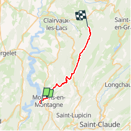
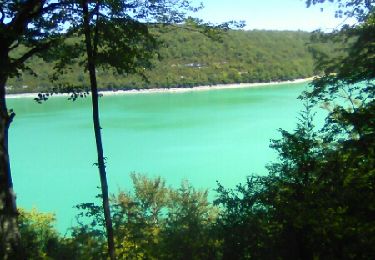
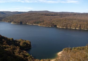
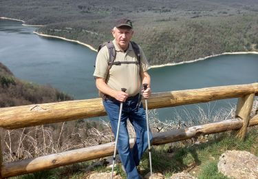
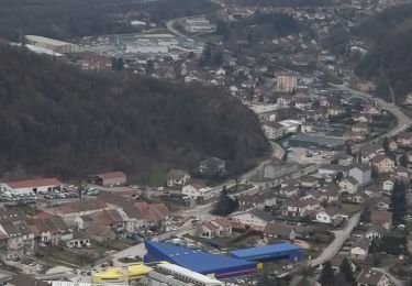
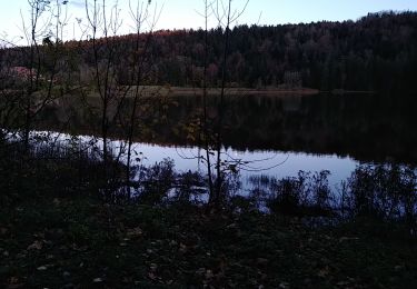
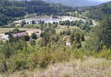
Randonnée Marche de 25 km à découvrir à Bourgogne-Franche-Comté, Jura, Moirans-en-Montagne. Cette randonnée est proposée par tracegps.
Description
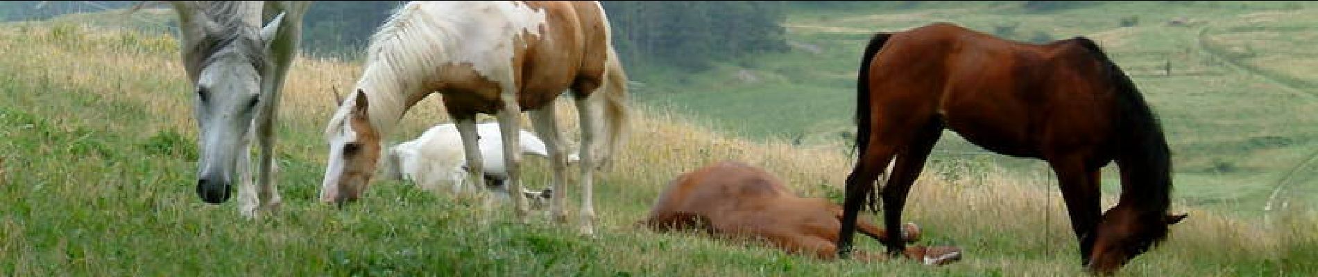
Moirans en Montagne - Saint Maurice. L’association du Jura du Grand Huit est née en 1987, elle est spécialisée alors dans la rando à cheval. Elle regroupe des hébergements de randonnée, des professionnels équestres proposant des séjours cheval (rando accompagnées, stages, roulottes…) et des bénévoles baliseurs. Elle entretient, balise et aménage les itinéraires équestres sur le département du Jura. Ses itinéraires sont accessibles aux cavaliers et aux marcheurs, ils permettent de parcourir l’ensemble du département, de la Bresse Jurassienne aux Hautes Combes en passant par le vignoble, les lacs et les plateaux. Le Grand Huit vous propose des idées de séjours en boucle de 2 à plusieurs jours. De multiples possibilités vous sont offertes, vous trouverez sur le site quelques propositions non exhaustives. Attention, les itinéraires peuvent changer d’une année à l’autre et subir des modifications.
Localisation
Commentaires
Randonnées à proximité
![Randonnée Marche Cernon - Cernon-bords de l'Ain - Photo](https://media.geolcdn.com/t/375/260/ext.jpg?maxdim=2&url=https%3A%2F%2Fservices.sitytrail.com%2FGeolivesWS%2FDownloadMedia.ashx%3FTrailID%3D791839%26Media%3Dfix__20170718122731.jpg)
![Marche Marche](https://static1.geolcdn.com/sitytour/trail-icons/101.png)
Marche
![](/images/other/stat-length.png)
![](https://static1.geolcdn.com/siteimages/upload/files/16400158638029165_repeat_loop_refresh_sync_direction_icon.png)
![Randonnée Marche Moirans-en-Montagne - Le Regardoir - Photo](https://media.geolcdn.com/t/375/260/2e2d2c64-b4bd-48ba-80a1-644324bc25bf.jpg&format=jpg&maxdim=2)
![Marche Marche](https://static1.geolcdn.com/sitytour/trail-icons/101.png)
Marche
![](/images/other/stat-length.png)
![](https://static1.geolcdn.com/siteimages/upload/files/16400158638029165_repeat_loop_refresh_sync_direction_icon.png)
![Randonnée Marche Martigna - rando a martgna dans le jura - Photo](https://media.geolcdn.com/t/375/260/6b33a252-c3e7-4c5b-8119-3accb2705ee1.jpg&format=jpg&maxdim=2)
![Marche Marche](https://static1.geolcdn.com/sitytour/trail-icons/101.png)
Marche
![](/images/other/stat-length.png)
![](https://static1.geolcdn.com/siteimages/upload/files/16400158638029165_repeat_loop_refresh_sync_direction_icon.png)
![Randonnée Marche Villards-d'Héria - Villard La vierge Tête d'Henri IV - Photo](https://media.geolcdn.com/t/375/260/bbf39f0f-4e97-453a-9b61-f28b822d2e71.jpg&format=jpg&maxdim=2)
![Marche Marche](https://static1.geolcdn.com/sitytour/trail-icons/101.png)
Marche
![](/images/other/stat-length.png)
![](https://static1.geolcdn.com/siteimages/upload/files/16400158638029165_repeat_loop_refresh_sync_direction_icon.png)
![Randonnée Randonnée équestre Moirans-en-Montagne - Jura_moirans_J1 - Photo](https://media.geolcdn.com/t/375/260/ext.jpg?maxdim=2&url=https%3A%2F%2Fstatic1.geolcdn.com%2Fsiteimages%2Fupload%2Ffiles%2F1524743154cheval.jpg)
![Randonnée équestre Randonnée équestre](https://static1.geolcdn.com/sitytour/trail-icons/301.png)
Randonnée équestre
![](/images/other/stat-length.png)
![](https://static1.geolcdn.com/siteimages/upload/files/16400158638029165_repeat_loop_refresh_sync_direction_icon.png)
![Randonnée Marche Villards-d'Héria - lac d'Antre Belvédère de Scia - Photo](https://media.geolcdn.com/t/375/260/6cd2b4bc-9d84-4485-b770-90954281a052.jpg&format=jpg&maxdim=2)
![Marche Marche](https://static1.geolcdn.com/sitytour/trail-icons/101.png)
Marche
![](/images/other/stat-length.png)
![](https://static1.geolcdn.com/siteimages/upload/files/16400158638029165_repeat_loop_refresh_sync_direction_icon.png)
![Randonnée Marche Villards-d'Héria - lac d antre - Photo](https://media.geolcdn.com/t/375/260/80be7616-6067-46a5-8c84-8aeff2838ece.jpg&format=jpg&maxdim=2)
![Marche Marche](https://static1.geolcdn.com/sitytour/trail-icons/101.png)
Marche
![](/images/other/stat-length.png)
![](https://static1.geolcdn.com/siteimages/upload/files/16400158638029165_repeat_loop_refresh_sync_direction_icon.png)
![Randonnée Marche Lect - voiglans - Photo](https://media.geolcdn.com/t/375/260/e17b03e5-b38e-4542-a2e2-43114f80d1b7.jpg&format=jpg&maxdim=2)
![Marche Marche](https://static1.geolcdn.com/sitytour/trail-icons/101.png)
Marche
![](/images/other/stat-length.png)
![](https://static1.geolcdn.com/siteimages/upload/files/16400158638029165_repeat_loop_refresh_sync_direction_icon.png)
![Randonnée Marche Lect - Vouglans par Lect - Photo](https://media.geolcdn.com/t/375/260/ff868cb7-fc24-44cd-b4c4-79d1aba7ecb6.jpg&format=jpg&maxdim=2)
![Marche Marche](https://static1.geolcdn.com/sitytour/trail-icons/101.png)
Marche
![](/images/other/stat-length.png)
![](https://static1.geolcdn.com/siteimages/upload/files/16400158638029165_repeat_loop_refresh_sync_direction_icon.png)