![](/images/other/stat-length.png)
![Randonnée Vélo Maîche - La Cendrée - Doubs - Photo](https://media.geolcdn.com/t/1900/400/ext.pjpeg?maxdim=2&url=https%3A%2F%2Fservices.sitytrail.com%2FGeolivesWS%2FDownloadMedia.ashx%3FTrailID%3D109431%26Media%3D3779_1.jpg)
La Cendrée - Doubs
tracegps
Utilisateur
![Longueur](/images/other/stat-length.png)
![Altitude max](https://static1.geolcdn.com/siteimages/upload/files/1508320355ic_sort_altitude_max_24dp.png)
![Dénivelé positif](https://static1.geolcdn.com/siteimages/upload/files/1508320355ic_sort_den_pos_24dp.png)
![Km-Effort](/images/other/stat-length.png)
![Altitude min](https://static1.geolcdn.com/siteimages/upload/files/1508320355ic_sort_altitude_min_24dp.png)
![Dénivelé négatif](https://static1.geolcdn.com/siteimages/upload/files/1508320355ic_sort_den_neg_24dp.png)
![Boucle](https://static1.geolcdn.com/siteimages/upload/files/16400158638029165_repeat_loop_refresh_sync_direction_icon.png)
![Vélo](https://static1.geolcdn.com/sitytour/trail-icons/200.png)
3h45
Difficulté : Difficile
![Scannez ce code QR pour ouvrir la randonnée dans l'application SityTrail](https://capi.geolives.com/qq0zvz2zws4bq2lad0pu/sitytour/trails/109431/qr.png?size=200)
Application GPS de randonnée GRATUITE
À propos
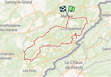
Randonnée Vélo de 77 km à découvrir à Bourgogne-Franche-Comté, Doubs, Maîche. Cette randonnée est proposée par tracegps.
Description
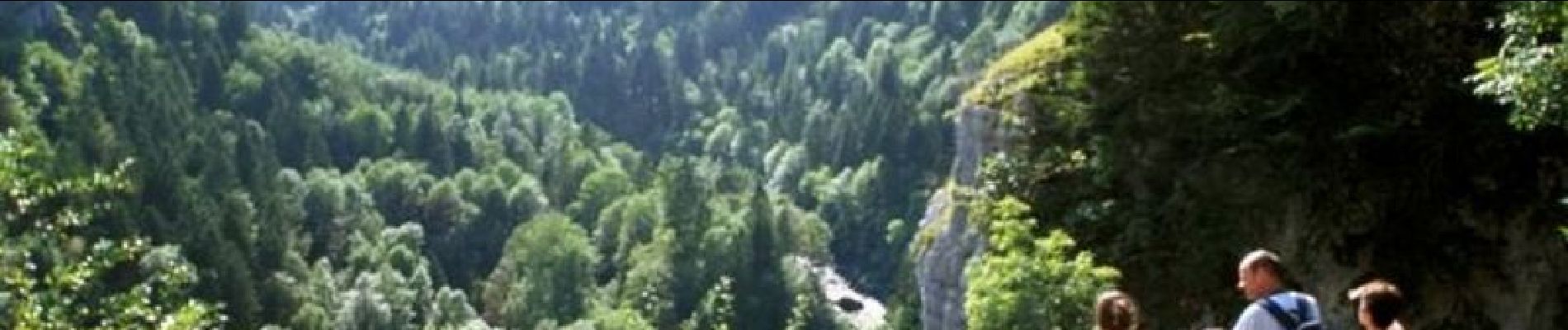
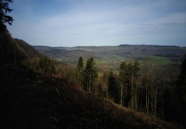
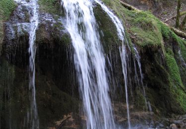
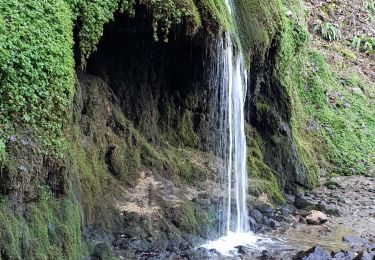
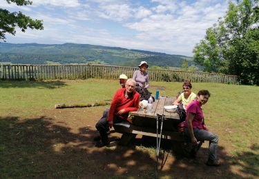
Le Doubs, réserve naturelle d’idées neuves ! La Cendrée OT à Maiche (03 81 64 11 88), berceau du cheval comtois Belvédère de la Crampoulotte Parc-aventure de la Combe Saint-Pierre, parcours aventure, dévalkart, rollherbe, descente VTT, via ferrata aux Echelles de la Mort … (03 81 68 65 50 ou 06 37 91 90 42) A proximité Les Echelles de la Mort (accès au pied du site via Fournet-Blancheroche) La vallée du Doubs Belvédère de la Cendrée à Charquemont Ferme des Guinots, produits régionaux à Bonnétage (03 81 68 62 54) Site des 3 sapins au Russey Eglise Saint-Georges du Bizot (XVIe) Tourbière des Seignes au Bizot Belvédère de la Roche du Prêtre, panorama sur le cirque de Consolation A proximité Site de Consolation (Fondation, parc, tyrolienne géante…) Ferme-musée du Montagnon à Fournets- Luisans (03 81 43 57 86) L’étang du Moulin à Bonnétage Horlogerie Frésard à Charquemont : collection et fabrication de montres mécaniques et automatiques d'origine des années 1920 à nos jours (03 81 44 03 54)
Localisation
Commentaires
Randonnées à proximité
![Randonnée Marche Mancenans-Lizerne - Mancenans Lizerne, château hermitage - Photo](https://media.geolcdn.com/t/375/260/f76adcbd-b8d5-4ca4-879a-bfd2f0700d8a.jpg&format=jpg&maxdim=2)
![Marche Marche](https://static1.geolcdn.com/sitytour/trail-icons/101.png)
Marche
![](/images/other/stat-length.png)
![](https://static1.geolcdn.com/siteimages/upload/files/16400158638029165_repeat_loop_refresh_sync_direction_icon.png)
![Randonnée Marche Orgeans-Blanchefontaine - Orgeans Rocher du Boubet et Grottes de Waroly (IBP 89 ) 26 avril 2021 CAF - Photo](https://media.geolcdn.com/t/375/260/0593139c-3ad8-41ac-8672-2ff846d0cfc3.jpg&format=jpg&maxdim=2)
![Marche Marche](https://static1.geolcdn.com/sitytour/trail-icons/101.png)
Marche
![](/images/other/stat-length.png)
![](https://static1.geolcdn.com/siteimages/upload/files/16400158638029165_repeat_loop_refresh_sync_direction_icon.png)
![Marche Marche](https://static1.geolcdn.com/sitytour/trail-icons/101.png)
Marche
![](/images/other/stat-length.png)
![](https://static1.geolcdn.com/siteimages/upload/files/16400158638029165_repeat_loop_refresh_sync_direction_icon.png)
![Randonnée Marche Vauclusotte - Dessoubre Pat Mimi - Photo](https://media.geolcdn.com/t/375/260/ext.jpg?maxdim=2&url=https%3A%2F%2Fstatic1.geolcdn.com%2Fsiteimages%2Fupload%2Ffiles%2F1553511878bg_sport_marche.png)
![Marche Marche](https://static1.geolcdn.com/sitytour/trail-icons/101.png)
Marche
![](/images/other/stat-length.png)
![](https://static1.geolcdn.com/siteimages/upload/files/16400158638029165_repeat_loop_refresh_sync_direction_icon.png)
![Randonnée A pied Mancenans-Lizerne - Mancenans Lizerne - Photo](https://media.geolcdn.com/t/375/260/6e54973e-7e76-462a-bec1-e00a1d535e21.jpg&format=jpg&maxdim=2)
![A pied A pied](https://static1.geolcdn.com/sitytour/trail-icons/100.png)
A pied
![](/images/other/stat-length.png)
![](https://static1.geolcdn.com/siteimages/upload/files/16400158638029165_repeat_loop_refresh_sync_direction_icon.png)
![Randonnée V.T.T. Thiébouhans - Pascal Loic - Photo](https://media.geolcdn.com/t/375/260/ext.jpg?maxdim=2&url=https%3A%2F%2Fstatic1.geolcdn.com%2Fsiteimages%2Fupload%2Ffiles%2F1524743154velo.jpg)
![V.T.T. V.T.T.](https://static1.geolcdn.com/sitytour/trail-icons/202.png)
V.T.T.
![](/images/other/stat-length.png)
![](https://static1.geolcdn.com/siteimages/upload/files/16400158638029165_repeat_loop_refresh_sync_direction_icon.png)
![Randonnée Marche Mancenans-Lizerne - 2020 06 12 Mancenans Lizerne - Photo](https://media.geolcdn.com/t/375/260/78ce7e26-d3b0-44da-bf96-1657b653adb7.jpg&format=jpg&maxdim=2)
![Marche Marche](https://static1.geolcdn.com/sitytour/trail-icons/101.png)
Marche
![](/images/other/stat-length.png)
![](https://static1.geolcdn.com/siteimages/upload/files/16400158638029165_repeat_loop_refresh_sync_direction_icon.png)
![Randonnée Vélo Charquemont - Charquemont - Morteau - Photo](https://media.geolcdn.com/t/375/260/ext.jpg?maxdim=2&url=https%3A%2F%2Fstatic1.geolcdn.com%2Fsiteimages%2Fupload%2Ffiles%2F1524743154velo.jpg)
![Vélo Vélo](https://static1.geolcdn.com/sitytour/trail-icons/200.png)
Vélo
![](/images/other/stat-length.png)
![](https://static1.geolcdn.com/siteimages/upload/files/16400158638029165_repeat_loop_refresh_sync_direction_icon.png)
![Randonnée Marche Trévillers - trévillers-les plains - Photo](https://media.geolcdn.com/t/375/260/ext.jpg?maxdim=2&url=https%3A%2F%2Fstatic1.geolcdn.com%2Fsiteimages%2Fupload%2Ffiles%2F1553511878bg_sport_marche.png)
![Marche Marche](https://static1.geolcdn.com/sitytour/trail-icons/101.png)
Marche
![](/images/other/stat-length.png)
![](https://static1.geolcdn.com/siteimages/upload/files/16400158638029165_repeat_loop_refresh_sync_direction_icon.png)