![](/images/other/stat-length.png)
![Randonnée Marche Sainghin-en-Weppes - Un siècle d'histoire à Sainghin en Weppes - Photo](https://media.geolcdn.com/t/1900/400/ext.pjpeg?maxdim=2&url=https%3A%2F%2Fservices.sitytrail.com%2FGeolivesWS%2FDownloadMedia.ashx%3FTrailID%3D109250%26Media%3D3352_6.jpg)
Un siècle d'histoire à Sainghin en Weppes
tracegps
Utilisateur
![Longueur](/images/other/stat-length.png)
Longueur
11,7 km
![Altitude max](https://static1.geolcdn.com/siteimages/upload/files/1508320355ic_sort_altitude_max_24dp.png)
Altitude max
41 m
![Dénivelé positif](https://static1.geolcdn.com/siteimages/upload/files/1508320355ic_sort_den_pos_24dp.png)
Dénivelé positif
47 m
![Km-Effort](/images/other/stat-length.png)
Km-Effort
12,3 km
![Altitude min](https://static1.geolcdn.com/siteimages/upload/files/1508320355ic_sort_altitude_min_24dp.png)
Altitude min
18 m
![Dénivelé négatif](https://static1.geolcdn.com/siteimages/upload/files/1508320355ic_sort_den_neg_24dp.png)
Dénivelé négatif
47 m
![Boucle](https://static1.geolcdn.com/siteimages/upload/files/16400158638029165_repeat_loop_refresh_sync_direction_icon.png)
Boucle
Oui
Date de création :
2014-12-10 00:00:00.0
Dernière modification :
2014-12-10 00:00:00.0
![Marche](https://static1.geolcdn.com/sitytour/trail-icons/101.png)
2h49
Difficulté : Moyen
![Scannez ce code QR pour ouvrir la randonnée dans l'application SityTrail](https://capi.geolives.com/qq0zvz2zws4bq2lad0pu/sitytour/trails/109250/qr.png?size=200)
Application GPS de randonnée GRATUITE
À propos
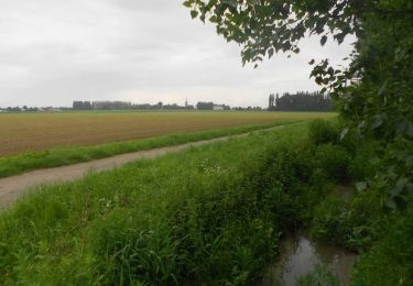
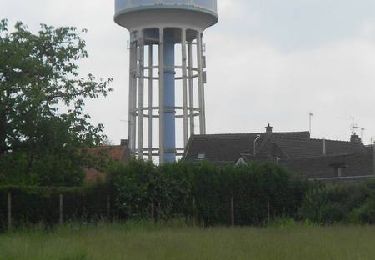
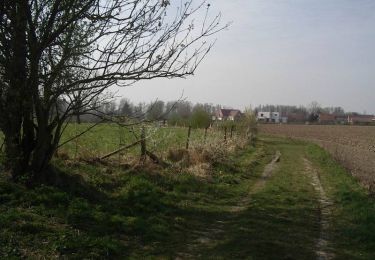
Randonnée Marche de 11,7 km à découvrir à Hauts-de-France, Nord, Sainghin-en-Weppes. Cette randonnée est proposée par tracegps.
Description
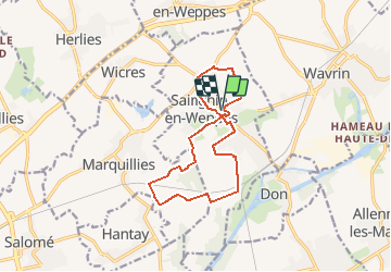
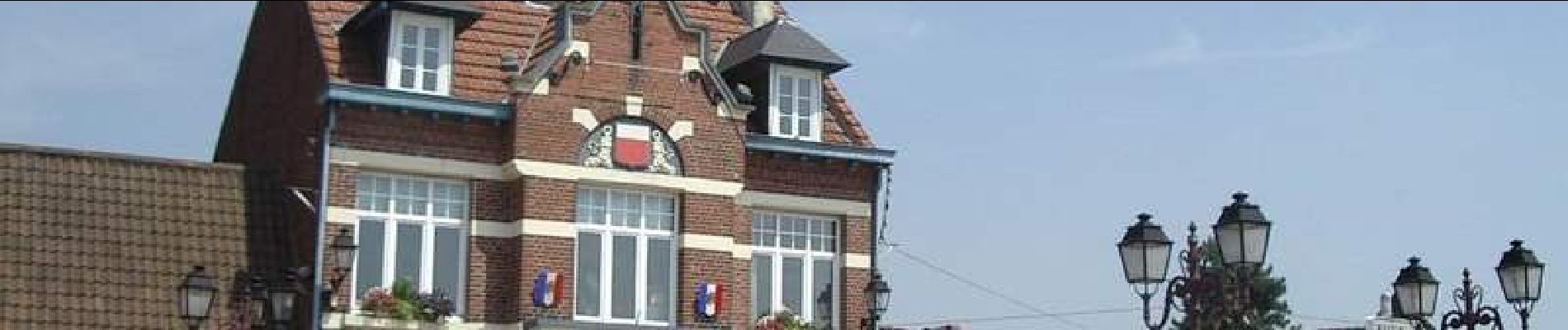
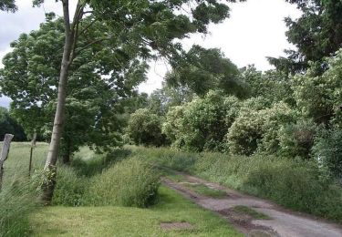
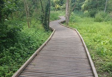
Départ du parking face à la mairie de Sainghin-en-Weppes. Le circuit se compose de petites routes et de chemins de terre qui traversent les plaines agricoles des Weppes. Retrouvez cette randonnée sur le site du Comité Départemental du Tourisme du Nord.
Localisation
Pays :
France
Région :
Hauts-de-France
Département/Province :
Nord
Commune :
Sainghin-en-Weppes
Localité :
Unknown
Départ:(Dec)
Départ:(UTM)
492890 ; 5601232 (31U) N.
Commentaires
Randonnées à proximité
![Randonnée Marche Herrin - Circuit des Naviettes - Herrin - Photo](https://media.geolcdn.com/t/375/260/ext.jpg?maxdim=2&url=https%3A%2F%2Fservices.sitytrail.com%2FGeolivesWS%2FDownloadMedia.ashx%3FTrailID%3D109192%26Media%3D3236_6.jpg)
![Marche Marche](https://static1.geolcdn.com/sitytour/trail-icons/101.png)
Circuit des Naviettes - Herrin
Marche
Facile
(1)
Herrin,
Hauts-de-France,
Nord,
France
![](/images/other/stat-length.png)
5,7 km | 6 km-effort
1h 30min
![](https://static1.geolcdn.com/siteimages/upload/files/16400158638029165_repeat_loop_refresh_sync_direction_icon.png)
Oui
![Randonnée Marche Santes - santes - Photo](https://media.geolcdn.com/t/375/260/ext.jpg?maxdim=2&url=https%3A%2F%2Fstatic1.geolcdn.com%2Fsiteimages%2Fupload%2Ffiles%2F1553511878bg_sport_marche.png)
![Marche Marche](https://static1.geolcdn.com/sitytour/trail-icons/101.png)
santes
Marche
Très facile
(1)
Santes,
Hauts-de-France,
Nord,
France
![](/images/other/stat-length.png)
4,6 km | 5,1 km-effort
1h 7min
![](https://static1.geolcdn.com/siteimages/upload/files/16400158638029165_repeat_loop_refresh_sync_direction_icon.png)
Non
![Randonnée Marche Santes - SANTES 2024 - SLCP - Photo](https://media.geolcdn.com/t/375/260/a11ce7ac-360b-4a28-aab8-b10fc449f75e.jpg&format=jpg&maxdim=2)
![Marche Marche](https://static1.geolcdn.com/sitytour/trail-icons/101.png)
SANTES 2024 - SLCP
Marche
Moyen
Santes,
Hauts-de-France,
Nord,
France
![](/images/other/stat-length.png)
7,2 km | 7,7 km-effort
1h 59min
![](https://static1.geolcdn.com/siteimages/upload/files/16400158638029165_repeat_loop_refresh_sync_direction_icon.png)
Oui
![Randonnée Marche Bauvin - Wingles - Photo](https://media.geolcdn.com/t/375/260/4ad96d20-0522-45e1-a005-6177e2c8edea.jpg&format=jpg&maxdim=2)
![Marche Marche](https://static1.geolcdn.com/sitytour/trail-icons/101.png)
![Randonnée Marche Beaucamps-Ligny - Autour de Beaucamps-Ligny - Photo](https://media.geolcdn.com/t/375/260/ext.jpg?maxdim=2&url=https%3A%2F%2Fservices.sitytrail.com%2FGeolivesWS%2FDownloadMedia.ashx%3FTrailID%3D318000%26Media%3D17453_6.jpg)
![Marche Marche](https://static1.geolcdn.com/sitytour/trail-icons/101.png)
Autour de Beaucamps-Ligny
Marche
Moyen
Beaucamps-Ligny,
Hauts-de-France,
Nord,
France
![](/images/other/stat-length.png)
12,8 km | 13,8 km-effort
3h 10min
![](https://static1.geolcdn.com/siteimages/upload/files/16400158638029165_repeat_loop_refresh_sync_direction_icon.png)
Oui
![Randonnée Marche Fournes-en-Weppes - En Bas Flandre - Fournes en Weppes - Photo](https://media.geolcdn.com/t/375/260/ext.jpg?maxdim=2&url=https%3A%2F%2Fservices.sitytrail.com%2FGeolivesWS%2FDownloadMedia.ashx%3FTrailID%3D317989%26Media%3D17433_5.jpg)
![Marche Marche](https://static1.geolcdn.com/sitytour/trail-icons/101.png)
En Bas Flandre - Fournes en Weppes
Marche
Moyen
Fournes-en-Weppes,
Hauts-de-France,
Nord,
France
![](/images/other/stat-length.png)
8 km | 8,6 km-effort
2h 0min
![](https://static1.geolcdn.com/siteimages/upload/files/16400158638029165_repeat_loop_refresh_sync_direction_icon.png)
Oui
![Randonnée Marche Billy-Berclau - Le chemin vert - Billy-Berclau - Photo](https://media.geolcdn.com/t/375/260/ext.jpg?maxdim=2&url=https%3A%2F%2Fservices.sitytrail.com%2FGeolivesWS%2FDownloadMedia.ashx%3FTrailID%3D317354%26Media%3D16572_6.jpg)
![Marche Marche](https://static1.geolcdn.com/sitytour/trail-icons/101.png)
Le chemin vert - Billy-Berclau
Marche
Moyen
Billy-Berclau,
Hauts-de-France,
Pas-de-Calais,
France
![](/images/other/stat-length.png)
9,2 km | 9,7 km-effort
2h 15min
![](https://static1.geolcdn.com/siteimages/upload/files/16400158638029165_repeat_loop_refresh_sync_direction_icon.png)
Oui
![Randonnée Marche Fromelles - Circuit des étangs des Weppes - Photo](https://media.geolcdn.com/t/375/260/ext.jpg?maxdim=2&url=https%3A%2F%2Fservices.sitytrail.com%2FGeolivesWS%2FDownloadMedia.ashx%3FTrailID%3D202879%26Media%3Ddb4ff915-1ab0-4dc0-bc2f-f9a8df100fdc.jpg)
![Marche Marche](https://static1.geolcdn.com/sitytour/trail-icons/101.png)
Circuit des étangs des Weppes
Marche
Très facile
Fromelles,
Hauts-de-France,
Nord,
France
![](/images/other/stat-length.png)
10,8 km | 11,5 km-effort
Inconnu
![](https://static1.geolcdn.com/siteimages/upload/files/16400158638029165_repeat_loop_refresh_sync_direction_icon.png)
Oui
![Randonnée Marche Santes - Le Bois de rive - Santes - Photo](https://media.geolcdn.com/t/375/260/ext.jpg?maxdim=2&url=https%3A%2F%2Fservices.sitytrail.com%2FGeolivesWS%2FDownloadMedia.ashx%3FTrailID%3D129611%26Media%3D13127_5.jpg)
![Marche Marche](https://static1.geolcdn.com/sitytour/trail-icons/101.png)
Le Bois de rive - Santes
Marche
Facile
Santes,
Hauts-de-France,
Nord,
France
![](/images/other/stat-length.png)
6,8 km | 7,2 km-effort
1h 45min
![](https://static1.geolcdn.com/siteimages/upload/files/16400158638029165_repeat_loop_refresh_sync_direction_icon.png)
Oui