Randonnée Marche Steenwerck - Promenade en bord de Lys - Steenwerck - Photo

Promenade en bord de Lys - Steenwerck

 tracegps
tracegps

Utilisateur

© OpenStreetMap contributors
Longueur
Longueur
4,7 km
Altitude max
Altitude max
18 m
Dénivelé positif
Dénivelé positif
18 m
Km-Effort
Km-Effort  
4,9 km
Altitude min
Altitude min
9 m
Dénivelé négatif
Dénivelé négatif
19 m
Boucle
Boucle
Oui
Date de création :
2014-12-10 00:00:00.0
Dernière modification :
2014-12-10 00:00:00.0

(2 Avis)

Marche
Marche
1h15
Difficulté : Facile

Scannez ce code QR pour ouvrir la randonnée dans l'application SityTrail

Application GPS de randonnée GRATUITE

Logo SityTrail SityTrail

IGN / Instituts géographiques

Télécharger SityTrail sur l'App Store Télécharger SityTrail sur Google Play

Logo SityTrail SityTrail World

Le monde est à vous

Télécharger SityTrail sur l'App Store Télécharger SityTrail sur Google Play Télécharger SityTrail sur Huawei AppGallery

À propos

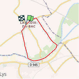
Randonnée Marche de 4,7 km à découvrir à Hauts-de-France, Nord, Steenwerck. Cette randonnée est proposée par tracegps.

Description

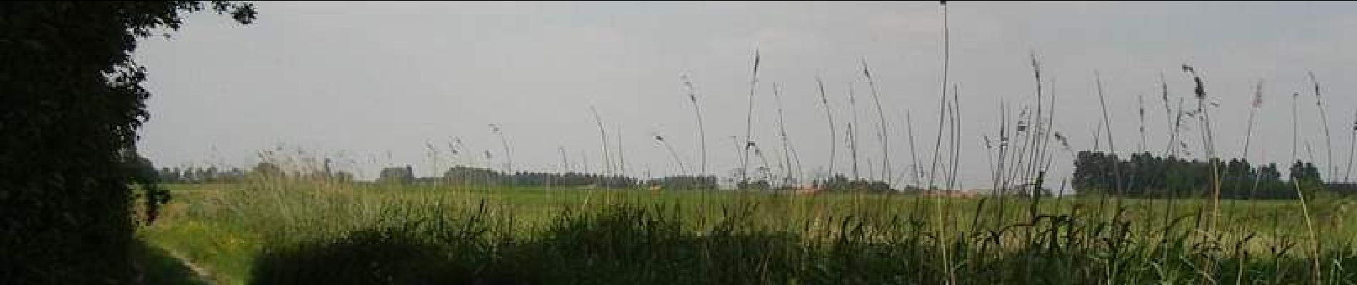
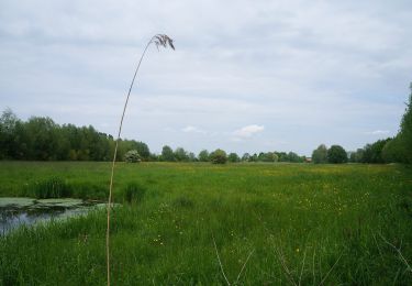
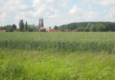
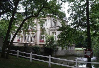
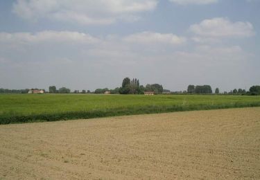
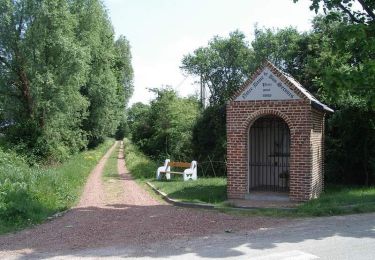
Départ de l’église du hameau de la Croix du Bac à Steenwerck. Ce circuit familial permet de découvrir la flore caractéristique et préservée des terres inondables du bord de Lys. Retrouvez cette randonnée sur le site du Comité Départemental du Tourisme du Nord.

Profil altimétrique

Photos

Localisation

Pays :
France
Région :
Hauts-de-France
Département/Province :
Nord
Commune :
Steenwerck
Localité :
Unknown
Départ:(Dec)
Départ:(UTM)
485185 ; 5613728 (31U) N.

Commentaires

Veuillez vous connecter pour laisser un commentaire ou une note


Bonne petite balade au bord de la Lys . Quand même pas mal de goudron.


Randonnées à proximité

Randonnée A pied Sailly-sur-la-Lys - Chemin Champêtre - Photo
A pied
PRO

A pied

Facile
Sailly-sur-la-Lys, Hauts-de-France, Pas-de-Calais, France
9,1 km | 9,7 km-effort
2h 11min
Non
Randonnée A pied Sailly-sur-la-Lys - Chemin de l’Alloeu - Photo
A pied
PRO

A pied

Facile
Sailly-sur-la-Lys, Hauts-de-France, Pas-de-Calais, France
3,6 km | 3,7 km-effort
50min
Oui
Randonnée A pied Sailly-sur-la-Lys - Chemin des Sûres - Photo
A pied
PRO

A pied

Facile
Sailly-sur-la-Lys, Hauts-de-France, Pas-de-Calais, France
5,3 km | 5,5 km-effort
1h 14min
Non
Randonnée Marche Sailly-sur-la-Lys - Chemin Champêtre - Sailly-sur-la-Lys - Photo
Marche
Blourouce

Marche

Moyen
(1)
Sailly-sur-la-Lys, Hauts-de-France, Pas-de-Calais, France
9,7 km | 10,3 km-effort
2h 18min
Oui
Randonnée Marche Sailly-sur-la-Lys - Chemin Champêtre - Sailly sur la Lys - Photo
Marche
tracegps

Marche

Moyen
Sailly-sur-la-Lys, Hauts-de-France, Pas-de-Calais, France
9,7 km | 10,3 km-effort
2h 30min
Oui
Randonnée Marche Sailly-sur-la-Lys - Chemin de l'Alloeu - Sailly sur la Lys - Photo
Marche
tracegps

Marche

Facile
Sailly-sur-la-Lys, Hauts-de-France, Pas-de-Calais, France
4 km | 4,1 km-effort
1h 0min
Oui
Randonnée Marche Nieppe - De Nieppe à la Lys - Photo
Marche
tracegps

Marche

Facile
Nieppe, Hauts-de-France, Nord, France
8,2 km | 8,6 km-effort
2h 0min
Oui
Randonnée Marche Steenwerck - Circuit de la Boudrelle - Steenwerck - Photo
Marche
tracegps

Marche

Difficile
Steenwerck, Hauts-de-France, Nord, France
12,9 km | 13,4 km-effort
3h 15min
Oui
Randonnée Marche Steenwerck - Circuit du Pont de Pierre - Steenwerck - Photo
Marche
tracegps

Marche

Difficile
Steenwerck, Hauts-de-France, Nord, France
12,2 km | 12,7 km-effort
3h 15min
Oui


Fermer
Mes abonnements