![](/images/other/stat-length.png)
![Randonnée Marche Étreux - Le Canal - Photo](https://media.geolcdn.com/t/1900/400/ext.pjpeg?maxdim=2&url=https%3A%2F%2Fservices.sitytrail.com%2FGeolivesWS%2FDownloadMedia.ashx%3FTrailID%3D108323%26Media%3D994_2.jpg)
Le Canal
tracegps
Utilisateur
![Longueur](/images/other/stat-length.png)
Longueur
12,5 km
![Altitude max](https://static1.geolcdn.com/siteimages/upload/files/1508320355ic_sort_altitude_max_24dp.png)
Altitude max
159 m
![Dénivelé positif](https://static1.geolcdn.com/siteimages/upload/files/1508320355ic_sort_den_pos_24dp.png)
Dénivelé positif
96 m
![Km-Effort](/images/other/stat-length.png)
Km-Effort
13,8 km
![Altitude min](https://static1.geolcdn.com/siteimages/upload/files/1508320355ic_sort_altitude_min_24dp.png)
Altitude min
115 m
![Dénivelé négatif](https://static1.geolcdn.com/siteimages/upload/files/1508320355ic_sort_den_neg_24dp.png)
Dénivelé négatif
96 m
![Boucle](https://static1.geolcdn.com/siteimages/upload/files/16400158638029165_repeat_loop_refresh_sync_direction_icon.png)
Boucle
Oui
Date de création :
2014-12-10 00:00:00.0
Dernière modification :
2014-12-10 00:00:00.0
![Marche](https://static1.geolcdn.com/sitytour/trail-icons/101.png)
3h15
Difficulté : Moyen
![Scannez ce code QR pour ouvrir la randonnée dans l'application SityTrail](https://capi.geolives.com/qq0zvz2zws4bq2lad0pu/sitytour/trails/108323/qr.png?size=200)
Application GPS de randonnée GRATUITE
À propos
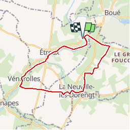
Randonnée Marche de 12,5 km à découvrir à Hauts-de-France, Aisne, Étreux. Cette randonnée est proposée par tracegps.
Description
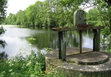
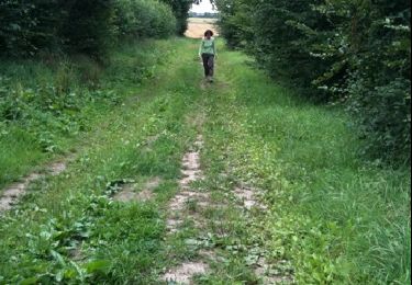
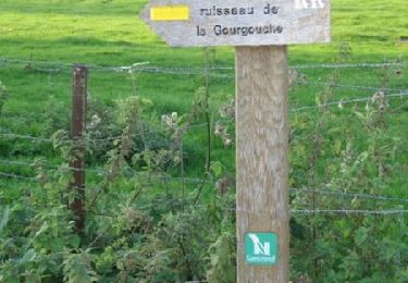
Au départ de la halte nautique du Gard, cette balade musarde le long de la partie amont du canal de la Sambre à l'Oise, ponctuée par neuf écluses : autant de possiblités d'observer les bateaux de marchandises et de plaisance. Toutes les infos sont ICI
Localisation
Pays :
France
Région :
Hauts-de-France
Département/Province :
Aisne
Commune :
Étreux
Localité :
Unknown
Départ:(Dec)
Départ:(UTM)
548777 ; 5538932 (31U) N.
Commentaires
Randonnées à proximité
![Randonnée Marche Rejet-de-Beaulieu - Circuit du canal de la Sambre à l'Oise. (Rejet-de-Beaulieu) - Photo](https://media.geolcdn.com/t/375/260/ext.jpg?maxdim=2&url=https%3A%2F%2Fservices.sitytrail.com%2FGeolivesWS%2FDownloadMedia.ashx%3FTrailID%3D109771%26Media%3D4700_4.jpg)
![Marche Marche](https://static1.geolcdn.com/sitytour/trail-icons/101.png)
Circuit du canal de la Sambre à l'Oise. (Rejet-de-Beaulieu)
Marche
Facile
Rejet-de-Beaulieu,
Hauts-de-France,
Nord,
France
![](/images/other/stat-length.png)
6,4 km | 7 km-effort
1h 40min
![](https://static1.geolcdn.com/siteimages/upload/files/16400158638029165_repeat_loop_refresh_sync_direction_icon.png)
Oui
![Randonnée Marche Rejet-de-Beaulieu - rejet de Beaulieu - Photo](https://media.geolcdn.com/t/375/260/ext.jpg?maxdim=2&url=https%3A%2F%2Fservices.sitytrail.com%2FGeolivesWS%2FDownloadMedia.ashx%3FTrailID%3D44159%26Media%3Dimage0.jpg)
![Marche Marche](https://static1.geolcdn.com/sitytour/trail-icons/101.png)
rejet de Beaulieu
Marche
Très facile
Rejet-de-Beaulieu,
Hauts-de-France,
Nord,
France
![](/images/other/stat-length.png)
3,9 km | 4,3 km-effort
Inconnu
![](https://static1.geolcdn.com/siteimages/upload/files/16400158638029165_repeat_loop_refresh_sync_direction_icon.png)
Oui
![Randonnée Marche Boué - Le sentier de Bo-we - Photo](https://media.geolcdn.com/t/375/260/ext.jpg?maxdim=2&url=https%3A%2F%2Fstatic1.geolcdn.com%2Fsiteimages%2Fupload%2Ffiles%2F1553511878bg_sport_marche.png)
![Marche Marche](https://static1.geolcdn.com/sitytour/trail-icons/101.png)
Le sentier de Bo-we
Marche
Très facile
Boué,
Hauts-de-France,
Aisne,
France
![](/images/other/stat-length.png)
971 m | 1,1 km-effort
Inconnu
![](https://static1.geolcdn.com/siteimages/upload/files/16400158638029165_repeat_loop_refresh_sync_direction_icon.png)
Non
![Randonnée Marche Rejet-de-Beaulieu - Sentier du ruisseau de Gourgouche (Rejet-de-Beaulieu) - Photo](https://media.geolcdn.com/t/375/260/ext.jpg?maxdim=2&url=https%3A%2F%2Fservices.sitytrail.com%2FGeolivesWS%2FDownloadMedia.ashx%3FTrailID%3D109772%26Media%3D4701_2.jpg)
![Marche Marche](https://static1.geolcdn.com/sitytour/trail-icons/101.png)
Sentier du ruisseau de Gourgouche (Rejet-de-Beaulieu)
Marche
Facile
Rejet-de-Beaulieu,
Hauts-de-France,
Nord,
France
![](/images/other/stat-length.png)
2,7 km | 3 km-effort
45min
![](https://static1.geolcdn.com/siteimages/upload/files/16400158638029165_repeat_loop_refresh_sync_direction_icon.png)
Oui
![Randonnée Marche Étreux - Le Canal - variante - Photo](https://media.geolcdn.com/t/375/260/ext.jpg?maxdim=2&url=https%3A%2F%2Fstatic1.geolcdn.com%2Fsiteimages%2Fupload%2Ffiles%2F1553511878bg_sport_marche.png)
![Marche Marche](https://static1.geolcdn.com/sitytour/trail-icons/101.png)
Le Canal - variante
Marche
Moyen
Étreux,
Hauts-de-France,
Aisne,
France
![](/images/other/stat-length.png)
10,2 km | 11,2 km-effort
2h 30min
![](https://static1.geolcdn.com/siteimages/upload/files/16400158638029165_repeat_loop_refresh_sync_direction_icon.png)
Oui
![Randonnée Marche Fesmy-le-Sart - fesmy_le _sars - Photo](https://media.geolcdn.com/t/375/260/ext.jpg?maxdim=2&url=https%3A%2F%2Fstatic1.geolcdn.com%2Fsiteimages%2Fupload%2Ffiles%2F1553511878bg_sport_marche.png)
![Marche Marche](https://static1.geolcdn.com/sitytour/trail-icons/101.png)
fesmy_le _sars
Marche
Très facile
(1)
Fesmy-le-Sart,
Hauts-de-France,
Aisne,
France
![](/images/other/stat-length.png)
10,5 km | 11,5 km-effort
2h 27min
![](https://static1.geolcdn.com/siteimages/upload/files/16400158638029165_repeat_loop_refresh_sync_direction_icon.png)
Oui
![Randonnée Marche La Neuville-lès-Dorengt - boué ballade le long du cana - Photo](https://media.geolcdn.com/t/375/260/ext.jpg?maxdim=2&url=https%3A%2F%2Fstatic1.geolcdn.com%2Fsiteimages%2Fupload%2Ffiles%2F1553511878bg_sport_marche.png)
![Marche Marche](https://static1.geolcdn.com/sitytour/trail-icons/101.png)
boué ballade le long du cana
Marche
Très facile
La Neuville-lès-Dorengt,
Hauts-de-France,
Aisne,
France
![](/images/other/stat-length.png)
11,7 km | 12,9 km-effort
2h 41min
![](https://static1.geolcdn.com/siteimages/upload/files/16400158638029165_repeat_loop_refresh_sync_direction_icon.png)
Non
![Randonnée Course à pied Boué - boué - Photo](https://media.geolcdn.com/t/375/260/ext.jpg?maxdim=2&url=https%3A%2F%2Fstatic1.geolcdn.com%2Fsiteimages%2Fupload%2Ffiles%2F1524743154running.jpg)
![Course à pied Course à pied](https://static1.geolcdn.com/sitytour/trail-icons/103.png)
boué
Course à pied
Très facile
Boué,
Hauts-de-France,
Aisne,
France
![](/images/other/stat-length.png)
10,8 km | 12,4 km-effort
1h 14min
![](https://static1.geolcdn.com/siteimages/upload/files/16400158638029165_repeat_loop_refresh_sync_direction_icon.png)
Oui