


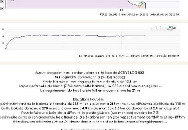
32 km | 41 km-effort


Utilisateur


Application GPS de randonnée GRATUITE
 SityTrail
IGN / Instituts géographiques
SityTrail World
Le monde est à vous
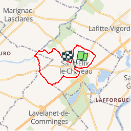
Randonnée Marche de 11,4 km à découvrir à Occitanie, Haute-Garonne, Saint-Élix-le-Château. Cette randonnée est proposée par tracegps.
Départ de st Elix le château, randonnée très facile à faire en famille.


V.T.T.

A pied
Marche

Marche
Marche
Marche
Marche
Marche
Marche