Randonnée Course à pied Carsan - Courir à Carsan - Photo

Courir à Carsan

 tracegps
tracegps

Utilisateur

© OpenStreetMap contributors
Longueur
Longueur
10,4 km
Altitude max
Altitude max
273 m
Dénivelé positif
Dénivelé positif
281 m
Km-Effort
Km-Effort  
14,1 km
Altitude min
Altitude min
131 m
Dénivelé négatif
Dénivelé négatif
277 m
Boucle
Boucle
Oui
Date de création :
2014-12-10 00:00:00.0
Dernière modification :
2014-12-10 00:00:00.0

(1 Avis)

Course à pied
Course à pied
1h00
Difficulté : Difficile

Scannez ce code QR pour ouvrir la randonnée dans l'application SityTrail

Application GPS de randonnée GRATUITE

Logo SityTrail SityTrail

IGN / Instituts géographiques

Télécharger SityTrail sur l'App Store Télécharger SityTrail sur Google Play

Logo SityTrail SityTrail World

Le monde est à vous

Télécharger SityTrail sur l'App Store Télécharger SityTrail sur Google Play Télécharger SityTrail sur Huawei AppGallery

À propos

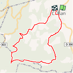
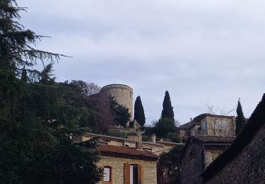
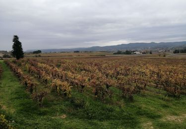
Randonnée Course à pied de 10,4 km à découvrir à Occitanie, Gard, Carsan. Cette randonnée est proposée par tracegps.

Description

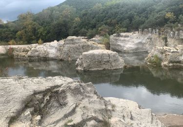
Course nature, parfois monotrace, vallonnée.

Profil altimétrique

Localisation

Pays :
France
Région :
Occitanie
Département/Province :
Gard
Commune :
Carsan
Localité :
Unknown
Départ:(Dec)
Départ:(UTM)
627245 ; 4899496 (31T) N.

Commentaires

Veuillez vous connecter pour laisser un commentaire ou une note


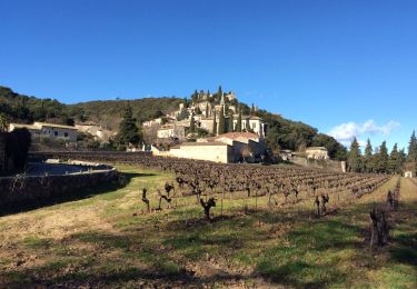
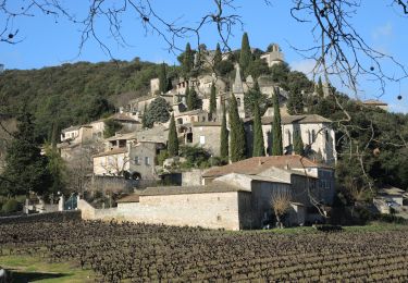
jolie rando. Jolis sentiers en sous bois. Ne pas manquer de faire un aller-retour au lac de La Valbonne.


Randonnées à proximité

Randonnée Marche Saint-Paulet-de-Caisson - Valbonne botaniques - Photo
Marche
raivavae

Marche

Facile
(1)
Saint-Paulet-de-Caisson, Occitanie, Gard, France
3,3 km | 4,4 km-effort
56min
Oui
Randonnée Marche Saint-Paulet-de-Caisson - PF-Chartreuse de Valbonne - Photo
Marche
MicDul

Marche

Moyen
(1)
Saint-Paulet-de-Caisson, Occitanie, Gard, France
14,9 km | 21 km-effort
4h 24min
Oui
Randonnée V.T.T. Saint-Alexandre - Alexandrine 2007 (20 km) - Photo
V.T.T.
tracegps

V.T.T.

Difficile
(1)
Saint-Alexandre, Occitanie, Gard, France
18,7 km | 25 km-effort
1h 45min
Oui
Randonnée Marche Vénéjan - Vénéjean Chateau de Gicon - Photo
Marche
GUIDE
nadinebondoux

Marche

Moyen
Vénéjan, Occitanie, Gard, France
16,5 km | 21 km-effort
4h 27min
Oui
Randonnée Marche Vénéjan - 30 venejean - Photo
Marche
randodyssée

Marche

Moyen
Vénéjan, Occitanie, Gard, France
23 km | 29 km-effort
7h 11min
Oui
Randonnée Marche Saint-Michel-d'Euzet - Les Cascades du Sautadet par Saint Michel d’Euzet - Photo
Marche
boudpn

Marche

Saint-Michel-d'Euzet, Occitanie, Gard, France
16 km | 19,9 km-effort
5h 33min
Oui
Randonnée Marche Saint-Michel-d'Euzet - PF-Saint-Michel-d'Euzet - La Roque-sur-Cèze - Cascade du Sautadet - Photo
Marche
MicDul

Marche

Moyen
(1)
Saint-Michel-d'Euzet, Occitanie, Gard, France
13,7 km | 17,2 km-effort
3h 39min
Non
Randonnée Marche Saint-Michel-d'Euzet - PF-Saint-Michel-d'Euzet - La Roque-sur-Cèze - Les Cascades du Sautadet - Photo
Marche
MicDul

Marche

Moyen
Saint-Michel-d'Euzet, Occitanie, Gard, France
8,8 km | 10,6 km-effort
2h 18min
Oui
Randonnée A pied Saint-Michel-d'Euzet - Les cascades du Sautadet - Photo
A pied
Bcomb

A pied

Facile
Saint-Michel-d'Euzet, Occitanie, Gard, France
7,5 km | 8,8 km-effort
1h 59min
Oui


Fermer
Mes abonnements