Randonnée Course à pied Patay - Patay : Randonnée circuit 1 très facile - Photo

Patay : Randonnée circuit 1 très facile

 tracegps
tracegps

Utilisateur

© OpenStreetMap contributors
Longueur
Longueur
21 km
Altitude max
Altitude max
133 m
Dénivelé positif
Dénivelé positif
99 m
Km-Effort
Km-Effort  
22 km
Altitude min
Altitude min
114 m
Dénivelé négatif
Dénivelé négatif
100 m
Boucle
Boucle
Oui
Date de création :
2014-12-10 00:00:00.0
Dernière modification :
2014-12-10 00:00:00.0

(0 Avis)

Course à pied
Course à pied
2h00
Difficulté : Moyen

Scannez ce code QR pour ouvrir la randonnée dans l'application SityTrail

Application GPS de randonnée GRATUITE

Logo SityTrail SityTrail

IGN / Instituts géographiques

Télécharger SityTrail sur l'App Store Télécharger SityTrail sur Google Play

Logo SityTrail SityTrail World

Le monde est à vous

Télécharger SityTrail sur l'App Store Télécharger SityTrail sur Google Play Télécharger SityTrail sur Huawei AppGallery

À propos

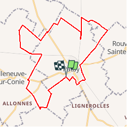
Randonnée Course à pied de 21 km à découvrir à Centre-Val de Loire, Loiret, Patay. Cette randonnée est proposée par tracegps.

Description

Petite randonnée VTT dans la Beauce autour de Patay. Niveau Très facile. Accès au départ : Grand Parking du centre commercial. Sécurisé et proche gendarmerie. Parcours très roulant, mélangeant chemins pédestres, singles et routes. Aucune difficulté. Chemins collants en automne - hiver.

Profil altimétrique

Localisation

Pays :
France
Région :
Centre-Val de Loire
Département/Province :
Loiret
Commune :
Patay
Localité :
Unknown
Départ:(Dec)
Départ:(UTM)
402394 ; 5322142 (31U) N.

Randonnées à proximité

Randonnée Course à pied Patay - Patay : Randonnée circuit 2 Facile - Photo
Course à pied
tracegps

Course à pied

Difficile
Patay, Centre-Val de Loire, Loiret, France
31 km | 33 km-effort
3h 0min
Oui
Randonnée V.T.T. Patay - Patay : Randonnée circuit 2 Facile - Photo
V.T.T.
tracegps

V.T.T.

Moyen
Patay, Centre-Val de Loire, Loiret, France
31 km | 33 km-effort
1h 30min
Oui
Randonnée V.T.T. Patay - Patay : Randonnée circuit 1 très facile - Photo
V.T.T.
tracegps

V.T.T.

Facile
Patay, Centre-Val de Loire, Loiret, France
21 km | 22 km-effort
1h 0min
Oui


Fermer
Mes abonnements