![](/images/other/stat-length.png)
![Randonnée Marche Corte - Monte Cardo via Furmicuccia - Photo](https://media.geolcdn.com/t/1900/400/ext.pjpeg?maxdim=2&url=https%3A%2F%2Fservices.sitytrail.com%2FGeolivesWS%2FDownloadMedia.ashx%3FTrailID%3D107442%26Media%3D12360_6.jpg)
Monte Cardo via Furmicuccia
tracegps
Utilisateur
![Longueur](/images/other/stat-length.png)
![Altitude max](https://static1.geolcdn.com/siteimages/upload/files/1508320355ic_sort_altitude_max_24dp.png)
![Dénivelé positif](https://static1.geolcdn.com/siteimages/upload/files/1508320355ic_sort_den_pos_24dp.png)
![Km-Effort](/images/other/stat-length.png)
![Altitude min](https://static1.geolcdn.com/siteimages/upload/files/1508320355ic_sort_altitude_min_24dp.png)
![Dénivelé négatif](https://static1.geolcdn.com/siteimages/upload/files/1508320355ic_sort_den_neg_24dp.png)
![Boucle](https://static1.geolcdn.com/siteimages/upload/files/16400158638029165_repeat_loop_refresh_sync_direction_icon.png)
![Marche](https://static1.geolcdn.com/sitytour/trail-icons/101.png)
24h00
Difficulté : Difficile
![Scannez ce code QR pour ouvrir la randonnée dans l'application SityTrail](https://capi.geolives.com/qq0zvz2zws4bq2lad0pu/sitytour/trails/107442/qr.png?size=200)
Application GPS de randonnée GRATUITE
À propos
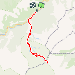
Randonnée Marche de 16 km à découvrir à Corse, Haute-Corse, Corte. Cette randonnée est proposée par tracegps.
Description
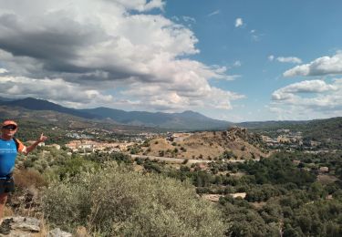
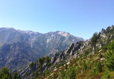
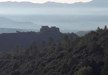
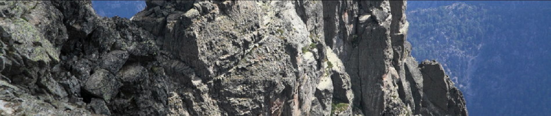
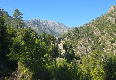
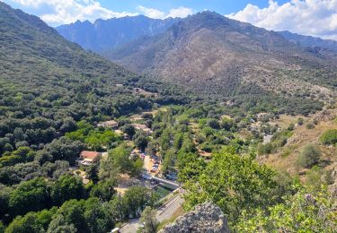
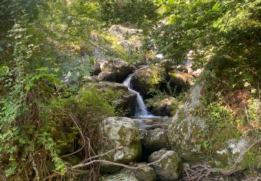
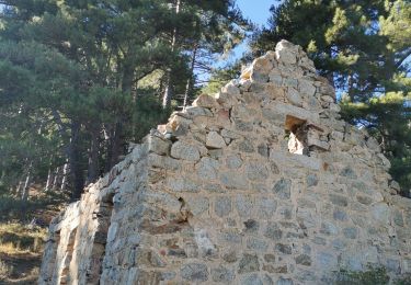
Tous les détails sur cette page. Cette randonnée propose de rejoindre un camp de base aux bergeries de Furmicuccia (qui ne sont pas indiquées sur la carte IGN au 25000), puis emprunte un itinéraire original et hors sentier pour rejoindre Monte Cardo, un des principaux sommets de la Corse. A noter que l’enregistrement GPS du trajet entre le départ (le camping de Tuani) et les bergeries n’est pas très fiable (mauvaise réception en fond de vallée), et qu’il est relativement facile de perdre le sentier. En revanche, la trace entre les bergeries de Furmicuccia et le sommet est de bonne qualité, et il est fortement conseillé de suivre celle qui est le plus au Nord (la trace du retour).
Localisation
Commentaires
Randonnées à proximité
![Randonnée Marche Santo-Pietro-di-Venaco - Monte Cardo - Photo](https://media.geolcdn.com/t/375/260/ext.jpg?maxdim=2&url=https%3A%2F%2Fservices.sitytrail.com%2FGeolivesWS%2FDownloadMedia.ashx%3FTrailID%3D856664%26Media%3Dfix__20171103120255.jpg)
![Marche Marche](https://static1.geolcdn.com/sitytour/trail-icons/101.png)
Marche
![](/images/other/stat-length.png)
![](https://static1.geolcdn.com/siteimages/upload/files/16400158638029165_repeat_loop_refresh_sync_direction_icon.png)
![Randonnée Marche Corte - Chjarasgiolu tuoni vallée Restonica - Photo](https://media.geolcdn.com/t/375/260/9c498096-14d4-450b-bb73-fe7642ccc6f6.jpg&format=jpg&maxdim=2)
![Marche Marche](https://static1.geolcdn.com/sitytour/trail-icons/101.png)
Marche
![](/images/other/stat-length.png)
![](https://static1.geolcdn.com/siteimages/upload/files/16400158638029165_repeat_loop_refresh_sync_direction_icon.png)
![Randonnée Marche Corte - Corte Balade patrimoine et lieux touristiques - Photo](https://media.geolcdn.com/t/375/260/bb2538ea-e175-4652-98f6-185f33b47fbc.jpg&format=jpg&maxdim=2)
![Marche Marche](https://static1.geolcdn.com/sitytour/trail-icons/101.png)
Marche
![](/images/other/stat-length.png)
![](https://static1.geolcdn.com/siteimages/upload/files/16400158638029165_repeat_loop_refresh_sync_direction_icon.png)
![Randonnée sport Santo-Pietro-di-Venaco - Chapelle Saint pietro de venaco - Photo](https://media.geolcdn.com/t/375/260/8b798a9a-801b-44cb-a16a-bfe1b4f80645.jpg&format=jpg&maxdim=2)
sport
![](/images/other/stat-length.png)
![](https://static1.geolcdn.com/siteimages/upload/files/16400158638029165_repeat_loop_refresh_sync_direction_icon.png)
![Randonnée Marche Corte - boucle corte-arche-refuge de forca-corte - Photo](https://media.geolcdn.com/t/375/260/6b3140bb-1ec4-4b9f-9f9a-60ef9189cc01.jpg&format=jpg&maxdim=2)
![Marche Marche](https://static1.geolcdn.com/sitytour/trail-icons/101.png)
Marche
![](/images/other/stat-length.png)
![](https://static1.geolcdn.com/siteimages/upload/files/16400158638029165_repeat_loop_refresh_sync_direction_icon.png)
![Randonnée Marche Corte - corte - Photo](https://media.geolcdn.com/t/375/260/8fa87d79-2316-4d09-ba16-60cdcea14f01.jpg&format=jpg&maxdim=2)
![Marche Marche](https://static1.geolcdn.com/sitytour/trail-icons/101.png)
![Randonnée Marche Corte - restauniqua - Photo](https://media.geolcdn.com/t/375/260/e17d2683-7f46-4d58-ae4d-281a34d22ffe.jpg&format=jpg&maxdim=2)
![Marche Marche](https://static1.geolcdn.com/sitytour/trail-icons/101.png)
![Randonnée Marche Corte - Tour d'Alzu - Photo](https://media.geolcdn.com/t/375/260/c5c7d823-0753-4bb8-b1f9-934c4ee69e9a.jpg&format=jpg&maxdim=2)
![Marche Marche](https://static1.geolcdn.com/sitytour/trail-icons/101.png)
![Randonnée Marche Corte - gite sega - Photo](https://media.geolcdn.com/t/375/260/66d91d6f-2993-4f92-a6a6-8f8882d82ed3.jpg&format=jpg&maxdim=2)
![Marche Marche](https://static1.geolcdn.com/sitytour/trail-icons/101.png)