![](/images/other/stat-length.png)
![Randonnée Marche Châteauneuf-les-Bains - La chapelle Saint Valentin - Chateauneuf les Bains - Photo](https://media.geolcdn.com/t/1900/400/ext.pjpeg?maxdim=2&url=https%3A%2F%2Fservices.sitytrail.com%2FGeolivesWS%2FDownloadMedia.ashx%3FTrailID%3D107367%26Media%3D12265_4.jpg)
La chapelle Saint Valentin - Chateauneuf les Bains
tracegps
Utilisateur
![Longueur](/images/other/stat-length.png)
![Altitude max](https://static1.geolcdn.com/siteimages/upload/files/1508320355ic_sort_altitude_max_24dp.png)
![Dénivelé positif](https://static1.geolcdn.com/siteimages/upload/files/1508320355ic_sort_den_pos_24dp.png)
![Km-Effort](/images/other/stat-length.png)
![Altitude min](https://static1.geolcdn.com/siteimages/upload/files/1508320355ic_sort_altitude_min_24dp.png)
![Dénivelé négatif](https://static1.geolcdn.com/siteimages/upload/files/1508320355ic_sort_den_neg_24dp.png)
![Boucle](https://static1.geolcdn.com/siteimages/upload/files/16400158638029165_repeat_loop_refresh_sync_direction_icon.png)
![Marche](https://static1.geolcdn.com/sitytour/trail-icons/101.png)
3h49
Difficulté : Moyen
![Scannez ce code QR pour ouvrir la randonnée dans l'application SityTrail](https://capi.geolives.com/qq0zvz2zws4bq2lad0pu/sitytour/trails/107367/qr.png?size=200)
Application GPS de randonnée GRATUITE
À propos
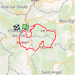
Randonnée Marche de 14,4 km à découvrir à Auvergne-Rhône-Alpes, Puy-de-Dôme, Châteauneuf-les-Bains. Cette randonnée est proposée par tracegps.
Description
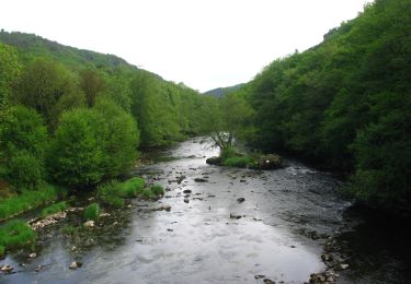
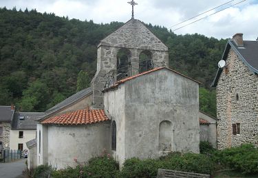
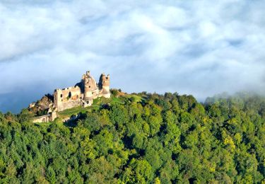
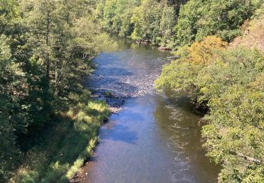
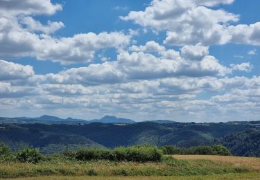
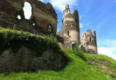
Départ au village thermal de Châteauneuf-les-Bains devant le syndicat d'initiative. Le début du parcours longe un méandre de la Sioule, puis s'élève dans la forêt domaniale de Blot (Vues sur la vallée et ses habitations). L'itinéraire sur des chemins larges et pierreux, très très rarement goudronnés, traverse bois de chênes, hêtres et résineux et longe parfois quelques prés. En automne, les couleurs sont partout magnifiques!
Localisation
Commentaires
Randonnées à proximité
![Randonnée Marche Blot-l'Église - Blot_Eglise_Pery - Photo](https://media.geolcdn.com/t/375/260/d9de8da0-8f81-48e6-a962-7e78784a81e9.jpg&format=jpg&maxdim=2)
![Marche Marche](https://static1.geolcdn.com/sitytour/trail-icons/101.png)
Marche
![](/images/other/stat-length.png)
![](https://static1.geolcdn.com/siteimages/upload/files/16400158638029165_repeat_loop_refresh_sync_direction_icon.png)
![Randonnée A pied Blot-l'Église - Chapelle Saint-Valentin - Photo](https://media.geolcdn.com/t/375/260/636b7308-827b-484c-af88-d10eb681c6f6.jpeg&format=jpg&maxdim=2)
![A pied A pied](https://static1.geolcdn.com/sitytour/trail-icons/100.png)
A pied
![](/images/other/stat-length.png)
![](https://static1.geolcdn.com/siteimages/upload/files/16400158638029165_repeat_loop_refresh_sync_direction_icon.png)
![Randonnée A pied Ayat-sur-Sioule - Les Cotes - Photo](https://media.geolcdn.com/t/375/260/1a7ac899-7188-4fdf-bd9b-f25ee51e895d.jpeg&format=jpg&maxdim=2)
![A pied A pied](https://static1.geolcdn.com/sitytour/trail-icons/100.png)
A pied
![](/images/other/stat-length.png)
![](https://static1.geolcdn.com/siteimages/upload/files/16400158638029165_repeat_loop_refresh_sync_direction_icon.png)
![Randonnée A pied Lisseuil - Lisseuil - Photo](https://media.geolcdn.com/t/375/260/5816c14b-dd3a-4f14-83b4-045502c6d651.jpeg&format=jpg&maxdim=2)
![A pied A pied](https://static1.geolcdn.com/sitytour/trail-icons/100.png)
A pied
![](/images/other/stat-length.png)
![](https://static1.geolcdn.com/siteimages/upload/files/16400158638029165_repeat_loop_refresh_sync_direction_icon.png)
![Randonnée V.T.T. Saint-Angel - St-Angel_Sioule_35 - Photo](https://media.geolcdn.com/t/375/260/ext.jpg?maxdim=2&url=https%3A%2F%2Fstatic1.geolcdn.com%2Fsiteimages%2Fupload%2Ffiles%2F1524743154velo.jpg)
![V.T.T. V.T.T.](https://static1.geolcdn.com/sitytour/trail-icons/202.png)
V.T.T.
![](/images/other/stat-length.png)
![](https://static1.geolcdn.com/siteimages/upload/files/16400158638029165_repeat_loop_refresh_sync_direction_icon.png)
![Randonnée Marche Lisseuil - Lisseuil_Chateau_Rocher - Photo](https://media.geolcdn.com/t/375/260/d16a416c-06fd-4b71-8673-2d1f708bade4.jpg&format=jpg&maxdim=2)
![Marche Marche](https://static1.geolcdn.com/sitytour/trail-icons/101.png)
Marche
![](/images/other/stat-length.png)
![](https://static1.geolcdn.com/siteimages/upload/files/16400158638029165_repeat_loop_refresh_sync_direction_icon.png)
![Randonnée Marche Châteauneuf-les-Bains - Gorges de la sioule - Photo](https://media.geolcdn.com/t/375/260/3e504d16-c296-422e-84ea-74304fd11fa5.jpg&format=jpg&maxdim=2)
![Marche Marche](https://static1.geolcdn.com/sitytour/trail-icons/101.png)
Marche
![](/images/other/stat-length.png)
![](https://static1.geolcdn.com/siteimages/upload/files/16400158638029165_repeat_loop_refresh_sync_direction_icon.png)
![Randonnée V.T.T. Châteauneuf-les-Bains - la chute - Photo](https://media.geolcdn.com/t/375/260/f918e99e-473c-42fc-b4ce-1c1c3aca889f.jpg&format=jpg&maxdim=2)
![V.T.T. V.T.T.](https://static1.geolcdn.com/sitytour/trail-icons/202.png)
V.T.T.
![](/images/other/stat-length.png)
![](https://static1.geolcdn.com/siteimages/upload/files/16400158638029165_repeat_loop_refresh_sync_direction_icon.png)
![Randonnée Marche Blot-l'Église - Blot l'Eglise et le Château Rocher - Photo](https://media.geolcdn.com/t/375/260/ext.jpg?maxdim=2&url=https%3A%2F%2Fservices.sitytrail.com%2FGeolivesWS%2FDownloadMedia.ashx%3FTrailID%3D129845%26Media%3D13398_4.jpg)
![Marche Marche](https://static1.geolcdn.com/sitytour/trail-icons/101.png)
Marche
![](/images/other/stat-length.png)
![](https://static1.geolcdn.com/siteimages/upload/files/16400158638029165_repeat_loop_refresh_sync_direction_icon.png)
faisable en vtt
Très sympa, j'ai publié le même parcours fait au printemps