Randonnée V.T.T. Agneaux - Marathon Saint Lois -Agneaux - Photo

Marathon Saint Lois -Agneaux

 tracegps
tracegps

Utilisateur

© OpenStreetMap contributors
Longueur
Longueur
75 km
Altitude max
Altitude max
174 m
Dénivelé positif
Dénivelé positif
1250 m
Km-Effort
Km-Effort  
92 km
Altitude min
Altitude min
10 m
Dénivelé négatif
Dénivelé négatif
1251 m
Boucle
Boucle
Oui
Date de création :
2014-12-10 00:00:00.0
Dernière modification :
2014-12-10 00:00:00.0

(0 Avis)

V.T.T.
V.T.T.
5h00
Difficulté : Très difficile

Scannez ce code QR pour ouvrir la randonnée dans l'application SityTrail

Application GPS de randonnée GRATUITE

Logo SityTrail SityTrail

IGN / Instituts géographiques

Télécharger SityTrail sur l'App Store Télécharger SityTrail sur Google Play

Logo SityTrail SityTrail World

Le monde est à vous

Télécharger SityTrail sur l'App Store Télécharger SityTrail sur Google Play Télécharger SityTrail sur Huawei AppGallery

À propos

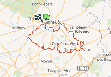
Randonnée V.T.T. de 75 km à découvrir à Normandie, Manche, Agneaux. Cette randonnée est proposée par tracegps.

Description

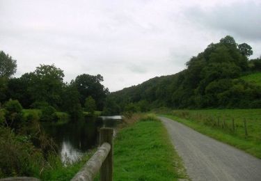
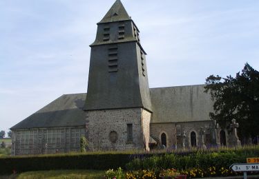
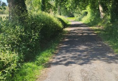
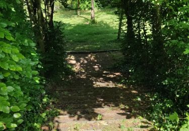
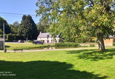
Circuit au sud de Saint Lô qui emprunte de nombreux chemins et Gr. Passe par le point de vue des Roches du Ham. Il s'agit d'une combinaison de circuit balisé rouge (Les 3 Vallées) édité par la mairie de saint Amand et d'une randonnée organisé par Gadbled en 2011. Parcours exigeant physiquement

Profil altimétrique

Localisation

Pays :
France
Région :
Normandie
Département/Province :
Manche
Commune :
Agneaux
Localité :
Unknown
Départ:(Dec)
Départ:(UTM)
636054 ; 5441274 (30U) N.

Randonnées à proximité

Randonnée V.T.T. Saint-Gilles - Balade St-Gillaise - St-Gilles - Photo
V.T.T.
tracegps

V.T.T.

Moyen
(1)
Saint-Gilles, Normandie, Manche, France
23 km | 28 km-effort
2h 30min
Oui
Randonnée Marche Saint-Gilles - St Gilles Château de Canisy - Photo
Marche
guy50880

Marche

Très facile
Saint-Gilles, Normandie, Manche, France
9 km | 10,7 km-effort
2h 26min
Oui
Randonnée V.T.T. Agneaux - L'Agnelaise 2014 - Agneaux - Photo
V.T.T.
tracegps

V.T.T.

Difficile
Agneaux, Normandie, Manche, France
44 km | 52 km-effort
3h 0min
Oui
Randonnée Marche Canisy - Le circuit Jean Follain - Canisy - Photo
Marche
tracegps

Marche

Moyen
Canisy, Normandie, Manche, France
9,2 km | 10,9 km-effort
2h 19min
Oui
Randonnée Marche Saint-Lô - Saint-Lô - La Vire et le Falaise - Photo
Marche
PatRando

Marche

Facile
Saint-Lô, Normandie, Manche, France
5,4 km | 6,6 km-effort
1h 20min
Oui
Randonnée Marche Saint-Lô - BALLADE 2 JUIN - Photo
Marche
PatRando

Marche

Très facile
Saint-Lô, Normandie, Manche, France
3,1 km | 3,7 km-effort
51min
Oui
Randonnée Marche Saint-Lô - Ballade 2 juin 2020 - Photo
Marche
PatRando

Marche

Très facile
Saint-Lô, Normandie, Manche, France
3,6 km | 4,2 km-effort
1h 2min
Oui
Randonnée Marche Saint-Lô - Ballade - Photo
Marche
PatRando

Marche

Très facile
Saint-Lô, Normandie, Manche, France
814 m | 940 m-effort
22min
Oui
Randonnée Marche Saint-Lô - Le Hutrel 27 ai 2020 - Photo
Marche
PatRando

Marche

Très facile
Saint-Lô, Normandie, Manche, France
2,3 km | 2,9 km-effort
48min
Oui


Fermer
Mes abonnements