![](/images/other/stat-length.png)
![Randonnée Marche Conques-en-Rouergue - La Vinzelle - Grand Vabre - Photo](https://media.geolcdn.com/t/1900/400/ext.pjpeg?maxdim=2&url=https%3A%2F%2Fservices.sitytrail.com%2FGeolivesWS%2FDownloadMedia.ashx%3FTrailID%3D107259%26Media%3D12139_6.jpg)
La Vinzelle - Grand Vabre
tracegps
Utilisateur
![Longueur](/images/other/stat-length.png)
Longueur
6,7 km
![Altitude max](https://static1.geolcdn.com/siteimages/upload/files/1508320355ic_sort_altitude_max_24dp.png)
Altitude max
489 m
![Dénivelé positif](https://static1.geolcdn.com/siteimages/upload/files/1508320355ic_sort_den_pos_24dp.png)
Dénivelé positif
325 m
![Km-Effort](/images/other/stat-length.png)
Km-Effort
11,1 km
![Altitude min](https://static1.geolcdn.com/siteimages/upload/files/1508320355ic_sort_altitude_min_24dp.png)
Altitude min
194 m
![Dénivelé négatif](https://static1.geolcdn.com/siteimages/upload/files/1508320355ic_sort_den_neg_24dp.png)
Dénivelé négatif
326 m
![Boucle](https://static1.geolcdn.com/siteimages/upload/files/16400158638029165_repeat_loop_refresh_sync_direction_icon.png)
Boucle
Oui
Date de création :
2014-12-10 00:00:00.0
Dernière modification :
2014-12-10 00:00:00.0
![Marche](https://static1.geolcdn.com/sitytour/trail-icons/101.png)
3h30
Difficulté : Moyen
![Scannez ce code QR pour ouvrir la randonnée dans l'application SityTrail](https://capi.geolives.com/qq0zvz2zws4bq2lad0pu/sitytour/trails/107259/qr.png?size=200)
Application GPS de randonnée GRATUITE
À propos
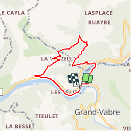
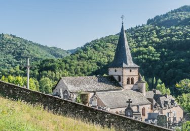
Randonnée Marche de 6,7 km à découvrir à Occitanie, Aveyron, Conques-en-Rouergue. Cette randonnée est proposée par tracegps.
Description
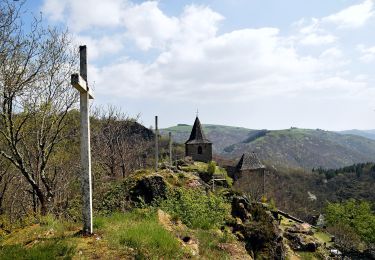
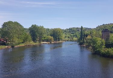
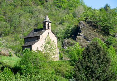
Jolie randonnée, très beaux sentiers escarpés, village classé de la Vinzelle avec possibilité de rallonger la randonnée. Au départ du village, une boucle 45 minutes et un balisage jaune plus panneaux.
Localisation
Pays :
France
Région :
Occitanie
Département/Province :
Aveyron
Commune :
Conques-en-Rouergue
Localité :
Grand-Vabre
Départ:(Dec)
Départ:(UTM)
448591 ; 4942660 (31T) N.
Commentaires
Randonnées à proximité
![Randonnée Marche Conques-en-Rouergue - Les Pelies La Vinzelle : boucle rapide - Photo](https://media.geolcdn.com/t/375/260/ext.jpg?maxdim=2&url=https%3A%2F%2Fservices.sitytrail.com%2FGeolivesWS%2FDownloadMedia.ashx%3FTrailID%3D815525%26Media%3D20170822112933.jpg)
![Marche Marche](https://static1.geolcdn.com/sitytour/trail-icons/101.png)
Les Pelies La Vinzelle : boucle rapide
Marche
Facile
(1)
Conques-en-Rouergue,
Occitanie,
Aveyron,
France
![](/images/other/stat-length.png)
5,4 km | 8,8 km-effort
3h 19min
![](https://static1.geolcdn.com/siteimages/upload/files/16400158638029165_repeat_loop_refresh_sync_direction_icon.png)
Oui
![Randonnée A pied Conques-en-Rouergue - TerraTrail 7 - Photo](https://media.geolcdn.com/t/375/260/a3c72d09-9e84-4bb5-99d1-f393f2772e29.jpeg&format=jpg&maxdim=2)
![A pied A pied](https://static1.geolcdn.com/sitytour/trail-icons/100.png)
TerraTrail 7
A pied
Facile
Conques-en-Rouergue,
Occitanie,
Aveyron,
France
![](/images/other/stat-length.png)
9,4 km | 15,8 km-effort
3h 36min
![](https://static1.geolcdn.com/siteimages/upload/files/16400158638029165_repeat_loop_refresh_sync_direction_icon.png)
Oui
![Randonnée A pied Conques-en-Rouergue - Terra trail 10 - Photo](https://media.geolcdn.com/t/375/260/c1627d11-6231-43ca-9a1f-6c8b11a3fcd5.jpeg&format=jpg&maxdim=2)
![A pied A pied](https://static1.geolcdn.com/sitytour/trail-icons/100.png)
Terra trail 10
A pied
Difficile
Conques-en-Rouergue,
Occitanie,
Aveyron,
France
![](/images/other/stat-length.png)
22 km | 34 km-effort
7h 41min
![](https://static1.geolcdn.com/siteimages/upload/files/16400158638029165_repeat_loop_refresh_sync_direction_icon.png)
Oui
![Randonnée Marche Conques-en-Rouergue - Conques Levinhac le Haut Avril 2018 - Photo](https://media.geolcdn.com/t/375/260/ext.jpg?maxdim=2&url=https%3A%2F%2Fservices.sitytrail.com%2FGeolivesWS%2FDownloadMedia.ashx%3FTrailID%3D954999%26Media%3Dfix__20180426142306.jpg)
![Marche Marche](https://static1.geolcdn.com/sitytour/trail-icons/101.png)
Conques Levinhac le Haut Avril 2018
Marche
Difficile
Conques-en-Rouergue,
Occitanie,
Aveyron,
France
![](/images/other/stat-length.png)
25 km | 36 km-effort
7h 4min
![](https://static1.geolcdn.com/siteimages/upload/files/16400158638029165_repeat_loop_refresh_sync_direction_icon.png)
Non
![Randonnée Marche Conques-en-Rouergue - Conques - Photo](https://media.geolcdn.com/t/375/260/b1ba52c1-bc17-4a66-9751-be2d2d70e0b7.jpg&format=jpg&maxdim=2)
![Marche Marche](https://static1.geolcdn.com/sitytour/trail-icons/101.png)
Conques
Marche
Très facile
Conques-en-Rouergue,
Occitanie,
Aveyron,
France
![](/images/other/stat-length.png)
10,9 km | 16,3 km-effort
3h 2min
![](https://static1.geolcdn.com/siteimages/upload/files/16400158638029165_repeat_loop_refresh_sync_direction_icon.png)
Oui
![Randonnée A pied Conques-en-Rouergue - Sentier Conques - Grand-Vabre - Photo](https://media.geolcdn.com/t/375/260/54393b8a-3c65-496a-ad24-69e3b20f1258.jpeg&format=jpg&maxdim=2)
![A pied A pied](https://static1.geolcdn.com/sitytour/trail-icons/100.png)
Sentier Conques - Grand-Vabre
A pied
Facile
Conques-en-Rouergue,
Occitanie,
Aveyron,
France
![](/images/other/stat-length.png)
4,9 km | 6,4 km-effort
1h 27min
![](https://static1.geolcdn.com/siteimages/upload/files/16400158638029165_repeat_loop_refresh_sync_direction_icon.png)
Non
![Randonnée A pied Conques-en-Rouergue - Tieulet - Photo](https://media.geolcdn.com/t/375/260/81ea3ff4-8db3-4406-ab2f-734b1935602f.jpeg&format=jpg&maxdim=2)
![A pied A pied](https://static1.geolcdn.com/sitytour/trail-icons/100.png)
Tieulet
A pied
Facile
(1)
Conques-en-Rouergue,
Occitanie,
Aveyron,
France
![](/images/other/stat-length.png)
6,6 km | 10,5 km-effort
2h 22min
![](https://static1.geolcdn.com/siteimages/upload/files/16400158638029165_repeat_loop_refresh_sync_direction_icon.png)
Non
![Randonnée A pied Conques-en-Rouergue - Chapelle Sainte-Foy - Photo](https://media.geolcdn.com/t/375/260/434a867d-228b-48bc-b18b-156cab88645d.jpeg&format=jpg&maxdim=2)
![A pied A pied](https://static1.geolcdn.com/sitytour/trail-icons/100.png)
Chapelle Sainte-Foy
A pied
Facile
Conques-en-Rouergue,
Occitanie,
Aveyron,
France
![](/images/other/stat-length.png)
5,8 km | 10,4 km-effort
2h 22min
![](https://static1.geolcdn.com/siteimages/upload/files/16400158638029165_repeat_loop_refresh_sync_direction_icon.png)
Non
![Randonnée Marche Conques-en-Rouergue - Conques - Photo](https://media.geolcdn.com/t/375/260/32cd5116-ab43-4910-8d1a-8e95108c73de.jpg&format=jpg&maxdim=2)
![Marche Marche](https://static1.geolcdn.com/sitytour/trail-icons/101.png)
Conques
Marche
Moyen
Conques-en-Rouergue,
Occitanie,
Aveyron,
France
![](/images/other/stat-length.png)
5,8 km | 10,2 km-effort
2h 4min
![](https://static1.geolcdn.com/siteimages/upload/files/16400158638029165_repeat_loop_refresh_sync_direction_icon.png)
Oui
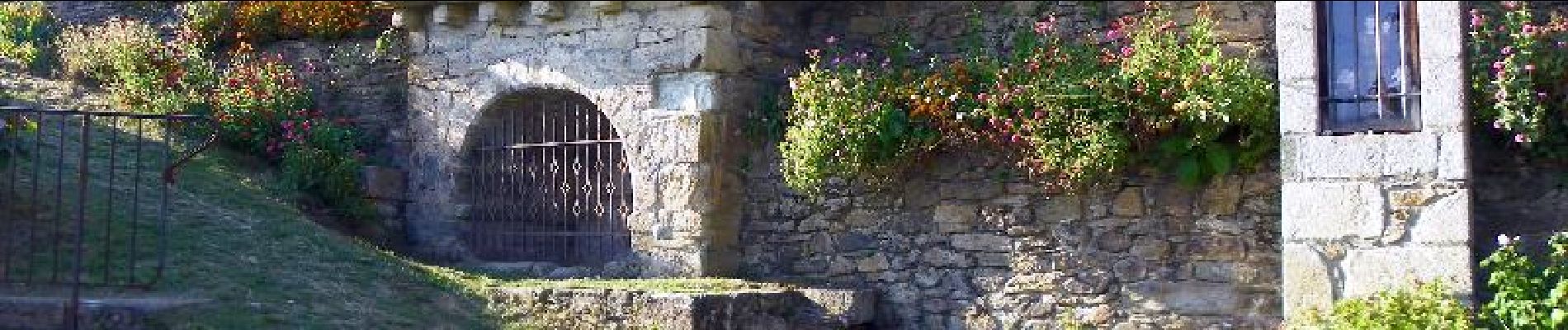
avec auberge à la vinzelle